Sable Island: Shifting sands of an island in motion
Did you know Sable Island is moving?
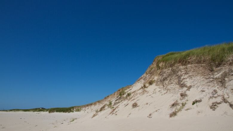
The crescent-shaped island, made entirely of sand, is slowly washing away on the west end while the sand on the east end is building up. That means the island is in a constant state of flux as the centre of the island moves toward the east.
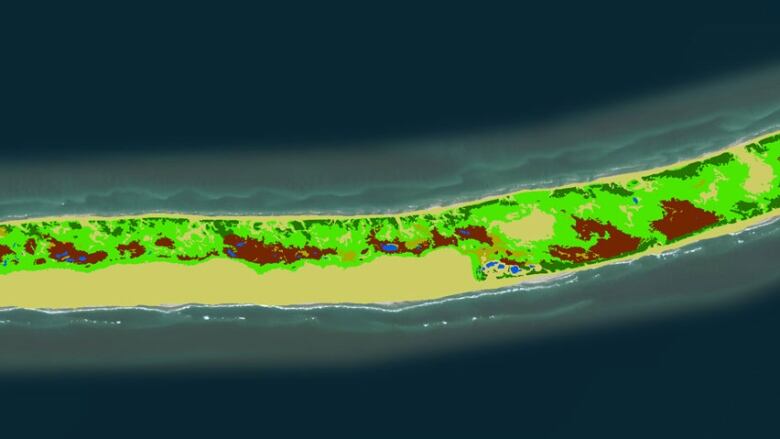
The task of mapping out the dynamic island began in 2002, when a handful of people with the Sable Island Preservation Trust now known as the Friends of Sable Island Society carried their makeshift collage of aerial photographs of the island taped together into David Colvilles office at the Applied Geomatics Research Group at the Nova Scotia Community College.
It was their only mapped reference of the state and shape of Sable Island at the time.
"It took two or three of them to carry it in and it was falling apart and it was really quite cumbersome," Colville said, recalling the scene.
"Obviously they were hoping to just have some better mapping and digital representation of what the island's current state was."
So Colville, a research scientist, set out to map the island with three of his colleagues. They flew back and forth across the island, photographing and georeferencing every inch of it.
That first experience mapping the island was followed up in 2009 with additional information gathered using lidar a laser-based technology that allowed the team to measure the topography of the island.
The rolling sand dunes in the middle of the ocean are subject to a lot of change, Colville explains; from one visit to the next the landscape can change entirely.
'We keep seeing that eastern end extending'
"We see pockets of change where sand dunes that were as high as 10 meters have been completely displaced," he said.
"The idea that the sand dunes can be as large and as tall as they are is what many people are quite surprised about. A lot of them are in excess of 30 metres high. That just gives people a wow factor."
The change in the height and formation of the dunes can now be tracked over time. Colville will be heading out this month to map the island for a third time his second trip using lidar technology.
He's excited to have a second topographical map to compare with the map he created in 2009. The hope is he'll be able to quantify the geographical change and see how fast the changes are occurring.
Colville said the topographical analysis of Sable Island will be used by Parks Canada as they create the conservation strategy and management plan for the national park reserve.
"Parks Canada does these ecological integrity measures as part of their monitoring program and that involves mapping like this to get a sense of, not only what is there but what was there and what's the rate of change? How quickly is change happening?" he said.
"That's really what were trying to aim at with these aerial surveys is to quantify that kind of change."
Many people are shocked to learn Sable Island is moving, said Colville.
"We keep seeing that eastern end extending and not by a couple of feet or a couple of meters but by a kilometre or more," he said.
"That's an amazing event to see it continue to grow."


_(720p).jpg)


 OFFICIAL HD MUSIC VIDEO.jpg)
.jpg)


