Water levels peak, flood warning lifted for Grand Forks, B.C.
But the River Forecast Centre says snowmelt could cause levels to rise again by next weekend
The risk of flooding near the British Columbia community of Grand Forks has been downgraded from a warning to an advisory.
After heavy rain and rapid snowmelt, the province's river forecast centre says water levels in the Boundary Region have peaked, including on the Kettle and Granby rivers running through Grand Forks.
The centre says rivers are expected to recede into the middle of the week but could rise again by next weekend due to more snowmelt at higher elevations.
"We are not quite out of the woods yet," saidBowinn Ma, the minister of emergency management and climate readiness, during a press event Monday where she said the province will continue to assist communities affected by flooding.
Ma said, as of Monday afternoon, there were 50 British Columbians under evacuation order due to rising water and another 2,000 on alert to do so if necessary.
"We ask British Columbiansto remain vigilant and prepared," said Ma.
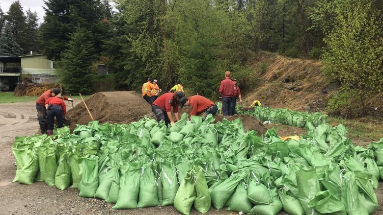
The Regional District of Kootenay Boundary became the most active flood zone in the province on Saturday, with officials ordering the evacuation of 40 properties in and around Grand Forks, not far from the Canada-U.S. border.
WATCH | Residents in Grand Forks B.C. relievedover flooding reprieve:

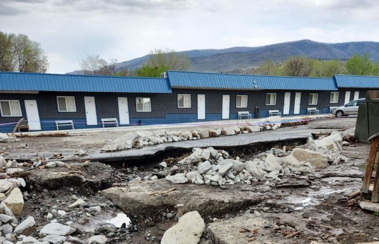
A flood warning remains in place for the Lower Thompson Region, including Cache Creek, where a state of local emergency was extended to at least May 13.
Cache Creek has been hit particularly hard in the last week, with water flowing through homes and businesses. Numerous properties have been placed on evacuation order and alert in the village within the Thompson region.
On Monday, residents of one property on Cariboo Highway were told to leave. As the response to the flooding situation continues in the community, a Facebook post from the village warned residents to stay away from workers performing flood mitigation work.
"Equipment operators don't expect members of the public standing within striking distance, and they can't see you. There is work going on all along the creek," read the post. "Please stay away and let them do their job!"
Dave Campbell, head of the B.C. River Forecast Centre, said unseasonably warm temperatures have melted almost a quarter of the province's snowpack already, and with warm daysforecast for the week ahead, there is the potential for more flooding in more areas of the province in the near future.
With files from Bridgette Watson


_(720p).jpg)


 OFFICIAL HD MUSIC VIDEO.jpg)
.jpg)


