Weather warnings cover much of B.C. as bitter cold settles in and snow starts to fall
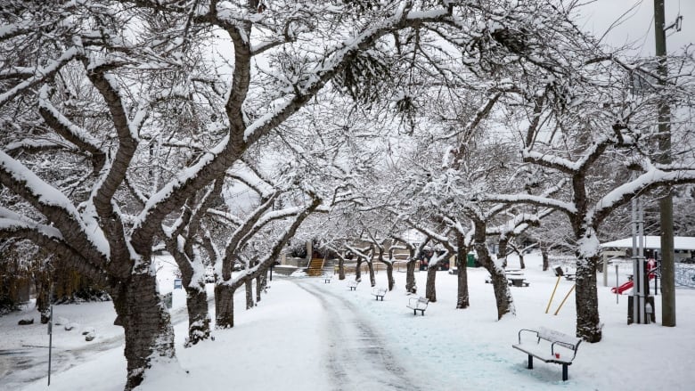
Another round of snow hit South Coast starting Monday afternoon, with up to 25 cm for Vancouver Island
UPDATE Dec. 20, 2022:Ferries, flights cancelled as blowing snow blankets B.C.'s South Coast
Environment Canada has issued weather warnings for most of British Columbia as winter weather conditions tightened theirgrip across the province, creating dangerous cold andcomplicating travel ahead of the holiday season.
The weather agency says another round of snow forthe South Coast started Mondayafternoon, due toa low pressure weather system coming up fromWashington state.
"We are looking at another system coming in from the Pacific," said meteorologist Derek Lee Monday, in an interview with On the Coast'sRohit Joseph.
"With the cold temperatures in place 10 to 15 degrees below seasonal we are going to see a lot of heavy snow."
In a tweet, the University of British Columbia said all 8:30 a.m. and 12 p.m. PT in-personexams set for Tuesday atits campus in Vancouver's Point Grey neighbourhood were cancelled.
Simon Fraser University in Vancouver, and the University of Victoria said they would updatestudents at 6:00 a.m. Tuesday.

Lee says southern Vancouver Island will be one of the areas hit the hardest, and the snow that started falling on the island movedto the mainland later Monday evening.
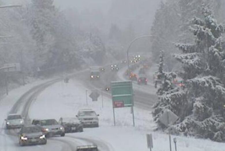
Drive B.C. warned commuters and anyone out on Lower Mainland roads and highways Monday evening to expect congestion, leave extra travel time and make sure their vehicles are well-equipped for winter weather.
#BCHwys Expect delays due to congestion on major routes in the #BCLowerMainland this evening. Leave extra travel time and plan ahead to winterize your vehicle. #ShiftIntoWinter #BCStorm pic.twitter.com/QZcacRxDjg
—@DriveBCThe Greater Victoria area, the Malahat Highway andthe Southern Gulf Islandscan expect as much as 25 centimetres, while Metro Vancouver and the Fraser Valley can expect 10-20centimetres.
It comes after 10-15 centimetres fell on the South Coast on Sunday morning.
Environment Canadaexpects a break in the snow on Wednesday before it picks up again on Thursday or Friday. Meteorologistssaid below-seasonal temperatures will stick around throughout next week, with maximum temperatures in Metro Vancouver "struggling" to break 5 C.
"It looks like the cold will likely linger with us until Friday,"said Lee, explaining that the forecast for this weekend is largely uncertain with back-to-back storm systems lined up, some of which could potentially bring in warmer air.
"It can be snow but quickly changing over to rain for the weekend," he said.
"Definitely prepare yourself for changing weather conditions: snow to rain or even freezing rain in the forecast later on this week."
Sunday's snowfall led to a number of road closures and flight delaysat Vancouver International Airport as well as the airports in Victoria and Kelowna.Several highways, including Highway 1 and the Coquihalla Highway, were either littered with spun-out vehicles or forced to close entirely.
The province said "drivers are advised to stay off the road unless their vehicle is properly equipped with winter tires."
For those with winter tires who have to drive, a statement Monday said drivers should pack an emergency kit in their vehicles.
WATCH | Tips and tricks for driving in the snow:

Extreme cold, risk of frostbite in northern B.C.
In the northern half of the province, more extreme cold is in the forecastfor regions including Chilcotin, Quesnel, Williams Lake, Prince George, Stuartand 100 Mile.
Frigid Arctic air is pushing temperatures as low as30 C, with wind chill making it feel like 40 C.
"A very cold Arctic air mass is has settled over the region," read a weather warning for the Cariboo region.
"Extreme cold puts everyone at risk. Risks are greater for young children, older adults, people with chronic illnesses, people working or exercising outdoors, and those without proper shelter."
Arctic outflow warnings remain in place for the central and north coasts, including inland sections. Extreme cold warnings are also in place in the Muncho Lake Park, Dease Lake, Cassiar Mountains and Watson Lake regions in the far north.

Special weather statementswarning of frostbite riskcover theHaines Road, Atlin, Teslin, Peace River, Williston and Fort Nelson regions.
In the southern Interior, extreme cold warnings are in place for the Elk Valley and Yoho Park regions, and a snowfall warning has been posted for the West Kootenay region.
Wind chill could make it feel like 35 C overnight near Elk Valley and Yoho Park, which straddle the B.C.-Alberta border.
Most of Alberta is also under extreme cold warnings, with wind chill making temperatures feel as cold as40 C across much of the province.
With files from Akshay Kulkarni


_(720p).jpg)


 OFFICIAL HD MUSIC VIDEO.jpg)
.jpg)


