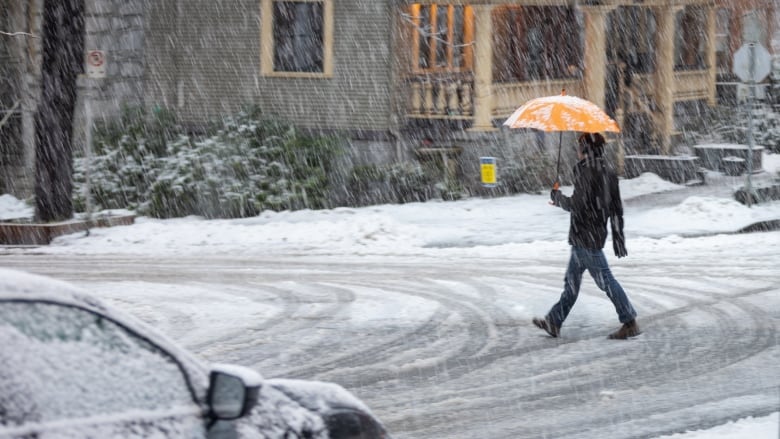
Snowfall warnings issued as 'bitterly cold' temperatures expected across B.C. this weekend
Arctic outflow warnings for Central and North Coasts, winter storm warnings for Coquihalla
Environment Canada issued a range of special weather statements and weather warnings across British Columbia on Saturday, warning of unseasonably cold temperatures and snowfall.
A snowfall warning forMetro Vancouver and Howe Sound said up to 10 centimetres of snow could fall in the region, with up to 25 centimetresin the Fraser Valley.
The amounts were an increase from forecasts made in special weather statements earlier Saturday.
Aspecial weather statementissued forWhistler also warned of periods of snow throughout the weekend.
There are Arctic outflow warnings in place across B.C.'s Central and North Coasts, including inland sections, with wind chill expected to make it feel like 20 C in those regions. Wind gusts could reach up to 80 km/h along the coast.
In the Fraser Valley and Fraser Canyon in southwest B.C., light snow is expected to intensify later Saturday afternoon. Around 15 centimetres of snow is expected to accumulate by Sunday afternoon.
There is also a winter storm warning in place for the Coquihalla Highway between Hope and Merritt, B.C., as well as special weather statements for the Lower Mainland and across northern B.C.
Expect wintry precipitation this weekend, followed by temperatures 10-20C below seasonal next week across #BC. Prepare for challenging travel conditions. Check water pipes. Follow @DriveBC for current road conditions and https://t.co/otY0x4IuD4 for weather alerts. #BCStorm
—@ECCCWeatherBC"If outside, dress warmly in layers and stay dry. Cover as much exposed skin as possible to avoid frostbite," reads a statement from the forecaster.
"Be prepared for unusually cold temperatures and strong winds."
An Arctic front will bring unseasonably cold temperatures to the region starting Sunday. Wind chill could make it feel like 15 C in Metro Vancouver, and 20 C in the Fraser Valley and Sea to Sky regions.
The system will bring up to 20 centimetres of snow to the recently-repaired Coquihalla Highway, according to the forecaster.
Good morning! We could be in for some more winter weather this weekend. Here are some of our top winter travel safety tips to help you when using public transit: https://t.co/A0f3gF2H76 Have a great Saturday! ^DA pic.twitter.com/bdMfqPxHTT
—@TransLinkThe province said drivers on the South Coast should stay off the road in poor conditions. If they must travel, they should pack an emergency kit and make sure their vehicle has proper snow tires.
TransLink, Metro Vancouver's regional transit authority, said they were preparing for the cold snap by proactively de-icing SkyTrain tracks and bus trolley wires, and were prepared to implement snow shuttle services if conditions get particularly bad.
Concern for northern B.C.
A series of special weather statements on Friday said Arctic air, blasting wind and plummeting temperatures will settle over the far north and stick around for several days.
The coldest temperatures are likely to be felt Monday to Wednesday, according tometeorologist Derek Lee.
Lee said the area from Peace Region to Fort Nelson could see overnight lows below 40 C. The Prince George and Cariboo areas could see overnight lows colder than 35 C.
The weather statements cover Haines Road, Atlin, Teslin, Cassiar Mountains, Dease Lake, Watson Lake, Peace River, Williston,Muncho Lake Park and Fort Nelson in the far north.
With files from Joel Ballard


_(720p).jpg)


 OFFICIAL HD MUSIC VIDEO.jpg)
.jpg)


