Chilcotin River floods an estimated 120 residential properties, officials say
Water levels expected to dip Thursday and into the weekend
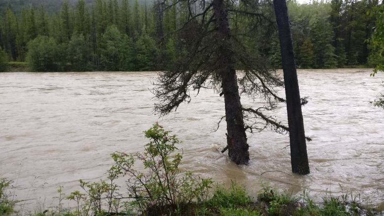
The B.C. River Forecast Centre says theChilcotinRiver has peaked and floodwaters are receding after a flood event not likely to happen again for another 200 years.
The centre saidriver levels began receding Wednesday after reaching a high Tuesday night, due to 100 millimetres of rainfall that swampedthe region beginning late last week.
"[It's] expected to decrease gradually through the rest of today and then and then should droppretty quickly over the next few days," said River Forecast Centre hydrologist Jonathan Boyd.
"So, [the situation] isimproving in the sense that it's not continuing to rise, but the flows are still high. So, of course, we're staying at a flood warning," he added.
As of Thursday, the warning remains in place for theChilcotinand its tributaries, except two: ahigh streamflow advisory is in place for the Chilko River and Big Creek.
Environment Canada said thunderstorms with rainfall of less than five millimetres were expected this week.
"There's a little bit of precipitation in the forecast but nothing compared to what we've received over the weekend," Boyd said Thursday.
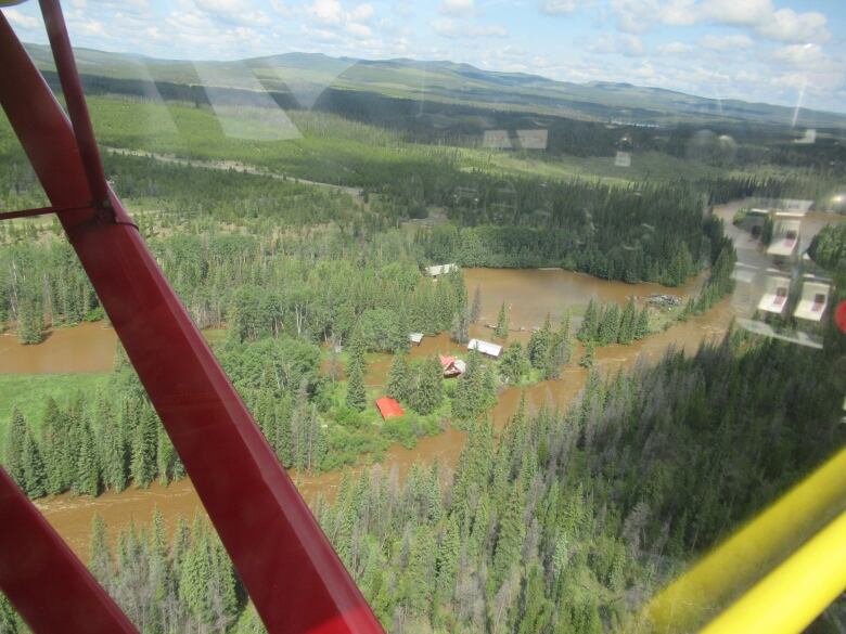
Properties, ranches flooded
Cariboo Regional District spokesperson Emily Epp said a flyover of the area reveals about 120 residential properties may be affected by the flood waters.
Epp said the flood-stricken region covers hundreds of kilometres and includes the community of Big Creek, the Xeni Gwet'in First Nation and the Nemaiah Valley.
"We haven't issued any evacuation orders or alerts so the majority of residents are staying in place and we're supporting them with food and water as they need," she said Thursday.

An advisory from Interior Health says well- or river-water systems affected by flooding should not be used.
Epp says the regional district was delivering potable water to some ranches, but the emergency operations centre wants to hear from more people in order to assess needs.
An advisory from the Transportation Ministry saidhalf a dozen roads have been closed as crews try to repair the flood damage.
The roads that are closed usually have low traffic volumes but they provide important access for isolated residents and camps, the ministry said.
With files from Rhianna Schmunk and Brady Strachan


_(720p).jpg)


 OFFICIAL HD MUSIC VIDEO.jpg)
.jpg)


