B.C. firefighters add drones to their toolkit
The B.C. Wildfire Service has been testing the aircraft for two years
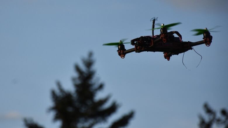
The B.C. Wildfire Service is officially adding drones to its firefighting toolkit.
Provincial Fire Information Officer Erin Catherall explained that the service had been testing drones for the past two years, mainly for mapping and scanning.
"We've been really impressed," she said.
"Based on the feedback we've received from crews and our fireline operations staff, it has been of great benefit for our fireline operations."
Drones can do what low-flying helicopters have previously done thermal imaging, hot-spot detection and fire perimeter mapping but much more cheaply, she said.
Best of all, drones do not require on-board personnel and can work overnight and in more dangerous situations.
The official use of fire service drones is in contrast to previous years whenunauthorized drones interfered with multiple firefighting efforts in the province, making it unsafe for pilots to man helicopters and planes.
Catherall said these official drones would be flown by specialized drone operators who have met all the necessary requirements through Transport Canada and have been specially trained for fire conditions.
The B.C. Wildfire Service currently has contracts for thesummerwith two separate operators.
With files from Daybreak North.


_(720p).jpg)


 OFFICIAL HD MUSIC VIDEO.jpg)
.jpg)


