27 structures destroyed by wildfire burning along Hwy 1 near Lytton, B.C., regional district says
6 homes among buildings confirmed lost to blaze burning across 180 sq. km
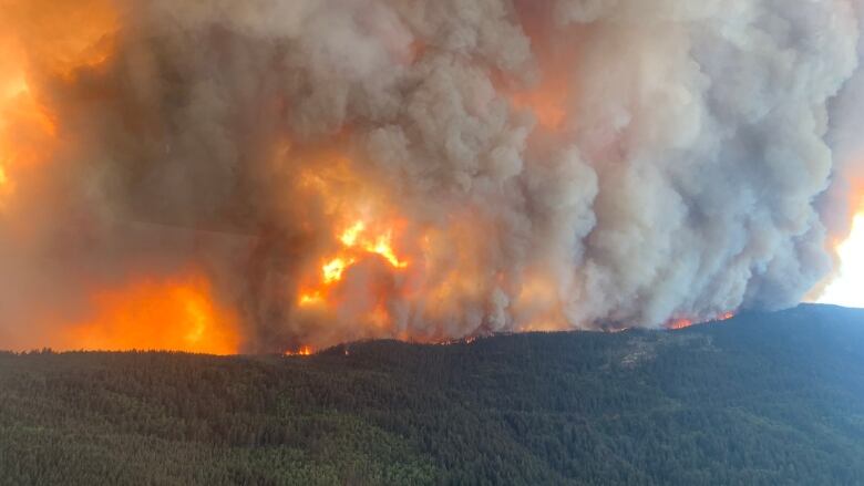
More than two dozen structures have been destroyed by the Kookipi Creek wildfire, which has been burning out of controlin southwest British Columbia since it was discovered in early July, the regional district says.
The Fraser Valley Regional District (FVRD) said in a releaseWednesday the fire destroyed a total of 27 properties, including six homes, in communities along Highway 1 north of Hope, B.C.The other structures were recreational properties and service buildings, it said.
"I am grateful for no loss of life and the ongoing resilience of residents," said Diane Johnson, a director with the FVRD.
"The impacts and trauma associated with the Kookipi Creek Wildfire are undeniable; however, the communities we call home will support each other as we recover from the impacts of the wildfire."
The fire, which was discovered July 8 and is believed to have been ignited by lightning, is now estimated to be 180 square kilometres in size. It resulted in evacuation orders and alerts, including in the Village of Lytton, which was destroyed by fire in 2021.
Residents in the FVRD, Thompson-Nicola Regional District, Lytton First Nation, Skuppah Indian Band and Kanaka Bar Indian Band were also ordered to evacuate their homes due to the fire, which forced the closure of Highway 1 fortwo weeks in August.
The news that more buildings have been destroyed in B.C.'s worst wildfire season on record by area burned comes as some evacuees beginto return to their communities to survey the damage and begin recovery.
'Tested beyond comprehension'
Officials with the province and local governments, such as the FVRD, say supports are in place to help affected residents begin to rebuild.
"Now that evacuation orders have been downgraded to alerts and residents are returning, we acknowledge you have been tested beyond comprehension. Community strength is built from a foundation of unity, and the strength you all have exhibited is inspirational," said FVRD chair Jason Lum.
Also on Wednesday, the province declared this year's wildfires an event that is eligible for disaster financial assistance (DFA), and communities can now apply for funding help to repair infrastructure.
DFA money is available to local governments and First Nations to assist in work and expenses related to rebuilding or repairing "essential" public infrastructure and paying insurance deductibles.
Ottawa funding equipment
At a federal update Thursday on the wildfire seasonacross the country, officials said B.C.recently signed anagreementwith the federal government to access its full notional allocation of the equipment fund portion of theFighting and Managing Wildfires in a Changing Climate Program.
Itwill mean $32 million for the province to match, allowing $64 million to be spent on wildfire-fighting equipment such as crew trucks,all-terrain vehicles, mass water delivery systems, weather stationsand pumps.
B.C.'s worst wildfire season on record has seen more than 2,000 wildfires since April 1 and over 22,000 square kilometres burned, including significant damage to populated areaslike West Kelowna and the north Shuswap.
As of early Thursday, the B.C. Wildfire Service said there are 409 active wildfires burning in B.C.Of those, 190 are deemed to be out of control and14 are considered wildfires of note, meaning they are particularly visible or pose a threat to local communities.
With files from Karin Larsen


_(720p).jpg)


 OFFICIAL HD MUSIC VIDEO.jpg)
.jpg)


