Brace yourselves: more snow is on the way
South Coast could see up to 20 cm of snow, but showers expected Saturday
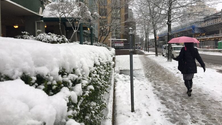
Get ready for a messy weekend followed by some freezing temperatures.
CBC meteorologistJohannaWagstaffesays the snow will continue for most parts of the South CoastFridaynight.
"We were talking about ranges between twoand 20 centimetres," saidWagstaffe."That's exactly what the South Coast is going to get."
That blast of snow caused Simon Fraserand Capilano Universitiesto shut down their campuses by mid-afternoon Friday. It also caused transit delays with bus services affected in Burnaby, Vancouver and the North Shore.
What happens Saturday is tough to predict. It could be anything from snow, rain, or a mix of the two depending on where you live.
"So the snow is not over for most, although it's still looking like it may change to rain for areas right at sea level Friday evening.
Wagstaffesays the weather is very 'elevation dependent.'
But there's still a good chance that much of Metro Vancouver will see yet another round of snowSaturdaymorning before the changeover to rain.
Freezing next week
Wagstaffesays the weather will clear upSundaybut only to make way for a new Arctic air mass.
"This is goingto be a biggerstory than the snow," saidWagstaffe. "BeginningSundaynight through next week, our overnight lows drop possibly to minus 10 degrees forMetro Vancouver."
"That is an even colder Arctic air mass than the one we just had."
She says whatever precipitationis on the groundSundaynight is going to freeze.
Wagstaffeadds that Metro Vancouver experiences a couple of cold snaps every year, but there's something unique about this one.
"What is unusual is that we had that snow move in to start that first Arctic air mass," saidWagstaffe.
"Normally, we often don't see a disturbance move through while we've got this Arctic air mass in place and leave that snow on the ground. That's unusual that we've got two cold snaps back to back."


_(720p).jpg)


 OFFICIAL HD MUSIC VIDEO.jpg)
.jpg)


