Historic photos show how Canada's mountains have changed in 150 years
New interactive website compares current and archival photos, showing effects of climate change
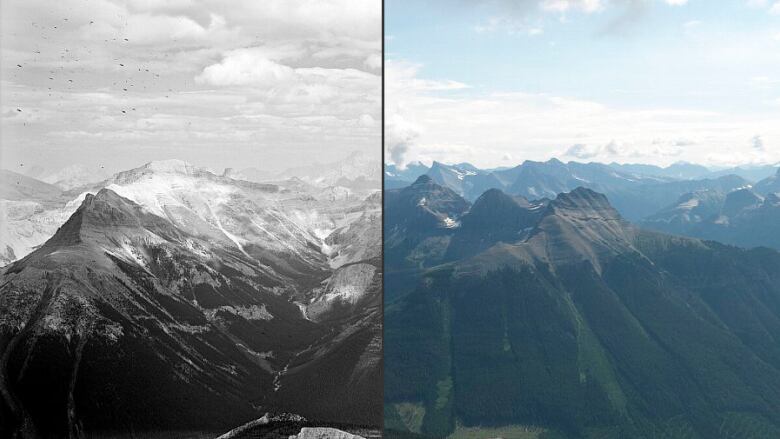
A new interactive website from the University of Victoria allows viewers to compare modern and historical images of Canadian mountains, showing dramatic change over the last 150 years.
EricHiggs, a University of Victoria environmental scientist and the leader of the project, says the effects of climate change are clearly illustrated by the photos.
"People can clearly see the significant changes brought about by a shifting climate, human activity and development, and ecological processes," Higgs said.
Researchers with theMountain Legacy Projectcompiled thousands of photographs taken by mountain surveyors between 1861 and 1958.
They then spent 19 years returning to the exact locations in B.C., Alberta and Yukon to take matching photos in order to compare the change in landscape.
Aninteractive map allows users to locate various mountain ranges, then click on red icons and compare past and current photos.
7,000 pairs of images
"Of course you're going to see amazing glacial change ... but if you look a little more closely, you're also going to see a change in the forest, in the composition," said Mary Sanseverino, a mountaineer, photographer and one of the project's researchers.
"You're going to see the tree line creeping up slope, you're going to see vegetation change and you're going to see things that are strikingly similar."
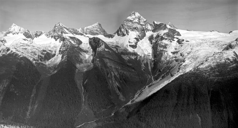
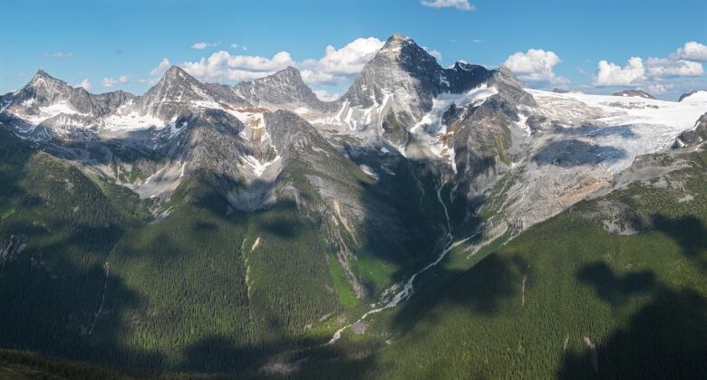
Sanseverino highlights a photo of Mt.Sir Donald near Revelstoke, B.C., and the Illecillewaet Glacier captured in 1901 by surveyor Arthur Wheeler. The same ridge photographed in 2011 shows a significant retreat of the glaciers and snowcaps.
The website includes more than 7,000 pairs of images. Researchers either hiked up by foot or reached the various mountain sites by helicopter.
Sanseverino said Canadians working in ecology, forestry and the wildfire service can assess the photos to track changes and plan for the future.
"We make use of the important photographic legacy left to Canada by the early surveyors. We walk in their footsteps, stand where they stood... and pay their legacy forward."
The project originally began at the University of Alberta but moved to the University of Victoria in 2002.
Monday is International Mountain Day, as designated by the United Nations. This year's theme is "Mountains under pressure: climate, hunger, migration."
With files from CBC's Daybreak South.


_(720p).jpg)


 OFFICIAL HD MUSIC VIDEO.jpg)
.jpg)


