Brace yourself! West Coast preps for Thursday night snowstorm
A 'significant amount of snow' expected to fall on Metro Vancouver and the South Coast late Thursday
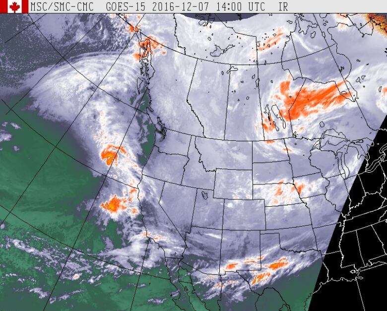
Environment Canada has some bad news for West Coast residents weary of the recent snow and cold temperatures: It's likely to get a lot worse before it gets better.
That's because an "intense" Pacific storm is expected to batter Metro Vancouver and the rest of the South Coast region late Thursday with "a significant amount of snow."
And to make matters worse, strong winds are in the forecast as well, meaning power outages could land a sucker punch on weather-weary residents of Vancouver Island, the Sunshine Coast and Metro Vancouver.
Wait, there is more...
By late Friday afternoon the snow could change to rain at lower elevations and a mix of snow and rain is expected to continue over the weekend.
Temperatures will remain cold over the weekend, meaning the snow is expected to remain on the ground for several days, according to the Environment Canada forecast.
In fact, more snow is expected next week as well, says the forecast.
Preparations already underway
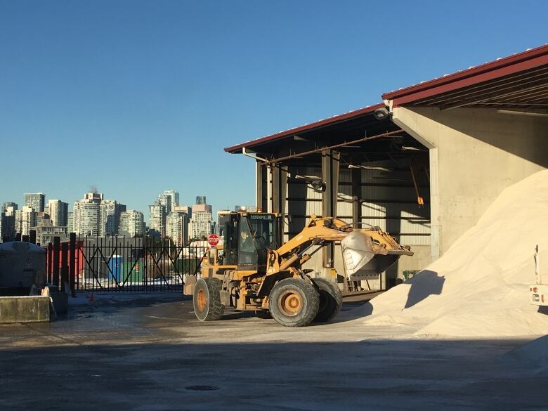
With all the snow in the forecast, Vancouver city officials are already making plans to put 46 trucks out to clear and salt the roads.
"Based on what we had on Monday, we can tell this is not going to be your typical winter weather," said street operations manager Ken Brown.
The city has already put more than 2,000 tonnes of salt on the roads twice the total amount used all of last winter and more has been ordered, he said.
Based on long-term forecasts for the winter, the city is expecting it will have to deal with about four major snowstorms linked to Arctic outbreaks this winter, said Brown.
Despite the snowy forecast, the Vancouver School District issued a notice saying parents should assume schools will remain open if at all possible, unless otherwise announced.
"Any district-wide closure will be decided by 7 a.m. at the latest with details posted on the district website and released to the media," said a statement released by the district.
Students will not be penalized for not attending if parents decide to keep them home, the district notes.
The province says it's also activating its emergency extreme weather shelter program, making an extra 1,000 emergency shelter beds available.
Avalanche risk and power consumption to rise
The snow is likely to raise the risk of avalanche in the backcountry, according to the Canadian Avalanche Centre.
For the South Coast region Friday the avalanche danger rating is forecasted to be considerable for both the alpine and treeline zones.
BC Hydro is also preparing for the snow, expecting demand for electricity will peak around 10,000 megawatts this week.
The power utility records the highest demand for electricity in the winter months between 4 and 8 p.m. on weekday evenings.
"This is when British Columbians come home, turn up the heat, switch on the lights, do laundry and make dinner," said a statement released on Wednesday.
The highest peak was recorded on Nov. 29, 2006 when consumption reached 10,113 megawatts between 5 and 6 p.m.
Arctic weather warnings in place
Meanwhile, until the snow arrives Thursday, strong Arctic outflow winds are expected to continue to bring cold temperatures and colder wind chill values to large parts of the province.
The temperatures will be particularly cold over the next two days along the North and Central Coasts, Howe Sound, the Fraser Valley and the Kootenay and Yoho Park regions, where Environment Canada has issued Arctic outflow warnings.


_(720p).jpg)


 OFFICIAL HD MUSIC VIDEO.jpg)
.jpg)


