Flood warning prompts Lethbridge County state of emergency
Water levels are extremely high in Oldman River basin
Lethbridge County has declared a state of local emergency, saying water levels in the Oldman River are extremely high and could rise to 1995 flood levels.
Albertans living in the Oldman River Valley are being told to anticipate a potential evacuation tomorrow, and to move livestock to higher ground.
- Overland flooding not expected in Calgary, say officials
- Alberta Emergency Alert |Flood warning issued
- Alberta Flood 2013: One Year Later
The City ofLethbridgeremains under a flood watch, and officials have gathered at the Emergency Operations Centre to plan a course of action in light of all the rain that is in the forecast.
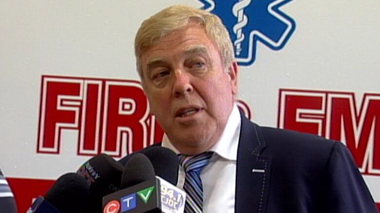
"We're taking precautions at this stage. We don't want people to be alarmed. At the same time the river is going to increase in its level and flow. We want people to stay away from the river. It's really important that they do," said Lethbridge Mayor Chris Spearman.
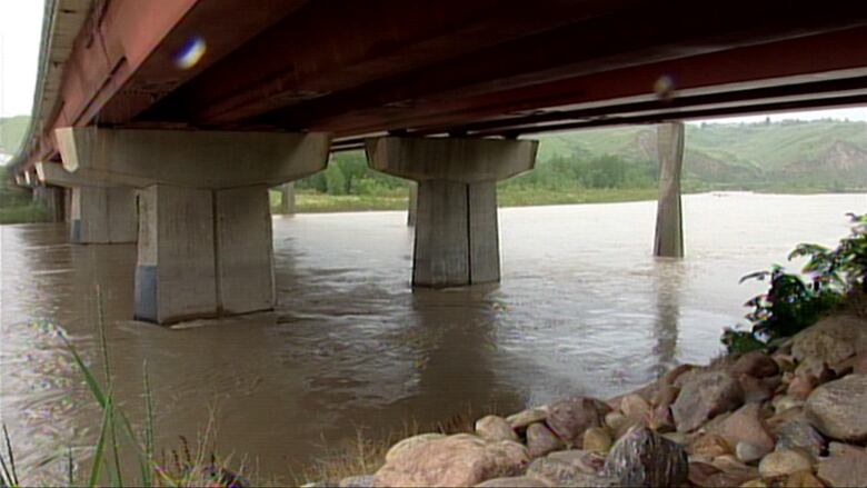
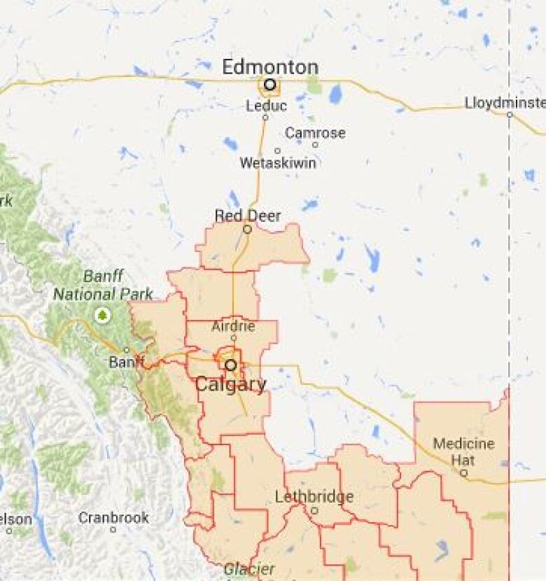
Emergency officials have issued a flood warning for the entireOldmanRiver basin in southern Alberta.
TheOldmanRiver is expected to peak late Wednesday or early Thursday, rising about six metres in Lethbridge,but no homes will be affected as there is almost no development in the city's river valley.
Bridge Valley Campground has been asked to evacuate by noon on Wednesday. Residents of Paradise Canyon will be getting sandbags.
Medicine Hat prepares for flooding
The Oldman River and the Bow River merge near Grassy Lake to become the South Saskatchewan River, which flows through Medicine Hat. Water flows are expected to peak in Medicine Hat about 36 hours after peaking in Lethbridge.
In preparation, Medicine Hat officials have also activated an Emergency Operations Centre and staff havebegun sandbagging and putting up temporary berms, based on extensive mapping done after last year's flooding.
Alberta's director of river forecasting, Evan Friesenham, said they're predicting a peak flow in the South Saskatchewan River of 5,300 cubic metres per secondin Medicine Hat,about the same as in 2013.
"Obviously that's a worst-case scenario," he said. "As the storm progresses and we have more information on the ground, we'll be refining forecasts throughout the basin and throughout the southern portion of the province as we go."
The warning issued Tuesday afternoon covers several rivers, creeks and a lake.
- Castle River.
- Crowsnest River.
- Oldman River upstream of Oldman Dam.
- Willow Creek downstream of Chain Lakes.
- Waterton River.
- Belly River.
- St. Mary River.
- Oldman River downstream of the Oldman Dam.
- Waterton Lake.
- Lee Creek.
- Pincher Creek.
Officials are urging peopleto becautious of rising water levels and to take appropriate measures to avoid flood damage.
Municipal Affairs Minister Greg Weadick said the stress level may be high for southern Albertans worried about flood watches and warnings.
"I just want to tell Albertans that we're here for you, we're ready, communities are ready to respond, we're ready to respond, we'll be there for you. We have flood response items in communities across the south.We've created mitigation projects.We're there for southern Albertans. We're there for all Albertans."
Rainfall warnings are still in effect for areas in the south of the province, butdo not includeCalgary.
Anxiety in High River
High River residents, badly hit by flooding a year ago, havebeen anxiously watching the water.
On Tuesday morning, town officials said forecasters are expecting a total of 70 millimetres of rain by Wednesday evening, which would result in a 1.2-metre rise in river levels with a 215 cubic metre per secondflow rate.
"With this flow rate it is only the neighbourhood ofWallacevillethat is in any danger of seeing low level flooding andWallacevillearea residents have been notified accordingly. The rest of the town is protected by berms, dikes and other flood mitigation methods to at least 1,200m/s," officials said in a press release.
- Environment Canada |Public Weather Alerts for Alberta
- Alberta Environment|Advisories and Warnings
- Flood watch, rainfall warnings issued in southern Alberta
Read the warning:


_(720p).jpg)


 OFFICIAL HD MUSIC VIDEO.jpg)
.jpg)


