Southern Alberta on winter storm watch this weekend
Pincher Creek and Waterton could potentiallyget up to 50 cm of snow
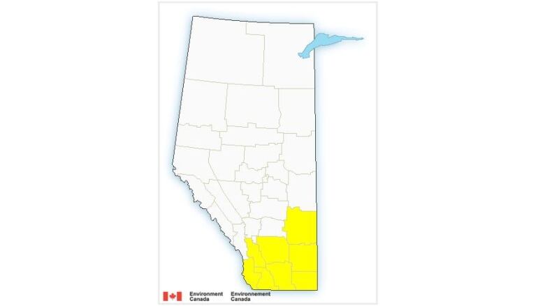
Winter storm watches have been issued by Environment Canada for a chunk of southern Alberta.
As of 1:30 p.m., Calgary was not included in the list. Thefollowing communities and surrounding areas are warned byEnvironment Canadathat the rapid snowfall could make travel difficult.
Communities on winter storm watch
- Brooks, Strathmore, Vulcan
- Cardston, Fort Macleod, Magrath
- Crowsnest Pass, Pincher Creek,Waterton Lakes National Park
- Cypress Hills Provincial Park, Foremost
- Hanna, Coronation, Oyen
- Lethbridge, Taber, Milk River
- Medicine Hat, Bow Island,Suffield
- Okotoks, High River, Claresholm
EnvironmentCanada said aboutfive centimetres is expected in Brooks, Hanna andOyen, as well as possibly 10 to 15 centimetresin the foothills.
Kyle Brittain, the local bureau chief for The Weather Network, told the Calgary Eyeopenerthat Albertans shouldn't be fooled by initial mild temperatures.
Brittain advised travellers tostay home if they can.
"We're actually going to be starting to see some of that light snow developing today across parts of far, southwestern Alberta," he said.
"But it's really going to start to ramp up as we get late into Friday night, early Saturday morning."
Brittain said over the weekend, there may be blizzard-like conditions for areas south of Calgary, particularly Medicine Hat.
"We're looking at a few different rounds of heavy snow potentially blowing around, especiallythe winds are really going to start to increase as we get into Saturday and into Sunday," he said.
As well, a potential "historic" snowstorm across parts of southern Saskatchewan maycause road closures.
"So something to keep in mind if there were travel plans to head east at all this weekend it may become difficult or impossible," Brittain said.
He said if you need to travel, carryan emergency kit, a charged phone and keep in contact with others.
Total snowfall amounts range from 30 to 40 centimetres, saidEnvironment Canada.
Up to 50 cm of snow in some communities
BrittainsaysPincher Creek and Waterton could potentiallyget up to 50 centimetresof snow between the span of Friday evening and Monday morning.
"So tucked into that southwestern corner of Alberta, we have the added effect of the terrain that the winds flow upslope in southwestern Alberta," he said.
"And as we progress into the weekend, it gets colder so that snow is going to become lighter and fluffier and certainly able to blow around in the strong winds."
Brittain said that's good enough reason to stay off the roads if you can.
Frankie MacDonald, a popular weather forecaster out of Nova Scotia, agrees. He says Albertans need to "be prepared!"
Take a listen to his full warning in the video below.
With files from theCalgary Eyeopener.


_(720p).jpg)


 OFFICIAL HD MUSIC VIDEO.jpg)
.jpg)


