Heavy rainfall warning for much of southern Ontario
25-50 mm of rain predicted as storms move in from west, south
The astonishing range of weather, from ice storm to sunburn andt-shirtstrollsover the Easter weekend, will haveone more feature forWaterloo Region Sunday night.
- EXTERNAL LINK: Environment Canada warnings for Southern Ontario
- GRCA issues floodwatch after Sunday melt, prediction of Monday rain
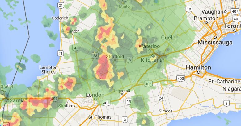
Environment Canada issued a heavy rainfall warning Sunday, with predictions of between 25 and 50 mm of rain in some areas beginning around midnight Sunday and stretching into the early morning hours of Monday.
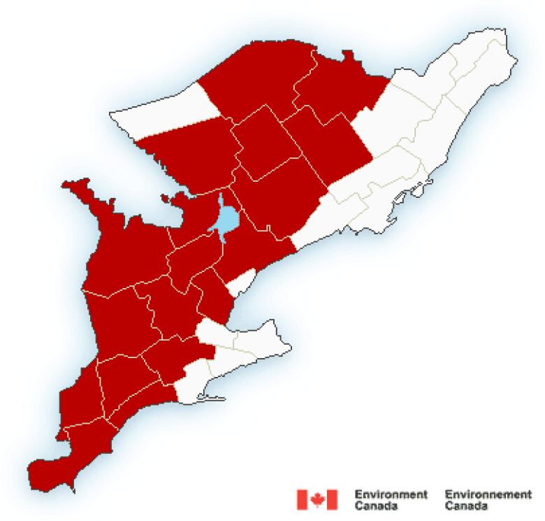
Areas under the Environment Canadawarning include:
- Guelph,Erin, southern Wellington County.
- Kitchener,Cambridge,Region of Waterloo.
- Mount Forest,Arthur, northern Wellington County.
- Caledon.
- Woodstock,Tillsonburg,Oxford County.
- Goderich,Bluewater, southern Huron County.
- Listowel,Milverton,northern Perth County.
- Stratford.Mitchell, southern Perth County.
- Wingham,Blyth, northern Huron County.
- Grey-Bruce.
- Dufferin-Innisfil.
"Total rainfall amounts of 25 to 50 mm are expected," the warning said.
"There is also a risk of an isolated thunderstorm this evening or overnight over Southwestern Ontario," it added in the warning.
"Heavy downpours can cause flash floods and water pooling on roads. If visibility is reduced while driving, turn on your lights and maintain a safe following distance," Environment Canada advised.
GRCAflood watch
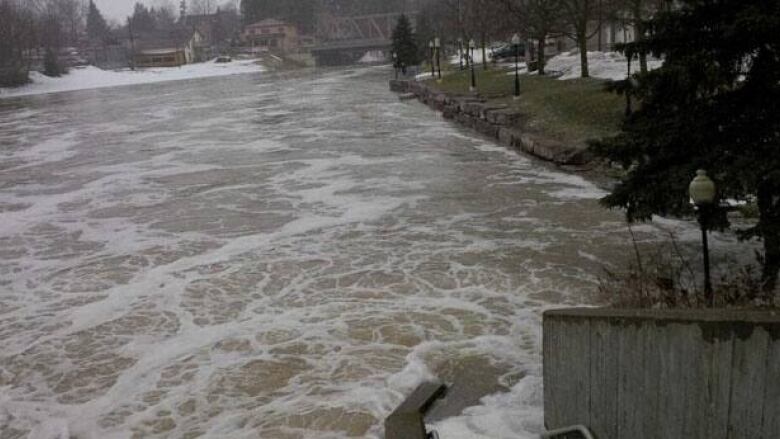
As a result of the combination of a warm snow melt on Sunday and the predicted heavy downpour Monday, the Grand River Conservation Authority issued a flood watchSunday.
The GRCAwarned that the most likely places for flooding werethe "traditional" flood-prone areas of Elora, New Hamburg, Ayr, Grand Valley and Drayton.


_(720p).jpg)


 OFFICIAL HD MUSIC VIDEO.jpg)
.jpg)


