Waterloo-based Aeryon Labs to help map Fort McMurray wildfire
Ventus Geospatial gets approval to fly unmanned aerial vehicles to survey damage, company says
A company based in Waterloo, Ont., says it has received approval to provide drone assistance in mapping outthe fire-ravaged regions of Fort McMurray, Alta.
- Tracking the Fort McMurray wildfire
- FortMcMurrayfirefighters save homes
- FortMcMurrayis 'still alive,' fire chief says
On Tuesday, AeryonLabswrote on its websitethat Calgary-basedVentusGeospatial was given an emergency complex restricted special flight operations certificate (SFOC) by Transport Canada in orderto operate the unmanned aircraft over the areas affected by wildfire, which is currently restricted airspace.
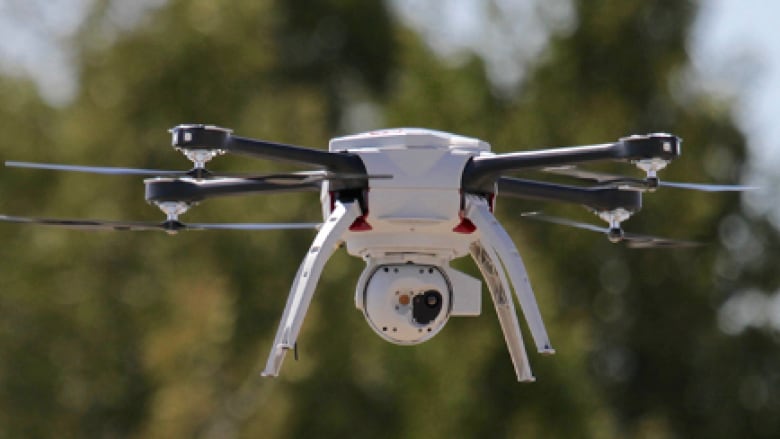
The Aeryon SkyRanger will be used for a limited periodduring operations, the company said, adding Ventus hasbeen using Canadian-madeunmanned aerial vehicles (UAV) since 2011. The SkyRanger is controlled by a single operator and can fly for up to 50 minutes, according to the company.
"The fire around Fort McMurray has affected in excess of 220,000 hectares. Using high resolution geolocated imagery and thermal infrared sensors, the team at Ventus have been approved to use the SkyRanger to co-ordinate with and assess forest fighting efforts," the company said.
The municipality locatedin northern Alberta, 434 kilometres north of Edmonton, has been devastated by a wildfire that became out of control. Advisories about the blaze were first issued on May 1. Since then, more than 80,000 people have left Fort McMurray, which is currently under a mandatory evacuation.
This is not the first time Ontario-madeUAVshave been used in damage assessments following a natural disaster. Last month,AeryonLabs provided a drone to map areasdamaged by a 7.8 magnitude earthquake in Ecuador. In those operations, the vehicle's pilot was trained inKitchenerby the Clarion Drone Academy.
.@VentusGeo Approved to Provide UAS Assistance using @aeryonlabs #SkyRanger in #yymfire Response in Fort McMurray: https://t.co/sCUx3OQFfi
—@aeryonlabs


_(720p).jpg)


 OFFICIAL HD MUSIC VIDEO.jpg)
.jpg)


