What forecasters mean by a major risk of flood
Worst-case scenario for southern Manitoba still spares cities and towns from serious headaches

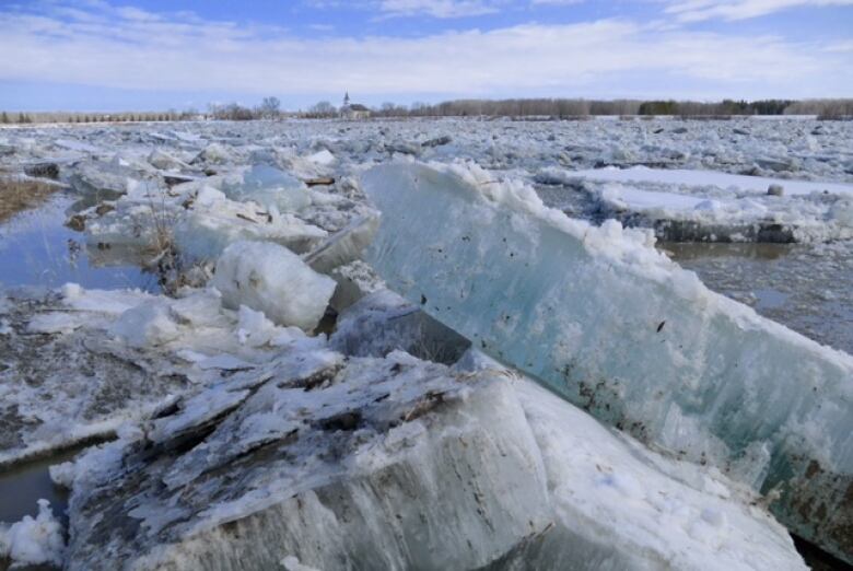
Roughly threeout of every five years,southern Manitoba experiences some form of significant spring flood. This year,the potential for that flooding has been characterized as major.
This one-word assessment doesn't paint a clear picture of what provincial hydrologists expect to see in a couple of weeks, when the rest of the winter snowpack melts away.
Here's what the province actually expects to see in southern Manitoba in the coming weeks, based on the flood outlook published on Monday.
Winnipeg
For decades, the City of Winnipeg has been protected by the Red River Floodway and the Portage Diversion. The floodway carries part of the Red River's flow around the city, while diversion sends some of the AssiniboineRiver's flow into Lake Manitoba.
These artificial channels wind up carrying floodwaters roughly three out of every five springs. This year, provincial officials say there's a very high chance they will both be used.
But even when these diversions carry water away from the city, the Red and Assiniboinerivers rise within city limits. Assuming all the ice moves off the Red before the river crests, the city is expecting it to hit17 to 19.5 feet above normal winter ice levels at James Avenue (or "feet James," as the measure is known).
That range straddles the line between a minor and moderate flood. When the river rises to this range, the city takes some steps to mitigate against flooding, such as sealing outflow gates on drains into the river.
The Red has crested within this range six times over the past two decades, in 1998, 1999, 2001, 2004, 2005 and 2007. If you don't remember those floods, there's a good reason: They were entirely uneventful for the city.
The possibility of ice jams, however, means the city is also preparing for a higher crest. Ice could bring the Red as high as 22 feet James this spring, or two feet above the unofficial level for a major flood.
If forecasts predict this level is likely, the city will notify owners of dozens to hundreds of low-lying properties, mostly along the Red River, and warn them to build sandbag dikes as a precaution.
The Red crested in the city around this range in 2006, 2009 and 2011. At 22.6 feet James, the 2009 crest was the highest in the city since the 1997 flood of the century. That was also the spring when ice jams had the greatest effect on river levels within the city.
Red River south
Provincial flood forecasters have put together three scenarios for flooding on the Red between the U.S. border and Ste. Agathe, depending on the weather.
Under favourable and average conditions that is, a gradual melt and relatively little additional rain and snow forecasters predict a moderate risk of flooding, which means the Red spills its banks in certain areas but generally does not force highways to close.
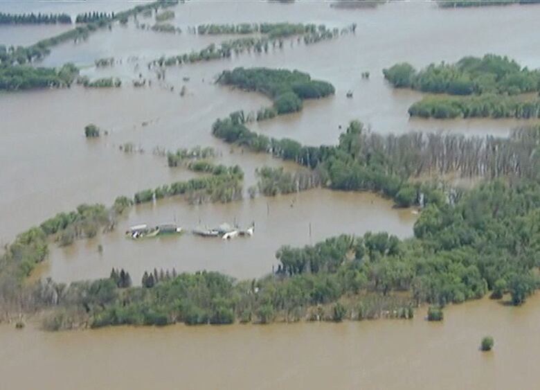
Under unfavourable conditions, whiich involve a faster melt or a lot more precipitation, the southern Manitoba stretch of the Red River will flood in a manner similar to the way it flooded in 2011. That year, portions Highway 75 were under water for 28 days.
Even in the worst-case scenario, towns and First Nations in the Red River Valley would only be inconvenienced. They would all be safe within theirring dikes.
"There is sufficient community protection within the Red River basin, as community dike elevations are higher than the predicted levels," flood forecasters say.
Assiniboine River
Communities along the Assiniboine River can bemore difficult to protect from floodsthan those along the Red River, given the relatively infrequent history of flooding in western Manitoba. The massive 2011 Assiniboine flood exposed weaknesses in flood protection at a number of spots along the way.
That said, flood forecasters are only expecting moderate flooding on the Assiniboineunder both favourable and average weather conditions. This would be like the 2009 flood on the Assiniboine, which was manageable.
Between Brandon and Portage la Prairie, unfavourable weather could result in flooding slightly less severe than 2011. This would meana lot of water would be sent through the Portage Diversion into Lake Manitoba again.
Souris River
The highest flood risk in southern Manitoba is along this waterway, which flows from the U.S. border to the Assiniboine River.
Flood forecasters are calling for moderate Souris flooding under favourable weather conditions, major flooding with average weather and potentially severe flooding if the melt is fast or a lot of precipitation falls.
That said, the towns of Melita, Souris and Wawanesa all have dikes built high enough to deal with the worst-case scenario, provincial officials said.
As usual, agricultural land will bear the brunt of overland flooding.


_(720p).jpg)


 OFFICIAL HD MUSIC VIDEO.jpg)
.jpg)


