First Nations say traditional knowledge should help shape federal flood maps
Gathering held in downtown Winnipeg to provide feedback on cross-Canada project
First Nation members from across the province gathered at Winnipeg's Fort Garry Hotel on Thursday to provide feedback on how the federal government can incorporate traditional knowledge into its flood mapping guidelines and processes.
Flood hazard maps and guidelines are key to assessing a community's flood risk, but the federal government says many of them are not always available or up to date.
A new cross-Canada project, the Flood Hazard Identification and Mapping Program, is coming toManitoba to help change that. Ottawa is spending about $64 million in the project over five years to help communities plan and prepare for future floods more effectively.
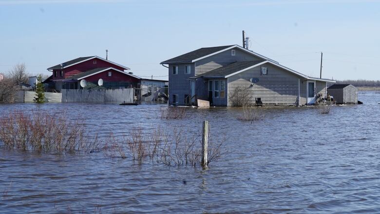
"It's very scary to deal with flooding for the first time," DakotaTraverse, a councillor of Kinonjeoshtegon First Nation, told CBC.
His First Nation experienced flood levels last year that have never been documented in the community's entire history, he said. The First Nation predicted the flood, while the province said otherwise,according to Traverse.
Acosys, an Indigenous consulting firm, was contracted by Natural Resources Canada to host Wednesday's engagement workshop, where First Nation members said more needs to be done to protect vegetation and natural habitats.
The guidelines should include knowledge that elders have gathered from living on the land, such as observing animal movements, which are good predictors of upcoming weather disasters, Traverse said.
"Usually when [otters] swim upstream, that means that wherever they swim, they're swimming away from danger."

David Carrire-Acco, president of Acosys, said the event was a way to have the realities of First Nation communities inform flood policy, which is often dictated by insurance companies and government.
"The people who have the knowledge they're the people in the community," he told CBC.
Under current guidelines, Peguis First Nation was considered to be at a low flood risk last year, he said. The community is still struggling to rebuild after major flooding forced more than 2,000 people to leave the First Nation last spring.
First Nation communities are often the hardest hit by flooding due to poor infrastructure, insufficient emergency management plansand a general lack of resources, according to a release fromAcosys.
Carrire-Acco said it can alsoaffect local gardens and residents' ability to grow food on their land, which impacts the community's overall food security.
"When you look at it holistically, the flood mapping guidelines don't take that into consideration."
Carriere-Acco hopes governments will work on flood plans with the First Nations as equal partners.
"It just pains me to see communities being impacted from decisions that were made 20 to 30 years ago, and using the same guidelines that have been stagnant."

With files from Brittany Greenslade


_(720p).jpg)


 OFFICIAL HD MUSIC VIDEO.jpg)
.jpg)


