Southern Manitoba communities brace for more rain amid worst flood in years
20-30 mm of rain expected to fall Monday
The mayor of a Manitoba community swamped by one of the province's worst floods in years says Ritchot is prepared for more rain, but it's not welcome.
Chris Ewen, mayor of the rural municipality of Ritchot, says the Red Riveris expected to crest in the area on Tuesday, but that could change because of the forecast.
"We were anticipating to see around 2009 flood water levels. I don't think we're there quite yet. We still have a couple of feet to go," he said.
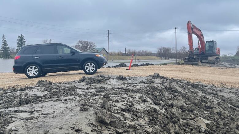
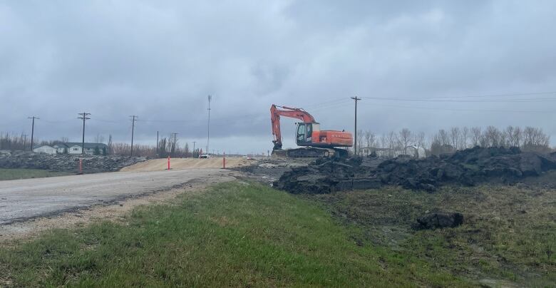
The municipalitysouth of Winnipegstraddles the riverand the major trucking route Highway 75, which was closed near Morris last week due to the widespread flooding across the Red River Valley.
Environment Canada has issued a special weather statement for much of southern and eastern Manitoba. Between 20 and 30 millimetres of rain is expected by Monday evening.
There is also the possibility of more rain later in the week.
The Red River flood of 2022 is already the sixth-largest on record by volumebased on flows recorded at Emerson, where the river is cresting, and Ste. Agathe. In recent memory, only the 1997 and 2009 floods were larger.
It looks like this year's flood will be amongthe top five or six Ritchot has seen, Ewen said.
Properties are protected to 1997 flood levels, but the municipality issued evacuation notices due to concerns about water over the roads.
"For Saturday, I believe we've seen 192 evacuation notices, and those are voluntary," Ewen said.
Of those, around 70 homes have beenevacuated.
The municipality has also handed out about 150,000 sandbags.
Highways 210 and 247 in the area are closed because of water over the road.
Ewen worries about the long-term impact of the flood once the water recedes.
"When are those farmers going to be able to get on their fields?Because right now it just looks like a lake when you look out there. What kind of damages are we going to see in our infrastructure?"
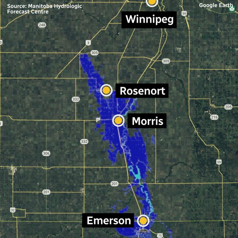
Ralph Groening, the reeve of the rural municipality of Morris, said from Arborg to Emerson, people are dealing with the impacts of high water on infrastructure.
Staff have only started working to try to identify all of the infrastructure repair needs, he said.
"This rain just adds to that," he said.
With the crest of the Red River expected in the region tomorrow, the rain might not increase the height of the water, but it could mean the flooding will last longer, further damaging roads over time, Groening said.
"This is going to be a busy, busy summer of repair."
The region willneed help from the Disaster Financial Assistance Programthe province announced on Monday, he said.
Infrastructure Minister Doyle Piwniuk said 26 municipalities remain under a state of emergency. Three hundred people on municipalities and 1,800 on First Nations have been forced out of their homes.
With files from Meaghan Ketcheson and Bartley Kives


_(720p).jpg)


 OFFICIAL HD MUSIC VIDEO.jpg)
.jpg)


