A century of water: As Winnipeg aqueduct turns 100, Shoal Lake finds freedom
In 1919, Winnipeg got a reliable source of water but imposed isolation on Shoal Lake 40
The taps to Winnipeg's drinking water were first turned on in April 1919, butas the city celebrated its engineering feat and raised glasses of that clear liquid, another community's fortunes suddenly turned dark.
Construction of anew aqueduct plunged Shoal Lake 40 into a forced isolation that it is only now emerging from, 100 yearsafter Winnipeg's politicians locked their sights on the water that cradlestheFirst Nation atthe ManitobaOntario border.
"The price that our community has paidfor one community to benefit from that resource, it's just mind-boggling," said Shoal Lake 40 Chief Erwin Redsky.
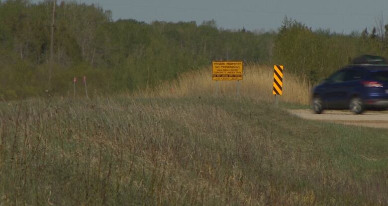
More than 1,200 hectares of the First Nation's ancestral land around Indian Bay was expropriated, including a burial ground that was excavated, to make way for construction of the water intake for the aqueduct thatstill brings drinking water from Shoal Lake to the city of Winnipeg.
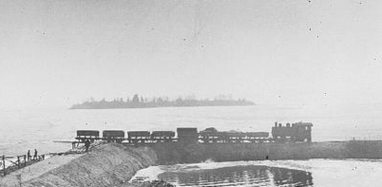
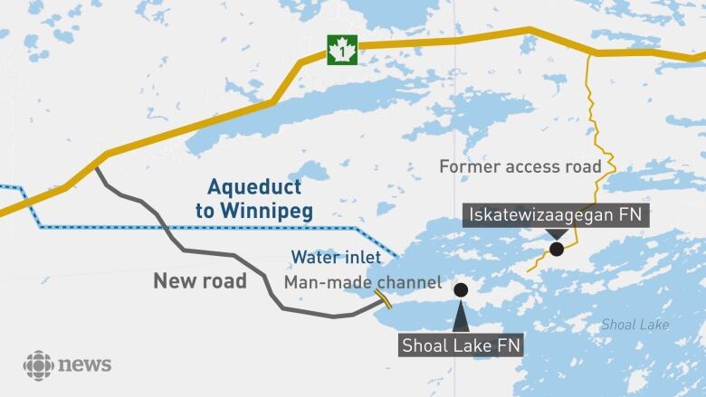
At the time, the band was given just over $2,000 for the land and relocated to a peninsula jutting into Shoal Lake, between Indian Bay and Snowshoe Bay. Not long after that, the peninsula was severed from the mainland, carved into an islandby a canal created as part of the aqueduct project.
The canal divertsdirtier, murky water from the Falcon River away from the intake.
That partitioning of Shoal Lake 40's land left community members with no reliable way in or out of the First Nation.
"We had people risk their lives on a daily basis just to do the basic things, whether that's checking the mail or picking up some groceries. We had to cross a body of water to get in and out of our community," said Redsky.
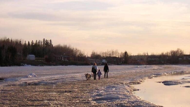
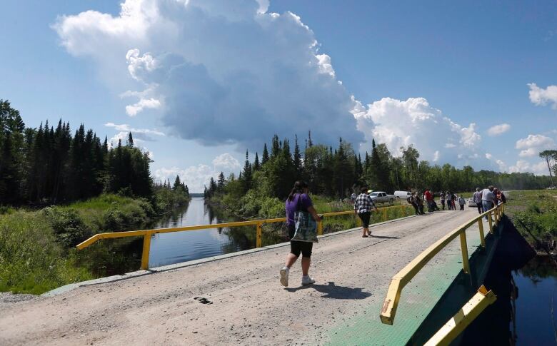
In early days, canoes were used to cross the 100-metre-wide channel of water between the island andneighbouring Iskatewizaagegan First Nation (also known as Shoal Lake 39)on the mainland. Ice roads allowedpassage in winter.
But many died over the years, falling through the ice or drowning as boats capsizedin hard winds and high waves.
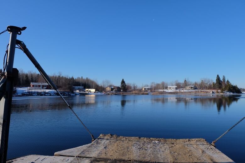
For the past 30 years, a barge ferry has operated between the two landings, but it is expensive and unreliable, breaking downfrequently and stranding people.
Here's the biggest irony: The waterShoal Lake sends to Winnipegis treated at a state-of-the-art- plantat the Deacon Reservoir, and has been recognized as being among the world's best drinking water.
Shoal Lake40, however, has spent 22 years hauling in bottled water atgreat expense because ofa boil-water advisory it's been under since 1997, due to a cryptosporidiosis outbreak.
And its isolation has made the cost of building a water treatment plant prohibitive, leaving the community engulfed in hardships that were never of its own making.
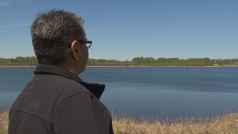
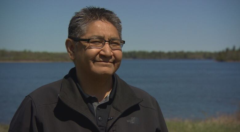
"We find a disconnect between what the city [of Winnipeg] achieved and what the impacts were for us,"saidTom Anderson, an elder and former Shoal Lake councillor.
"We got displaced from the optimum spot to the least desirable spot."
The original Shoal Lake site allowed for gardening,trapping and harvesting of wild rice.The move to the peninsula left the community with a terrain of swamp,clay and rock.
Typhoid troubles
The City of Winnipeg's search for acleaner water supply began shortly after 1899, when it purchased the privately run company thatfor two decades had provided residents with water pumped from the Assiniboine River,according to the Manitoba Historical Society.
The supply sourcewas changed to artesian wells due tocontaminated river water leading totyphoid outbreaks.
Theyield from the wells was inconsistent, though, and the water was mineral-laden which, while safe for drinking, caused problems for industries whose boilers became coated inscale deposits.
The citybuilt the first municipal water-softening plant in North America in 1901 to address the hardness of the water, butas Winnipeg's population continued to balloon from23,000 in 1890 to 132,000 people by 1910 city officials realized a much larger and cleaner source was necessary.
Not only was it needed for consumption, but there was also a growing demand for a better firefighting supply.In emergencies, the city would tap into the river, but that source would spray as much mud as water.
In 1907, a commission appointed to investigate the best available source of water submitted a report recommending the Winnipeg River, northeast of the city.
But the city was in the process of building a hydroelectric generating station and the world economy was in a recession, so the water supply project was postponed.
Identifying Shoal Lake
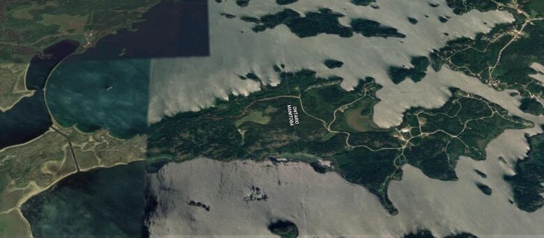
In 1912, a renewedsearch for soft water began and engineers identified Shoal Lake, at the western arm of Lake of the Woods, as the best around.
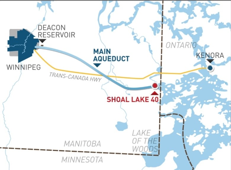
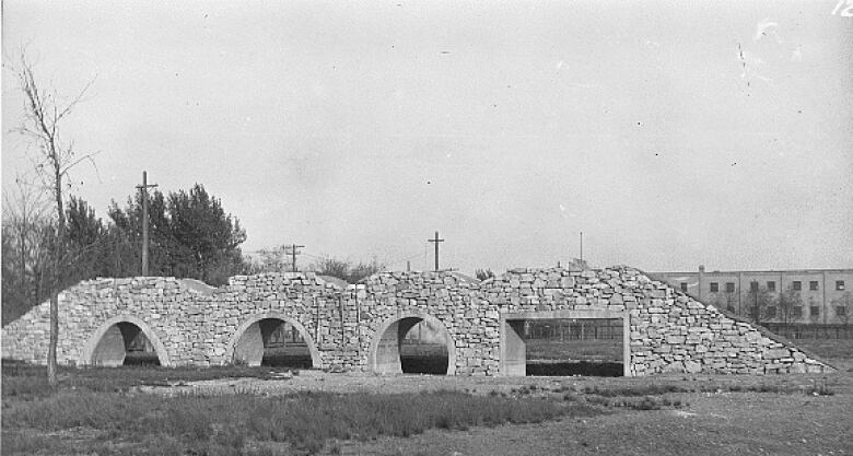
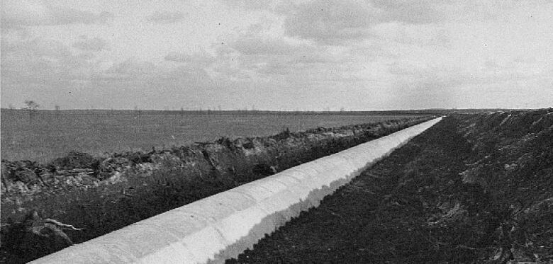
Its elevationwas also91 metreshigher than Winnipeg, which meantgravity could feed the flow down a 155-kilometre-long concrete pipe to a reservoir at the east edge of the city, as well as to the McPhillipsStreetReservoir first built to hold water from the artesian wells.
From there, smaller branch lines would bebuilt to carry water to municipalpumping stations.
The reservoir east of the city is nownamed forThomas Deacon,a civil engineer, businessman and mayor of Winnipeg in 1913-1914. It was under his guidance that the project pushed ahead, along with the creation of theGreater Winnipeg Water District tosupply not only Winnipeg but municipalities around it.
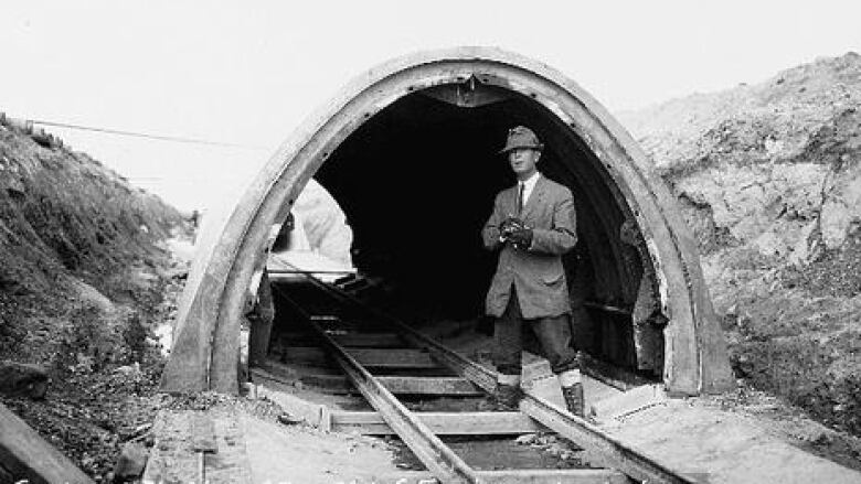
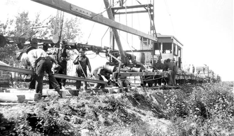
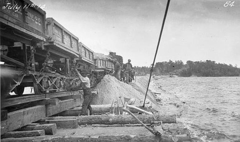
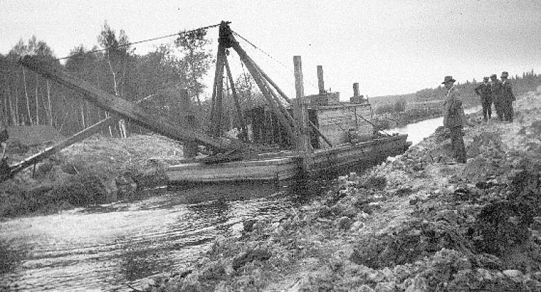
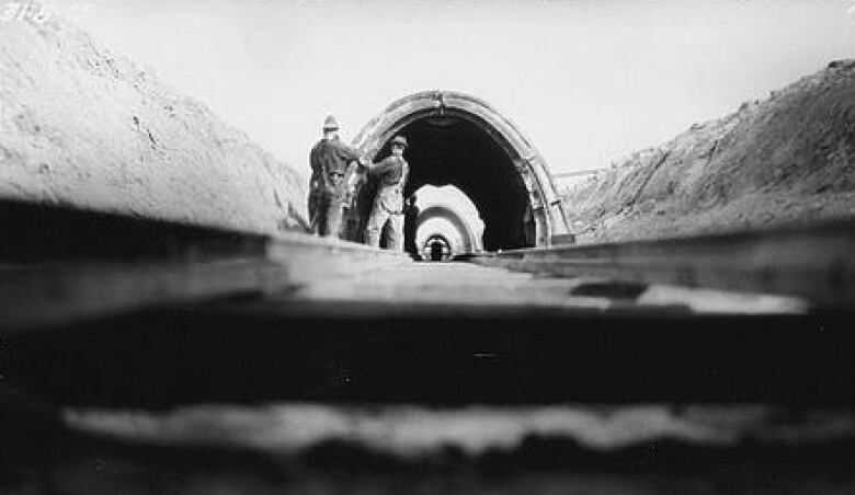
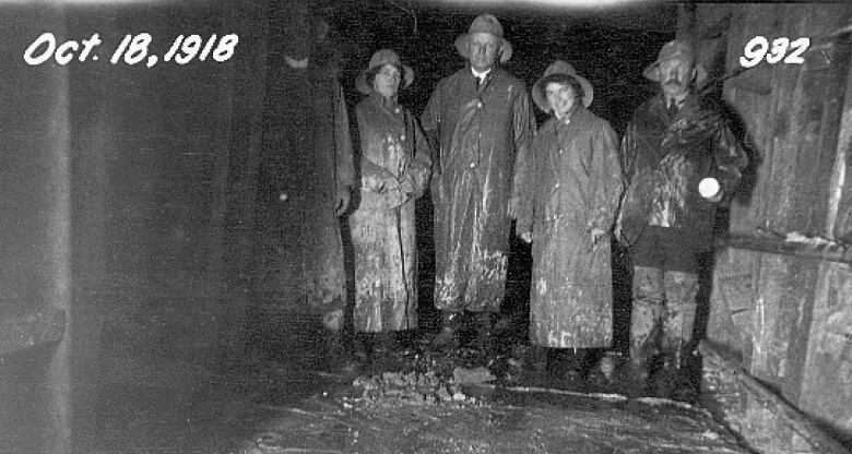
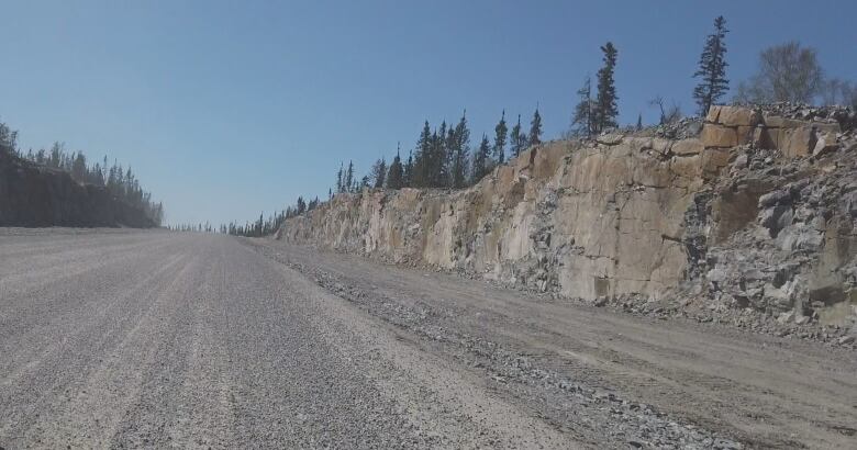
Work on the aqueductbegan in 1914,with the building of a railway to the Indian Bay siteto deliver materials and crews. Clearing of land, digging of tunnels and laying down the aqueduct beganin 1915and took until the start of 1919, according to the City of Winnipeg's website.
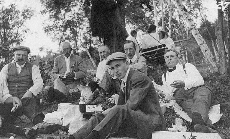
Engineers also looked to the Catskill aqueduct,which is part of a system that brings water to the city of New York, as a guide.Test sections of the Winnipeg aqueduct were displayed at the city's exhibition grounds as the project got underway, giving the public a view of what was being constructed.
Isolating Shoal Lake 40
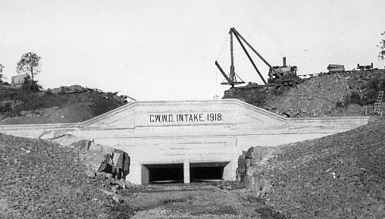
At Indian Bay, crews carved out part of Shoal Lake 40's ancestral land and used it to build a large dike at the western edge of the bay. The purpose was to separate the clean lake and the intake fromthe Falcon River's outflow.
That riverdrains from an area of muskeg, drawingbrown, organics-laden water with it. So crews blocked the area where it enters the bay and cut a channel to drain it down to Snowshoe Bay and into the greater Shoal Lake.
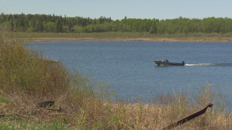
That channel is what severed the reserve from everything else. Shoal Lake 40's residents once used the clean water straight from the clear portion of the lake, but over the years, development of cottages and an increase in watercraft left it tainted.
On March 29, 1919, the first flow of water from Shoal Lake arrived at the McPhillipsreservoir, and distributionthroughout Winnipeg began on April 5.
Shoal Lake 40's residents have suffered as Winnipegthrived.
The reserve has no way to transport garbage orsewage off the island, so it is instead dumped in designated areas.Paramedics and home-care workers are reluctant to go into the community for fear of not being able to get across the water or back again.
A kindergartenGrade 8 school was eventually built, but those heading into high school were forced to go to Kenora, 60 kilometres away that is, if they were able to get across to Shoal Lake 39 territory and take the access road up to the Trans-Canada Highway.
The barge ferry was started in 1990, which made it easier to make the trek across, but the community remained restricted in what could be transported:the barge had size and weight limits, making it difficult to bring in building supplies and other freight.
The barge also had limited operatinghours, from 7 a.m. until 11 p.m.
"We were almost living in a curfew," Chief Redsky said."There are many stories where people were stranded on the mainland, unable to make it home for the night."
In winter, the ice road thickness determined the weight that could be hauled, and in springthere was always the risk of a vehicle plunging through.
It wasn't until 1990 that a running water system was built, but it was shut down seven years later due to the ongoing contamination.
"There's kids out here, if they're 20 years or youngerthey've lived all their lives with drinking bottled water. It's just the older people that can remember when they used to drink out of the lake, when it was pristine," said Anderson.
He said the reserve spends up to $150,000 annually to importdrinking water.
Exhausted and frustrated, people had been relocating to Kenora and other nearby communities. According to census data from September 2017,the band had 641 people but just 285 still lived on the reserve.
Ainsley Redsky, 16, said youth in Shoal Lake 40including herselfwould suffer from depression, sometimes not coming out of their rooms for days.
"I felt anger, lots of anger inside," she said."We don't get to drink out of our own taps. It's sad.
"No one deserves to go through what my family and everyone else on the reserve went through."
Freedom Road
In 2001,the federal government proposed buildinga bridge between the two Shoal Lake reserves, but Iskatewizaagegan voted against it, not wanting a public thoroughfare.
So in2003, Shoal Lake 40 focused instead on getting a road across the Falcon River outflow channel to link with the mainland and up to the Trans-Canada Highway.
It lobbied and pleaded, but fordecadesthe City of Winnipeg fought all efforts to build a permanent road, fearing development would threaten its water supply.
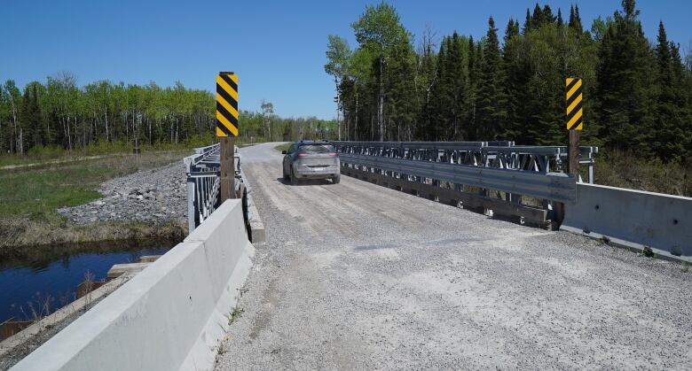
In 2013, a temporary bridge over the channel was built, finally connecting the community to the mainland. Itled to a rough, unpaved winter road, butit was a first taste of freedom, said ChiefRedsky.
"Many people, when they look at that piece of steel, it's just a piece of steel, but for usit's reconnecting to the rest of Canada," he said.
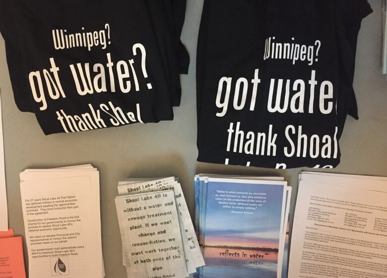
After years of battling the politicians on its own, Shoal Lake launched a campaign in 2014aimed at educating Winnipeggersabout where their water comes from not the tapbut the true source.
Before long, T-shirts and posters were seen with the message: "Got Water? Thank Shoal Lake 40."
Those thank-yous came flooding in and governments felt the pressure.
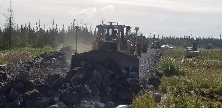
After working out logistics,the province of Manitoba, the City of Winnipeg and the federal government reached a three-way funding agreement in December 2016 to build a$30- to $40-million permanent road, which has been named Freedom Road.
Construction began in 2017 and the road officially opens this week.
"We like to call [Freedom Road]the road to reconciliation, and there's a lot of work to do in terms of reconciliation. The road is just the beginning," he said.
Emergency responders can now reach the community;liquid and solid waste can be transported out;health services off-reserve can be accessed;and some of the trailers currently being used for homes and administrative offices can be replaced with new, permanentstructures.
The money saved fromthe now-retired barge ferry can go toward those needs, said Anderson, whose youngest brother died in a house fire in 2002 because emergency vehicles couldn't get across the soft April ice.
A new school is being planned, new houses are already being built, anda water treatment plant is finally coming, expected in2021.
The future is wide open, said Anderson.
"Wehave a lot of ground to make up for all of the opportunities we've missed, but I would say the sky's the limit now," he said.
"The little toddlers now, the people in preschool, the young kids in daycare, they'll never have to live with isolation. All they'll know is the permanent road, so we're very happy about that."
There is one more thing ChiefRedsky would like to see corrected.
Winnipeg has a number of monuments that pay tribute to the aqueduct, but none of them mention Shoal Lake 40.
"One of the things I would like to see at the city's end of the pipe would be some sort of monument to recognize that there is a community out here, and it made some sacrifices so Winnipeg can benefit."


_(720p).jpg)


 OFFICIAL HD MUSIC VIDEO.jpg)
.jpg)


