Newfoundland on hurricane watch as Leslie draws near
Leslie approaches as heavy rains sweep into western Newfoundland
Newfoundland is bracing for a potential hurricane or at least a ferocious tropical storm Leslie on Tuesday, as the system continues to churn towards the island's southeast, bringing with it winds of up to 111 km/h.
All schools on the island were ordered closed in advance of the storm, and the Canadian Hurricane Centre in Halifax issued an eveningbulletin forecasting the storm's centrewill benear the Burin Peninsula in southeast Newfoundland.
Leslie was moving towards Newfoundland at 55 km/h on Monday night.
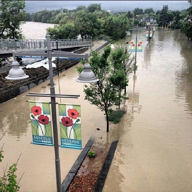
But even before Leslie is expected to hit Newfoundland on Tuesday, a separate weather system was flooding roads and homes in western Newfoundland.
Several roads were closed in Ship Cove, Piccadilly, and West Bay on the Port au Port Peninsula as water cascaded over them, badly damaging shoulders along some parts of the roads.
Patrick Young said he has lived in Ship Cove for 45 years, and he had never seen anything like Monday's flooding damage.
"The worst is yet to come where they're predicting another 30 to 70 mm of rain over the next day or so," worried Young. "And we haven't seen Hurricane Leslie yet."
Newfoundland's Avalon, Burin and Bonavista peninsulaswhich cover much of the eastern half of the island and the majority of its populationhave been put on a hurricane watch for Tuesday.
Environment Canada has also put Newfoundland's south coast and other areas of Newfoundland on a tropical storm watch, with warnings for winds.
Stormy conditions, though, were already causing problems on Monday,with heavy rainssweepinginto western Newfoundlanddue to atrough of low pressure thathad stalled in the region.
RCMP and government officials urged motorists to use extreme caution in some areas, particularly on Newfoundland's Port au Port Peninsula and near the Corner Brook Stream Bridge, where westbound lanes closed Monday afternoon.
Marine Atlantic began parking the ferries that travel between Newfoundland and Nova Scotia, with regular service not expected to resume until Wednesday.
Leslie, which had been slowly churning in the Caribbean for days, has picked up speed and is expected to lash into Newfoundland on Tuesday morning. While some areas could get more than 100 millimetres, others will get very little, but are being told to brace for winds thatcould gust asfast as 140km/h in exposed areas.
With a diameter on Monday of about 800 kilometres, Leslie's reach will be extensive.
Environment Canada meteorologist Devon Telford said the storm will combine with a cold front, which will mean a lot of rain in some areas.
"The rain's going to be very heavy and it's going to be falling in a very short amount of time, so the total rainfall for most of the island, except for the Avalon, you're looking for anywhere from 70 to 110 millimetres when it's all said and done," Telford said.
Expected to make landfall Tuesday
CBC meteorologist Ryan Snoddon said Leslie will push much of its moisture to its western track, while in the east, the storm will largely be about its fierce winds. He said residents of St. John's, for instance, will likely see a fraction of the rain that will come to the west.
Leslie comes almost two years after Hurricane Igor, a powerful storm that ripped apart roads, destroyed bridges and washed away infrastructure. The storm killed one man and knocked out power in many parts of eastern Newfoundland.
However, the impact of Leslie is not expected to be as severe as Igor.
"This trough will accelerate and steer Leslie toward southeastern Newfoundland where it is expected to make landfall as a marginal hurricane or strong tropical storm later Tuesday morning," Environment Canada said in a statement Monday morning.
"As Leslie interacts with the trough it will enhance the heavy rainfall already occurring with the trough as well as strengthen the winds behind it."
With files from The Canadian Press







_(720p).jpg)


 OFFICIAL HD MUSIC VIDEO.jpg)
.jpg)


