Alaska volcano sees 36th eruption since December, and biggest ash cloud to date
Bogoslof volcano eruption on Tuesday night prompts warning to airliners and nearby fishing port
An Alaska volcano that has erupted periodically since mid-December sent up its biggest cloud to date late Tuesday night and into Wednesday morning, prompting warnings to airliners and a major U.S. fishing port in the Aleutian Islands.
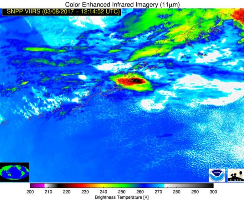
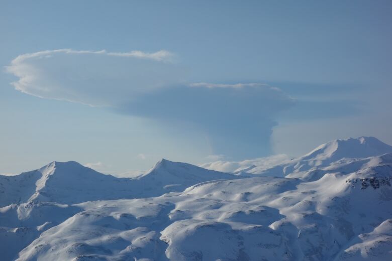
Bogoslof Volcano erupted at 10:36 p.m. local time on Tuesday, spewing ash for three hours and sending a cloud of it about 10 kilometres high, the Alaska Volcano Observatory reported.
The National Weather Service warned that trace amounts less than 1 millimeter of ash could settle on Dutch Harbor, a major port for Bering Sea crab and pollock.
It was the 36th eruption for Bogoslof over the last three months, and the first since Feb. 19.
"It was the most significant event for the entire eruption," said U.S. Geological Survey geologist Kristi Wallace.
The eruption was marked by 200 lighting strikes, Wallace said, and elevated seismic activity that lasted until 1:30 a.m. Wednesday.
"And then it just shut off," Wallace said.
Ashes a threat to jets
The Aleutians Island volcano is about 1,300 kilometres southwest of Anchorage. The volcano remains in a heightened state of unrest and could erupt again at any time.
Ash clouds rising above 6,000 metresare a threat to jets flying between Asia and North America. Air traffic controllers receive an advisory after eruptions and warn jets to fly around or above ash clouds, which can drift for hundreds of kilometres.
Volcanic ash can erode jet engine turbine blades. Ash melted by high temperatures in the engines adheres to critical parts and can cause engine failure, according to the observatory. Ash can also scrape cockpit windows and interfere with electronics of navigation systems.
Fine ash drifting to cities can cause respiratory problems for people and animals, interfere with electrical equipment and damage air filters and gasoline engines.
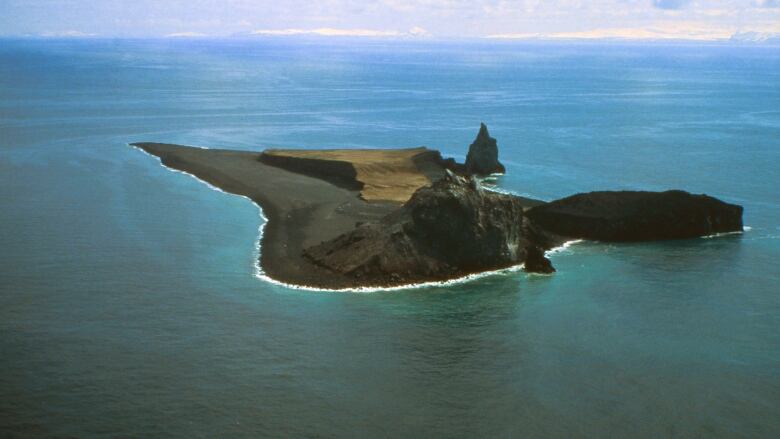
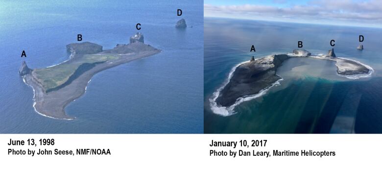
Bogoslof Island is the tip of an underwater volcano that extends down 1,700 metresin a cone shape to the floor of the Bering Sea. The island first appeared after an underwater eruption in 1796.
Subsequent explosions and eruptions have caused the island to grow and shrink.
The current eruptions are from a shallow, underwater vent on the island's southeast side.
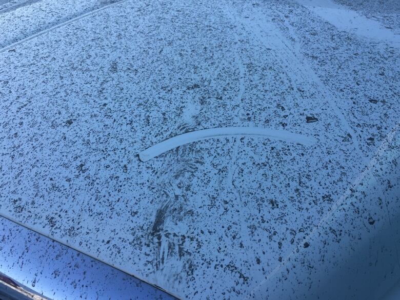
The city of Unalaska and Dutch Harbor are about 100kilometres southeast of the volcano. Donnie Lane, communication officer for the Unalaska Department of Public Safety, said police had not received any reports of ash falling on the community as of 9 a.m. Wednesday.
Wallace said the observatory had received reports of light dustings of ash in the community of about 4,500 people but that winds may have blown the ash cloud away from the island.


_(720p).jpg)


 OFFICIAL HD MUSIC VIDEO.jpg)
.jpg)


