After 15 years, final Yukon agreement signed to protect the Peel watershed
Long-awaited regional plan completed with involvement from 5 governments
It has taken more than 15 years of consultations, protests, court battlesand more consultations and now a final plan for the future of the vast expanse of Yukon wilderness known as thePeel Watershed has been set.
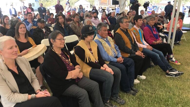
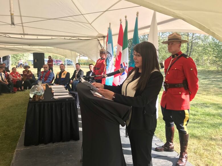
The Peel Watershed Regional Land Use Plan was signed Thursday afternoon on the bank of the StewartRiver in Mayo, Yukon. It was signed by the Yukon governmentand the Yukon First Nations of Na-Cho Nyk Dun, Tr'ondek Hwch'in and Vuntut Gwitchin, as well as the Gwich'in Tribal Council of the Northwest Territories.
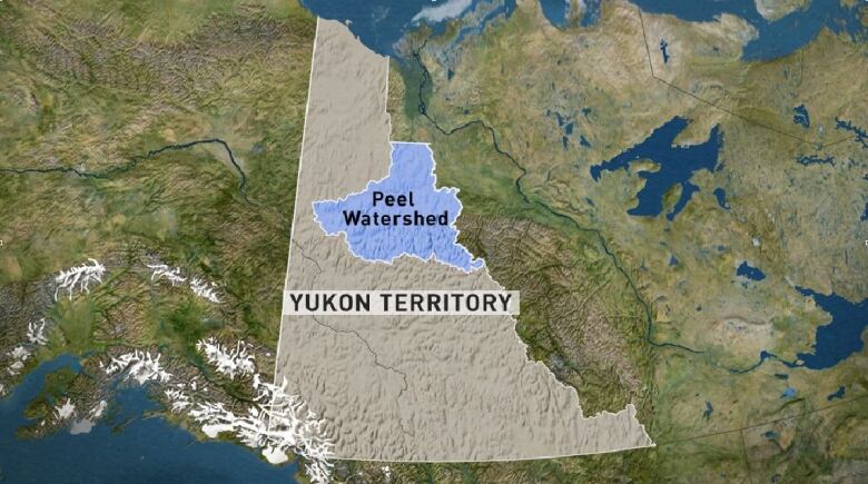
According to a news release, the plan guides the future use of land and resources of67,431 square kilometres of "ecologically sensitive" land in northern Yukon. That amounts to about 16 per cent of the territory.
"The way it finally worked out, to have the interests of the Yukon people and the interests of First Nations in this plan to have that accepted and prevail is fantastic," said David Loeks, who chaired the Peel Planning Commission, the independent body that handled the initial consultation and recommendations.
"To have this legacy of this large landscape well protected is equally wonderful."

Theregion is divided into 16 land management units, each ofwhich will have specific recommendations around land use, conservation and monitoring. The unitswillinclude:
- 55 per cent: special management area
- 25 per cent:wilderness area
- 17 per cent:integrated management area
- Three per cent:wilderness area Boreal caribou
The wilderness area Boreal caribou is a new designation to address Yukon's obligations to protect the caribou's habitat.
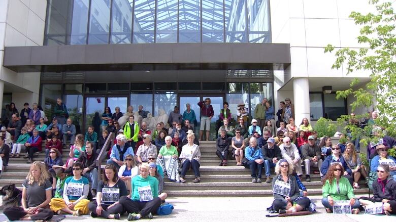
Disagreement between the Yukon government, conservationists and First Nations over how much of the watershed should be protected from industrial development went all the way to the Supreme Court of Canada.
The territorial government was found to have ignored its treaty obligations when, in 2012, it ignored the Peel Planning Commission's recommendations to protect about 80 per cent of the region from development, and instead presented its own plan that would have seen roughly 30 per cent of the region protected.
The attempt to subvert the protection of the Peel kicked off a widespread grassroots protest and createda flashpoint for First Nations-government relations in Yukon.
In 2017, the Supreme Court ordered the territorial government restart the process and follow its obligations to meaningfully consult First Nations and respect the recommendations of that consultation. By that time, an election had ousted the Yukon Party, whichhad brought forward the controversial plan.
"After 15 years of controversy that led all the way to the Supreme Court of Canada, we have confirmed the integrity of our final agreements and the rights of our people to sit at the decision-making table when the fate of our ancestral lands is determined," saidNa-cho Nyk Dun Chief Simon Mervyn.
Tr'ondk Hwch'in Chief Roberta Joseph said in the statement that this plan "completes our journey todefend the integrity of our agreements."
"It also protects an area of value to First Nations people, and I am so pleased the pristine nature of this landscape will exist for our citizens yet to come."
"This is truly a great day,"Chief Mervynsaid in the statement. "I am tempted to think that my work as chief is over; that I can kick back now and fade into oblivion knowing that my people have a sanctuary for future generations.
"But in truth, the real work is just beginning."
Celebrations were scheduled to follow the signing ceremony Thursday, including dinner and music at the community hall and a campfire hosted at the First Nation of Na-Cho Nyk Dun's government house.
Corrections
- This story has been corrected to state that Mayo is on the bank of the Stewart River, not the Peel River.Aug 22, 2019 7:31 AM CT
With files from Claudiane Samson, Steve Silva


_(720p).jpg)


 OFFICIAL HD MUSIC VIDEO.jpg)
.jpg)


