N.W.T. fires have released 97 megatonnes of carbon, says European agency 277 times what its people emit
Territory on track to beat 2014 record for how much land has burned
Wildfires in the N.W.T have emitted 97 megatonnes of carbon into the air so far this year 277times more than what was caused by humans in the territory back in 2021.
Mark Parrington, a senior scientist working at the European Union's Copernicus Atmosphere Monitoring Service (CAMS), said the N.W.T. has contributed the most of all the provinces and territories to Canada's total wildfire emissions.
From the start of the year up until Aug. 23, wildfires across Canada have emitted 327 megatonnes of carbon into the air according to CAMS data. (For context, one megatonne is a million tonnes.)
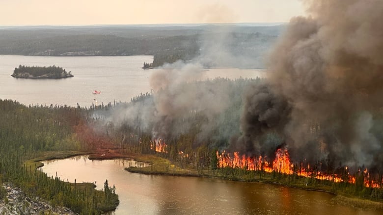
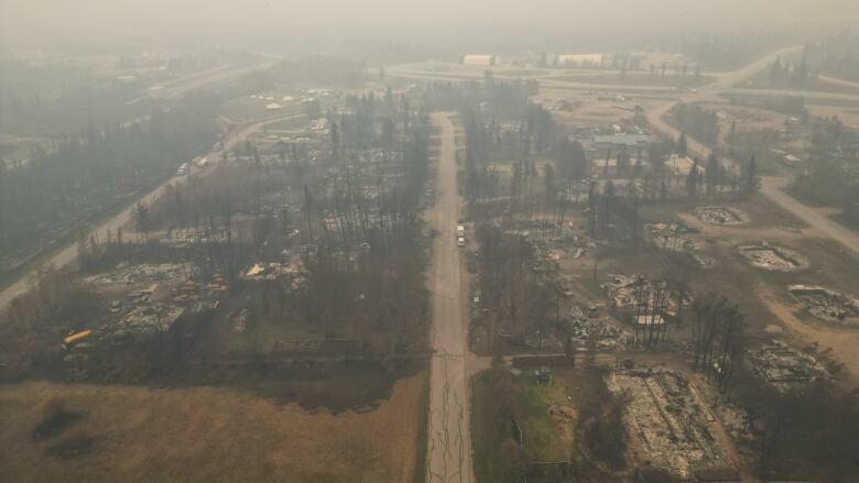
More than a quarter of that has been generated by wildfires in the N.W.T., which began burningback in May and have displaced tens of thousands of residents across 10 communities this summer including the capital city of Yellowknife. The fires havecaused damage so far in Kt'odeeche First Nation, Enterprise and Behchok.Hay River and Kt'odeeche First Nation have been displaced twice by wildfire in a matter of months.
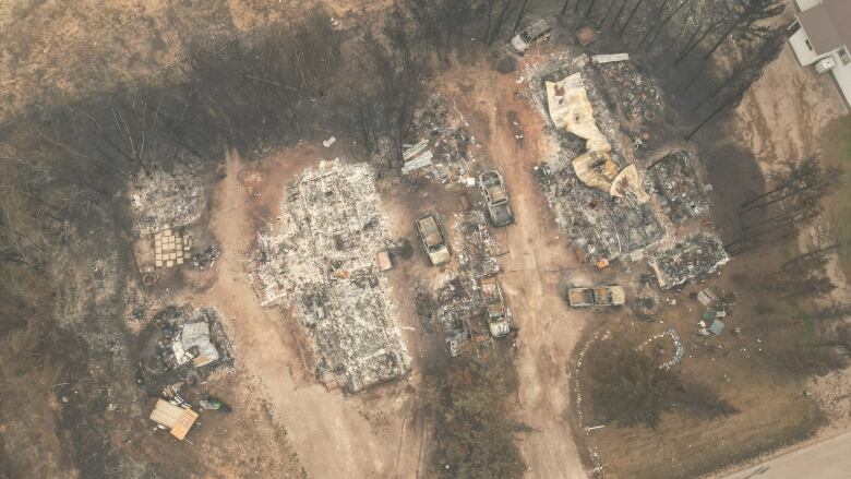
Canada's North is warming faster than other parts of the planet, leading to more severe wildfires. It's also the reason why N.W.T., infrastructure is jeopardized bythawing permafrost, traditional ways of life arethreatened as species come and go, andone N.W.T. community is at risk of washing away.
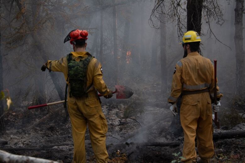
"We can all unequivocally agree this is climate change at the very root of this," said Jessica Davey-Quantick, a territorial wildfire information officer, during a press conference last week.
"We're going to see more active fire behaviour, more extreme weather, more drought-like conditions all of those factors have kind of combined. But it's really hard to say that there's one culprit that led it to communities this year, when it didn't in previous years."
The nerdy part
Let's walk through the math:97.09megatonnes of carbon emitted as of Aug. 23 this year is equivalent to 356.32megatonnes of carbon dioxide.You can convert the rate ofcarbon into carbon dioxide equivalent by multiplying the figure by 3.67.
It's important to make that conversion because the territory reports its annual human-causedemissions in the form of carbon dioxide equivalent which also takeinto account othergreenhouse gases, like methane and nitrous oxide.
In 2021, the territory emitted1.287megatonnes of carbon dioxide equivalent.
Now, we can compare those two numbers equally.
The carbon dioxide equivalent emittedby wildfires this year (356.32 megatonnes) is 277 times more than what was emitted by humansin 2021 (1.287 megatonnes).
17th week of Canadian #wildfires & continued growth in fire emissions for Northwest Territories, British Columbia & Alberta with NWT surpassing 2014 to set new record for the last two decades. #CopernicusAtmosphere GFAS data based on MODISactive fire obs https://t.co/mW6aU0WPm1 https://t.co/OH6aQ0Ve79 pic.twitter.com/mQXvqqs8AK
—@m_parringtonHow does it all compare to 2014?
The N.W.T.'s vast boreal forest usually sequesters more carbon than it emits except during big fire years.
Up until now, 2014 has been considered the territory's worst wildfire year. According to CAMS data up until Aug. 23, the current wildfire season has not quiteeclipsed 2014 in terms of emissions. (It has, however, if you compare it to Natural Resources Canada data which says fires that year emitted roughly 94.5 megatonnes of carbon.
According to N.W.T. Fire, 2.96 million hectares of land have burned in fires so far this year, butit'scalculating anupdated figure. The agencysaid the territory is well on its way to beating the record set back in 2014 of 3.4 million hectares burned.
Wildfires emit more than just carbon
CAMS monitors where wildfires are around the worldand how intensely they're burning. It also tracks emissions and forecasts the effect smoke has on the atmosphere.
Parrington said they're able to do this using meteorology and satellite imagery. It's important to monitor wildfire emissions, he said, because of the effects it has on air quality and human health.
"Fires release far more pollutants into the atmosphere than the usual activities like road transport, energy production, industry," he said. "As well as the carbon gases, there's a lot of very harmful and hazardous constituents of smoke, including particulate matter, things like benzene, which a lot of people might associate only as an industrial pollutant."
When fires stop and the wind shifts, Parrington said air quality improves but pollution from wildfires can persist for a long time if it settles on rivers and water bodies too.
The link between fires and climate change
World Weather Attribution, a U.K. based group that estimates the contribution of climate change to individual extreme weather events, recently released a study that found record-setting fires in Qubec earlier this year were made twice as likely because of human-caused warming.
The group says it's exploring options to study wildfires in other parts of Canada, butYan Boulanger, a forest ecology scientist with Natural Resources Canada and one of the Qubec study's authors, said its findings can be extrapolated to Canada's North.
Qubec is one of the areas of Canada that's least affected by climate change, he explained, yet climate change still played a very big role in the fires there.
Given that climate change is having a bigger effect on British Columbia, Alberta, Saskatchewan, Northwest Territories and Yukon, Boulanger saidwildfires in those provinces and territories are probably made more than twice as likely by climate change.
"These are very, very conservative estimates," he said.
Still, Boulanger said he's shocked by the record number of people displaced across the N.W.T. and the evacuations that have taken place in Qubec, B.C., Alberta, Ontario, Manitoba, Saskatchewan and Yukon.
He said Indigenous people are over-represented among evacuees, and they will continue to be over-represented in the future because their communities are typicallyin very fire-prone environments.
World Weather Attribution's Qubec analysis has not yet been subject to scientific peer review, but it is based on peer-reviewed modelling. In the past, the research group has subjected its analyses to review and has not had to change its findings.
Clarifications
- Due to an editing error, an earlier version of this story had a headline that suggested that N.W.T. fires released more carbon than all people. It's been updated to clarify that the fires released more carbon than all people in the N.W.T.Aug 28, 2023 1:51 PM CT


_(720p).jpg)


 OFFICIAL HD MUSIC VIDEO.jpg)
.jpg)


