Timeline: What to expect from Nova Scotia's first wintery blast of the season
Between 15 to 25 cm of snow expected across the province, some areas could see more

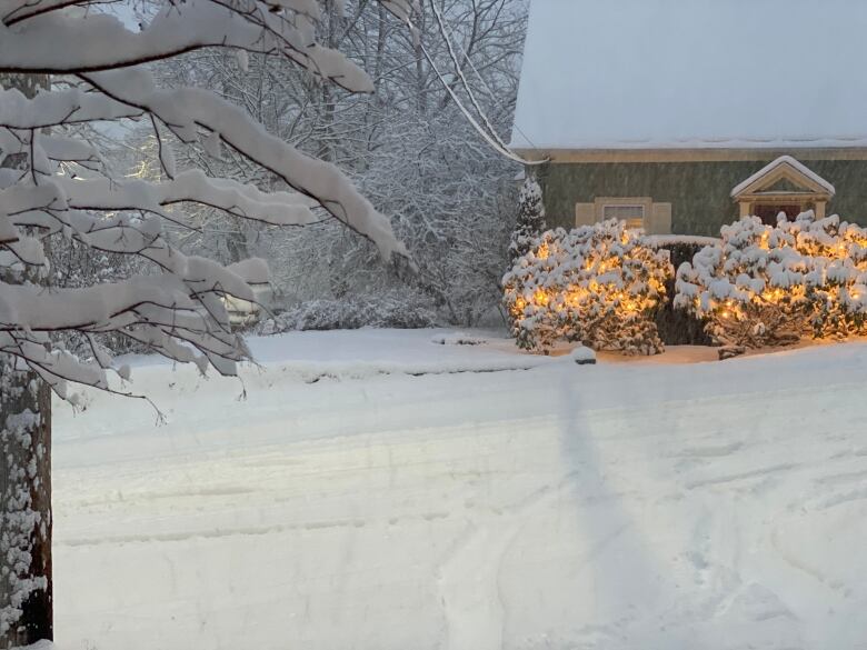
The first significant snowfall of the season is rolling into Nova Scotia.
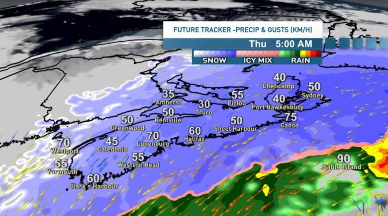
Snow and gusty winds are on tap for tonight and will continue into Thursday.
The latest guidance continues to show a widespread swath of 15 to 25 cm across most of Nova Scotia. There are still some differences in the forecast models and a slight shift to the north or south could alter totals.
That said, the best chances for snowfall in the 20 to 25 cm range will be closer to the Atlantic coastline, especially just inland and over higher terrain where amounts closer to 30 cm are possible.
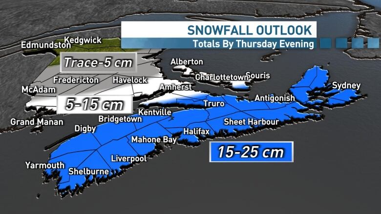
Amounts will drop quickly to the north of the system, with amounts ranging from five to 15 cm.
Northerly winds will also kick up with this system through Wednesday night and into Thursday, leading to localized blowing and drifting.
Generally, gusts of 50 to 70 km/h are looking set for the mainland, while 60 to 80 km/h gusts are on tap for Cape Breton on Thursday.
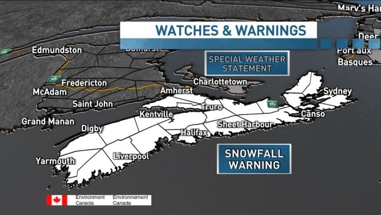
Environment Canada has issued snowfall warnings for the entire province for Wednesday night.
Timeline
Wednesday afternoon: The snow will begin in the southwestern area and then slowly track eastward across the mainland through the evening and overnight.
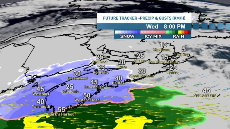
Wednesday overnight: For the mainland, the steadiest snow is set for late Wednesday nightand early Thursday morning, before slowly tapering off to lighter snow then flurries from west to east throughout the morning.
Thursday morning: The Thursday morning commute will be snowy, slick and slow going. Leave yourself lots of extra time.
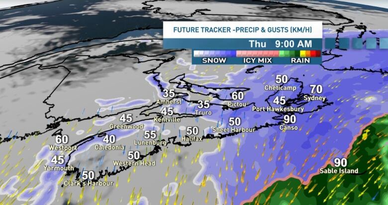
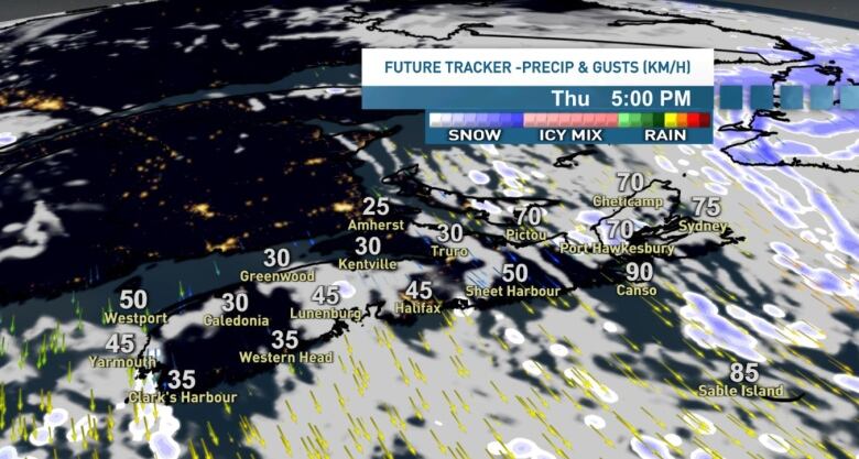
While the snow will ease in the morning, the winds will continue breezy leading to some localized blowing and drifting right through Thursday afternoon.
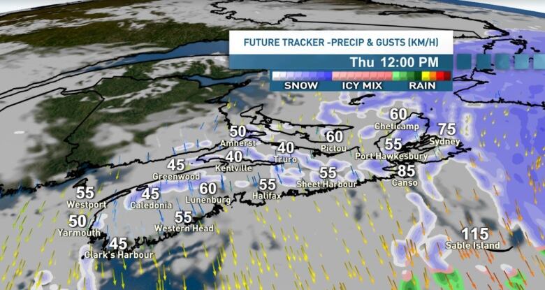
Thursday afternoon: The steadier snow will linger into the late morning and afternoon for the Northumberland Shore and across Cape Breton on Thursday, with northeasterly winds gusting 60 to 80 km/h.
Travel through much of the day will likely be slick and snowy with blowing and drifting a factor, especially in exposed areas.
My advice would be not to break your back moving every flake that falls onto your walkway or driveway, as it already has an expiry date.
We're looking at a significant push of warm air for the weekend, with more rain and some double digit temperatures, which will lead to lots of melting of the snow that does fall.
More details on that story with your seven-day forecast this evening at 6 p.m. on CBC TV and CBCGem.


_(720p).jpg)


 OFFICIAL HD MUSIC VIDEO.jpg)
.jpg)


