Post-tropical storm expected over N.S. waters by mid-week
Storm unrelated to Harvey and no landfall is anticipated, but it may have some influence on weather
A post-tropical storm is expected to pass close to or through the eastern-most marine districts of Nova Scotia mid-week.
The storm is unrelated to Harvey and will be named Irma should it strengthen over the next 24 hours.
The system is currently an area of thunderstorms just off the coastline of the state of Georgia, but is showing signs of organizing into a tropical storm. This means it is developing a centre of low pressure andthe thunderstorms are beginning to circulate around that centre.
The National Hurricane Center of the United States has issued a forecast that brings the system up to tropical storm strength by or before Tuesday at 7 a.m. as it moves north past the coastline of the Carolinas.
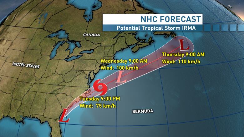
A tropical storm warning has been issued for parts of the North Carolina coast. As the storm progresses northon Wednesday, it is anticipated to be directed first south and then east of Nova Scotia.
The track of the weather system as it becomes post-tropical may take it through the Georges Bank and Scotian Slope marine areas.
No landfall anticipated
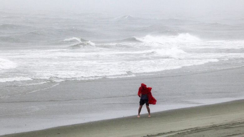
While no landfall is anticipated, the passing storm may have some influence on weather conditions Wednesday into Thursday.
Some forecast models have the outermost rain from the storm coming onshore beginningWednesdayafternoon and evening before clearingThursdaymorning.
Those same forecast models are indicating that rainfall would most likely range from 10 to 30 millimetres for parts of the province.
There remains the possibility that the system will movefar enough to the east that the rain stays offshore.
Northerly wind gusts
Other impacts would include some northerly winds gusts of 30 to 50 km/h near the coast and some elevated ocean swell.
Swell period and height are likely to increase to 11 seconds and twometres respectively for a timeon Thursday.
An increase in wave action against the coastline would be noticeable but would not lead to any coastal flooding.
Rip currents along the coastline will become stronger lateWednesdayandThursday. Extra caution should be taken if swimming in the water on the Atlantic coastline during this time.


_(720p).jpg)


 OFFICIAL HD MUSIC VIDEO.jpg)
.jpg)


