Snow, strong winds and bitterly cold temperatures on the way
Snow will make for a slick Thursday afternoon and evening commute. Long john weather arrives Friday
A system moving through Nova ScotiaThursday and into Friday will bring some snow, strong winds and then usher in the coldest temperatures so far this season.
A few days ago, this soon-to-be-storm was looking primed to bring the province one of the biggest snowfalls of the winter. Since then, however, forecast models have shifted and shuffled further southeast with the track, keeping the significant snowfall offshore instead.
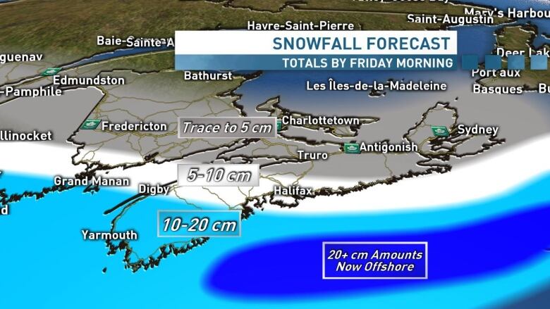
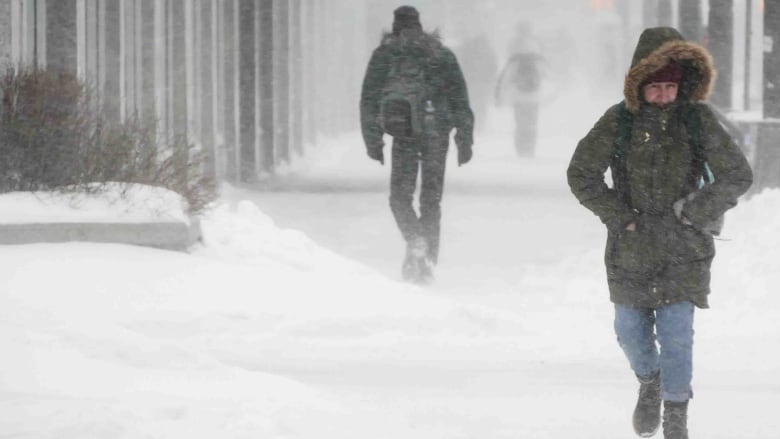
Having said that, the timing of the snow will make for a slick Thursday afternoon and evening commute for the Halifax region and across much of the province. Be sure to leave yourself some extra time and space out there.
Wintry winds
The strengthening system will become a full on storm as it tracks south of the Maritimes on Thursday night. And while we aren't looking at big-time snowfall totals, the winds will be wicked across the region on Friday.
Widespread gusts of 60-80 km/h look set for mainland Nova Scotia on Friday, with the strongest along the coasts. For the Northumberland shore and Cape Breton winds look likely to reach 90-110 km/h, with onshore flurries and blowing snow for Friday and Friday night.
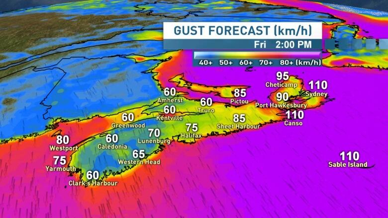
Winds will ease from west to east across the mainland on Friday night and in Cape Breton on Saturday.
Arctic air arrives
Get yourlong johns and wooly socks ready, because those strong winds will be ushering in the coldest temperatures so far this season acrossthe province. The Arctic air will spill in on Friday and stick around for Saturday as well.
Highs on Friday will be in the -9 Cto -12 Crange. With those howling winds, windchill values will be well into the minus teens and -20sthroughout the day.
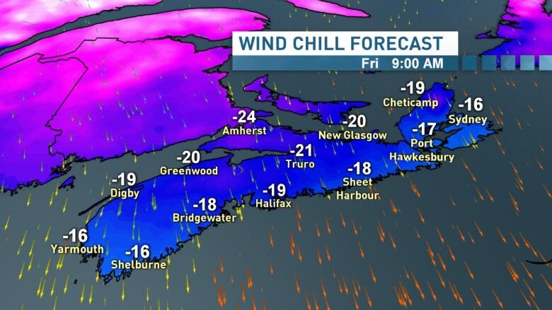
Temperatures will bottom out in the minus teens and -20s across the province on Friday night and will remain cold on Saturday, with -10 C to -13 C highs looking set for most. Friendly reminder to bring your pets inside when temperatures are this cold.
Temperatures will rise dramatically on Sunday, thanks to yet another system looking set to track into the region. At this point, that system is looking likely to be another snow mixing to ice, rain and wind event.
For an updated look at the incoming snow and wind for Thursday and Friday, plus the latest on the weekend, tune into CBCRadio this afternoon and watch CBC Nova Scotia News At 6 on CBC-TV and CBC Gem.
Follow the live blog
Keep up to date with our live weather blog, updated every day.


_(720p).jpg)


 OFFICIAL HD MUSIC VIDEO.jpg)
.jpg)


