Storm expected Friday is set to affect travel in the Maritimes, threaten power grid
Storm will bring strong winds, heavy rain, storm surge, with snow also on way for northern areas

A storm headed for the Maritimes beginning Friday and into Saturday is expected to bring heavy rainfall, strong winds and the risk ofstorm surge along somecoastal areas.
Central and northern New Brunswick will also see freezing rain and snow.
Environment and Climate Change Canada (ECCC) has already issued special weather statements ahead of the storm and warns that "utility outages are possible."
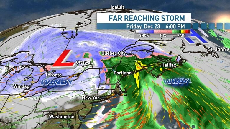
Folks travelling beyond the Maritimes should also be aware that this massive storm will likely impact travel across much of eastern North America, including Ontario, Quebec and Newfoundland and Labrador.
Strong winds and heavy rain
While we are still a few days out, early forecast projections continue to show the potential for wind gusts in the 80 to 100 km/h range across the Maritimes.
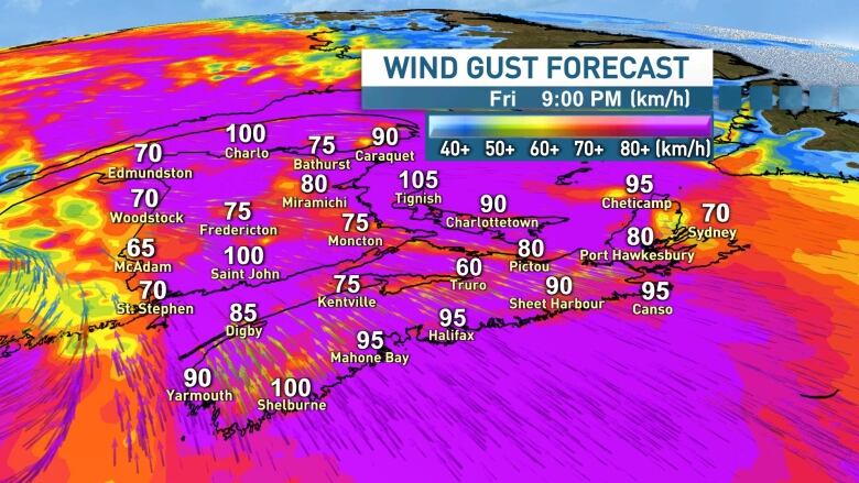
Winds of this strength typically bring power outages to the region and folks should prepare accordingly.
The strongest winds are expected to arrive late Friday, along with the heavy rainfallin the 20 to 50 millimetrerange. Heavier amounts are possible along Nova Scotia's Atlantic coast and the Fundy coast of New Brunswick.
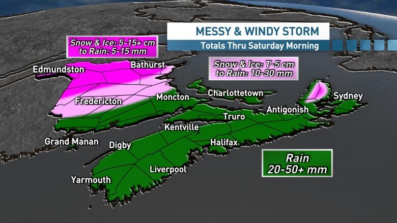
Central areas of N.B., including Fredericton, look set to transition to rain fairly quickly through the day on Friday, however northern areas of N.B. and the Cape Breton Highlands will see accumulating snow and ice pellets, before an eventual transition to rain through Friday night.
The rain and wind will linger into Saturday morning, especially for eastern areas, before gradually clearing through the afternoon with a calmer Christmas Eve afternoon and evening on tap.
Storm surge
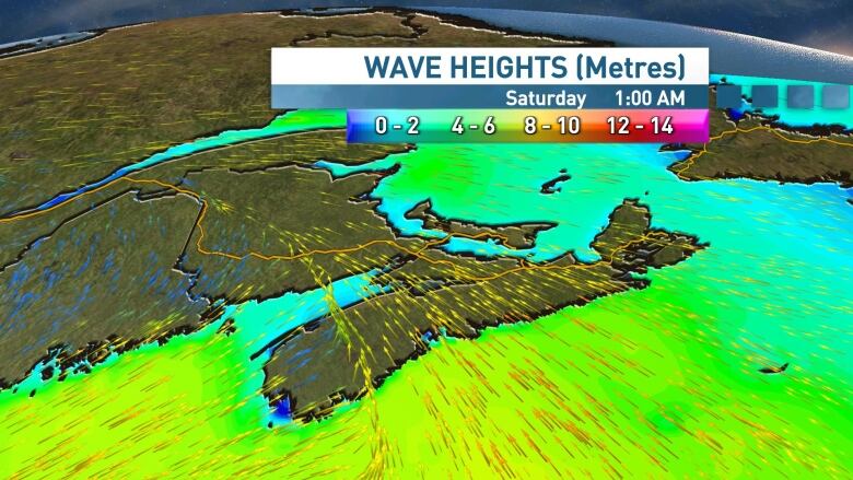
In Nova Scotia, the south facing Atlantic coastline will be most vulnerable and ECCC is warning of a run of spring tides that have "the potential to produce warning level storm surge and rough and pounding surf."
In New Brunswick, ECCC is warning of coastal erosion and possible damage in the Bay of Chaleur and Acadian Peninsula due to storm surge and pounding surf on Friday night into Saturday.
In P.E.I., storm surge and spring tides will bring the potential for higher than normal water levels near high tide on Saturday.
Stay tuned for updates on CBC radio, TV and onlineover the next few days as this storm tracks in.


_(720p).jpg)


 OFFICIAL HD MUSIC VIDEO.jpg)
.jpg)


