September in Nova Scotia warmest on record in past 30 years
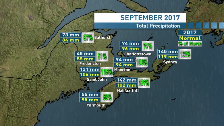
September was also a wet month, with Halifax and Sydney recording high-than-normal rainfall amounts

September 2017 wasone of the warmest on record for Nova Scotia, with mean temperatures exceeding 30-year climate normals by more than 2 C for much of the province.
Mean temperature is the average air temperature during a given time period, in this case the month of September.
At the Halifax Stanfield International Airport the mean temperature was 16.6 C. That is exactly two degrees over the normal of 14.6 C.
It was also warm enough to take sixth place on the list for all-time warmest September mean temperatures. The warmest September on record was 1999 which finished with a mean temperature of 18.5 C.
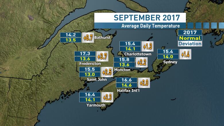
The warmth wasn't just felt in Nova Scotia but the Maritimes in general. The Fredericton area in New Brunswick recorded its warmest September on record with a mean temperature of17.3 C.
Charlottetown on P.E.I. wasn't quite as balmy with a mean temperature of 15.4 C, good enough for 21st warmest on a list of records that goes back to 1873.
Rainfall for the month was quite varied across the province. Drier conditions were found in southwestern Nova Scotia, with Yarmouth reporting 58 per cent of the climate normal amount of rain and Greenwood reporting 74 per cent.
The Halifax and Sydney airports both came in with rainfall well in excess of climate normals, 139 per cent and 122 per cent respectively.
Looking forward, current climate prediction models run by Environment and Climate Change Canada are favouring warmer-than-normal conditions to continue through October, November and December.
The same model is predicting near normal amounts of precipitation over those same months.
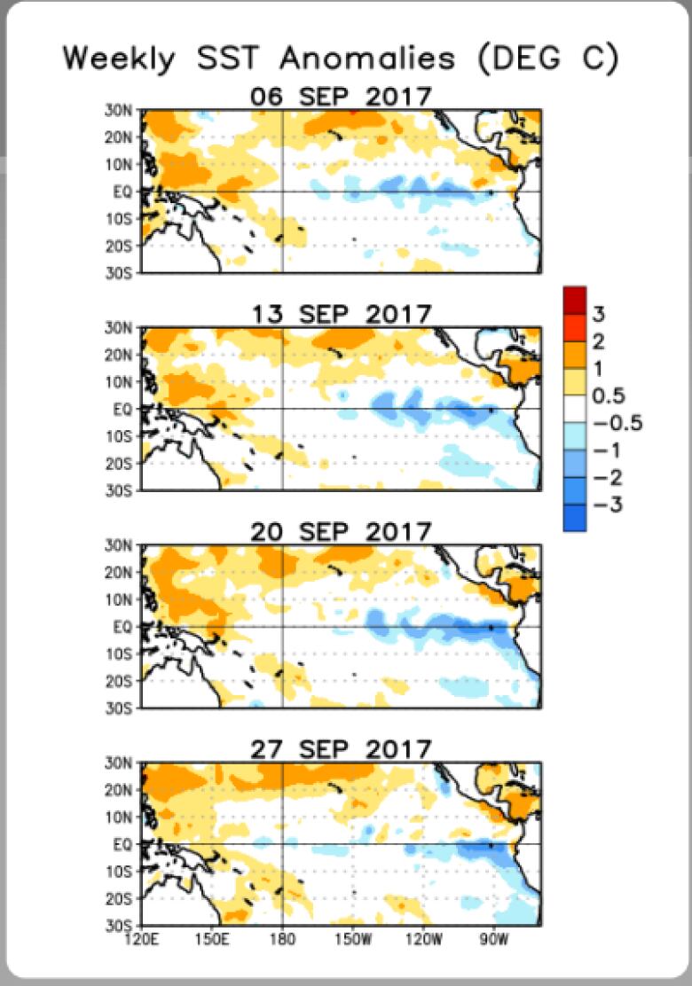
One factor to watch for in our upcoming winter will be the forecast development of a La Nina in the Pacific Ocean.
La Nina is the presence of cooler-than-normal surface waters in the southeastern Pacific, opposite of an El Nino which features warmer surface waters in the same area.
There is a weak correlation between La Nina and colder, snowier winters for the Maritimes.


_(720p).jpg)


 OFFICIAL HD MUSIC VIDEO.jpg)
.jpg)


