Another winter storm to hit Nova Scotia on Friday
Storm will come in 2 parts: a messy morning commute followed by windy winter weather Friday evening

Environment Canada sayssnow, rain, strong winds and storm surge are forecast to hitNova Scotia as another winter storm heads toward the East Coast on Friday.
Northern and western parts of the province are under a winter storm watch and can expect total snowfall amounts of between 20 and 40 centimetres,and even more over the Cobequid Pass area.
Starting Friday afternoon, Environment Canada said periods of rain in those areas will start to change over to snow, at times heavy,likely mixing with ice pellets before midnight.
The temperature will continue to drop significantly by Saturday morning.
Other parts of the province can expect between five and 15 centimetres of snow, with extended periods of freezing rain and freezing ice pellets as the storm moves eastward, transitioning from rain to snow.
The highest rainfall amounts will rangefrom 30 to 50 millimetres.
Possible bad roads both Friday morning and Friday evening
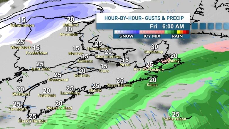
CBC meteorologist Tina Simpkin said there are two windowsfor mixed precipitation on Friday. The first is in the morning as the temperatures are expected to sit just below freezing, around -3 C. It's expected to warm up quickly in the morning, which will bring a mix of precipitation shifting between flurries and showers.
That means a risk of freezing drizzle, especially along the coast Friday morning, which could make for a messycommute.
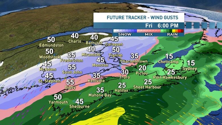
"From west to east across the province that's where the cold air arrives. First in the west, and then by early Saturday morning, in the eastern parts of the mainland," said Simpkin.
"The transition between rain over to snow is going to be a messy one. It includes the chance of freezing rain, ice pellets and in some areas even freezing drizzle."
The most slipperyconditions are currently expected after the suppertime rush hour in Halifax on Friday.
Environment Canada said most of the province can expect wind gusts near 100 km/h Friday night, which could cause blowing snow and power outages.
Simpkin said there's also a chance of thunder snow as the two systems combine, similar to the storm of Jan. 7.
With files from Tina Simpkin


_(720p).jpg)


 OFFICIAL HD MUSIC VIDEO.jpg)
.jpg)


