Real test yet to come as Ottawa River expected to peak Wednesday or Thursday
Record-breaking water levels already reachedupstream from Ottawa
With already record-high Ottawa River water levels expected to peak Wednesday or Thursday, people in the National Capital Region are anxiously watching and waiting to see just how bad they will be.
The river is expected to rise nearly half a metre to its peak by Thursday in Gatineau, Que., where floodwaters have already surrounded homes in several neighbourhoods, according to the Ottawa River Regulation Planning Board'slatest update at 5 p.m.ET Monday.
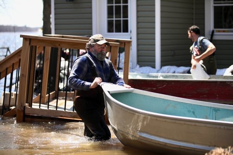
There are more than 1,400registered flood victims in Gatineauup 200 from Sunday morningrepresenting159 households. The City of Gatineau assisted with 95 voluntary evacuations.
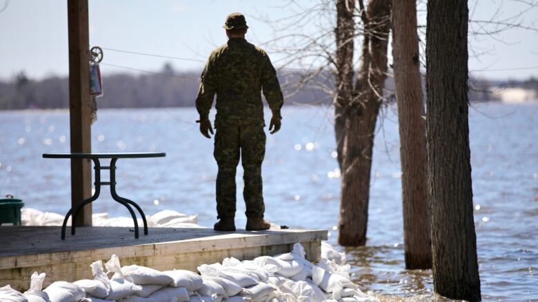
The water level in west Ottawa's Britannia neighbourhood, meanwhile, is expected to rise another 27centimetres, peaking on Wednesdayafter setting arecord high over the weekend. The peak is set to be 41 centimetreshigher than 2017 levels.
An engineer with the Rideau Valley Conservation Authority was brought in over the weekend to inspect a bermin Britannia designed to protect hundreds of homes in the west-end neighbourhood after there were concerns about water flowing through,said Laila Gibbons, Ottawa's director of public safety and environment services.
She said the city is still waiting on the engineer's report and will decide if additional sandbags are needed in the area.

Well water could be contaminated
Officials also assured residents that the city's drinking water is safe, despite concerns about rising floodwaters potentially cutting off access to at least one water purification plant.
However, the city is still urging residents who get their drinking water from wells to stop using them if flood waters have covered the top of the well or they suspect contamination.
People can pick up bottled water and hand sanitizer from Ottawa Fire Station 63 at 341 Bayview Dr. between 12 p.m. and 7 p.m. ET or they can use one of threeself-service facilities available 24 hours:
-
5201 Canon Smith Dr.
-
274 Morris Island Dr.
-
Intersection of Greenland Road and Armitage Avenue
Around 600Canadian Armed Forces members are working to deal with rising waters in the Ottawa area. More than a million sandbags have been filledwith the help of more than 9,000 volunteers, according to a news conference held by thecity Monday afternoon.
So far, there have been 21 voluntary evacuations in Ottawa.
CBC News captured drone footage of flooded areas in Gatineau, just across the river from central Ottawa, on Monday. You can watch what's been capturedbelow.

Can't see it? Click here for images from the Highway 50 area,click here for images from the Lac-Beauchamp neighbourhood, and click here for images near the sewage treatment plant in east Gatineau.
CBCNews receivedspecial permission from Transport Canada and local officials for theflights. Drones are not allowed within nine kilometres of flooded areas in Quebec.
The City of Gatineau said water levels were at the 100-year flood threshold in Aylmer, Hull and Pointe-Gatineau, with levels in Masson-Angers to the east less than 10 centimetres from that level.
Can't see the infographic above? Click here to see how much higher water levels are expected to be this year than in 2017.
This week's new reality
One of the five bridges connecting Ottawa and Gatineau theChaudire Bridge is closed to all trafficafterthe swollen Ottawa River started to rush against it.
An average of 19,000 vehicles 13 per cent of interprovincial traffic normally use it daily, as well as 1,350 cyclists.
- How the major flooding road closures will affect the commute
- The latest road closures in Ottawa, Gatineau and beyond
- Where to get sandbags in Ottawa and Gatineau
- Communities under a state of emergency
- How to volunteer

Hydro Ottawa has opened up every span of its nearby dam at Chaudire Falls,the second time in its 100-year historyit has been forced to do so.
On the Ontario side of the river, the hardest-hit communities include Cumberland, Fitzroy Harbour, Constance Bay, Britannia andDunrobinin Ottawa, and Clarence-Rockland, Ont., just east of Ottawa.
On the Quebec side of the river, the hardest hit areas include Aylmer, Point-Gatineau, Lac Beauchamp and Masson-Angers in Gatineau, and Pontiac, Que., west of Gatineau.
Can't see the map above? Click here to see which communities are under a state of emergency.
Danger notover when levels peak
The river is expected to peak in the next few days, but that won't spell theend of the crisis.
"We need people to sustain our efforts for multiple weeks," City of Ottawa manager Steve Kanellakossaid during a weekend newsconference.
"It just doesn't end when the water peaks."


_(720p).jpg)


 OFFICIAL HD MUSIC VIDEO.jpg)
.jpg)


