April snowstorms aren't done with the Prairies
Another major snow event is setting up to hit Saskatchewan
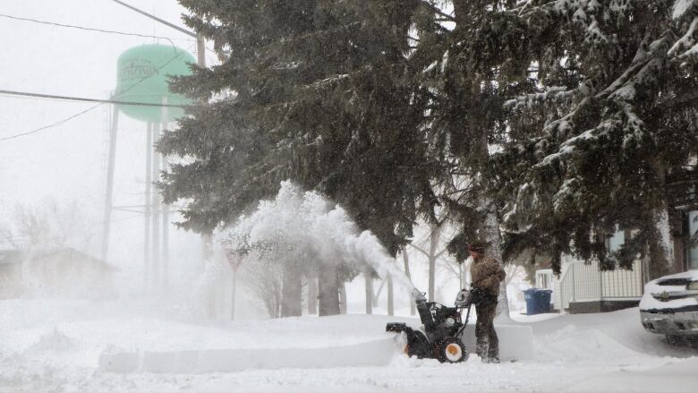
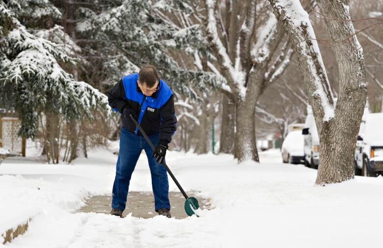
Just as people finished digging themselves out of last week's storm, another series of storms are coming, culminatingwith another Colorado Low at the end of the week.
Unlike last week'sstorm, which hit Saskatchewan, Manitoba and parts of western Ontario withtwo consecutive days of snow, this pattern will be spread out over fivedays.
Brian Luzny, a meteorologist with Environment and Climate change Canada, saysan Alberta clipper is currently developing in the Rockiesandpicking up steam.Alberta will bear the brunt of this first stormwith snowfall totals anywhere between 5 to 25 cm of snow, and the capital citycould see between 5 to 15 cm.
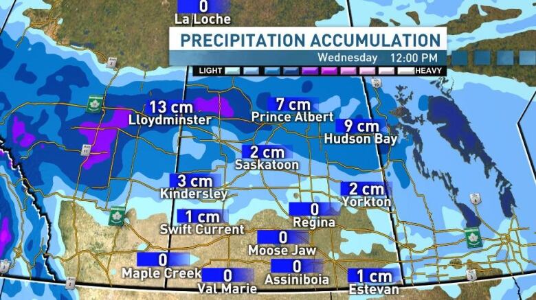
For Saskatchewan, this clipper is forecasted tocrossover into the province early Tuesday morning. At times it will bring heavy, moisture-ladensnow with a rain mix. This will make commuting messy and reduce visibility at times.
"The hardest hit areas will be Saskatoon and the northern greenbelt with ...5 to 10 centimetreson Tuesday evening, and then south through southern Manitoba with again 5 to 10 centimetres, maybe a few pockets of 10centimetres or more, but not as significant as the last system," Luzny said.
Areas closest to the Alberta border will be the hardest hit with a possible 10 to15 cm of snow in Lloydminster.Over in the southeast corner of Saskatchewan, another centimetre of snow is possible in Estevan, but this might feel like just a drop in the bucket from the already 30 to 40 centimetres they received last week.
Further south in Regina, residents could see 1 cm, but in the south it will be all about the wind.
Typically with clippers, a strong wind is associated with this type of system.
"On Tuesday, we'll havesoutheasterly wind ahead of the low, gusting up to 60 km/hin southeastern Saskatchewan. And then kind of wrapping around the low and hitting Shaunavon, Leader and theSwiftCurrent region wecould see wind gusts reaching80 km/hr," Luzny said.
In both Saskatchewan and Manitoba the snowfall amounts may trigger snowfall warnings, but Luznysaysit's too early to say for sure. But he is certain the snow from this clipper will move quickly to our eastern neighbours.
Colorado Low returns
By the end of this week,people may get a feeling ofdj vuas another Colorado Lowaimsstraight for Saskatchewan and Manitoba.
But this lowwill be different. It will still be a high-impact storm bringing heavy snow, however, the totals are looking significantly lower than the pre-Easter thumping.
Forecasters are closely watching this low as it could bringblizzard-like conditions across parts of the southern Prairies.
Luznysayshis models are showingearly signs of significant snow and rain impacting a large area of southern Manitoba and southeastern Saskatchewan.
However, he said"this system, in contrary to the other one, it looks to be a lot warmer, with a lot more wet precipitation, especially for southern Manitoba than the previous one."
Right nowthe exact track of the low is too far out, and is hard to determine the exact precipitation amounts and type, Luzny said.He advises people to keep a close eye for changes in the weather thisweek.
Relief in sight

The one question people keep asking iswhen will this snow finally end?
Luzny does offer a ray of hope to those sick of their winter boots and shoveling.
"I think once the Colorado Low passes this past weekend, that should shift the upper air pattern, which which could bring in some warmer air, warmer weather means different types of precipitation, hopefully some days with no precipitation, none at all."
Hopefully, all these April showers bring a bounty of gorgeous May flowers.


_(720p).jpg)


 OFFICIAL HD MUSIC VIDEO.jpg)
.jpg)


