Flooding worries rise for some as Churchill River system hits highest peak on record
High rainfall in areas of northeastern Alberta, northwestern Sask. contributed to increase: WSA
In her 61 years of life, Rita Ray, who lives near Sandy Bay, Sask., and frequently visits the community, said she's never seen the water as high as it has been this year.
She said she worries about the people in Sandy Bay a village about 475 kilometres northeast of Saskatoon including some of her family members, who live near the river.
"If you go to my sister's deck, you can see the water is only about five feet from her house," Ray said in an interview with CBC last weekend.
Sandbags were deployed in the community in areas that were threatened by the high water, she said.
A particularly wet year has prompted numerous warnings from the Saskatchewan Water Security Agency about the Churchill River system, which stretches throughnorthwestern Saskatchewan and into northeastManitoba.
Ray said flooding hasn't been her only worry due to this year's water levels.
Her husband works at the Island Falls hydro station, west of Sandy Bay. The facility went into a state of emergency in early July as a result of unprecedented rainfall.
"I'm so worried about those workers, that's all I can say. Those are the most impacted in Sandy Bay right now," Ray said.
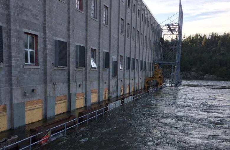
She noted every gate at the station is open, allowing water to flow through freely.She's also seen lots of debris floating down the Churchill this year and is concerned about possible damage to the hydro facility.
Scott McGregor, a SaskPower spokesperson, said on Friday that while water levels in the region are still much higher than average, they peaked earlier this week and are now starting to recede.
He said the station is operating at a heightened level and the Crown power utility is watching water levels in the north.
There are frequent inspections to ensure the facility is operating properly, he said, andhe wasn't aware of any damage reported to the Whitesand or Island Falls facilities both along the Churchillas a result of debris flowing down the river.
"Everything's been operating as well as we'd hoped."
Increases in rainfall to blame: WSA
In a June advisory, the Water Security Agency raised safety concerns about the river system, based on high water levels brought about due to an increased rainfall combined with the melting snow.
In early July, the WSA said the Churchill river system posed the greatest concern among a series of advisories and warnings that were issued at that time.
High water flows from the Whitesand dam, near Southend, combined with flows from the Churchill River were expected to result in the highest flows on record at Island Falls and Sandy Bay, the July 8 advisory said.
Those predictions turned out to be true.
WSA spokesperson Patrick Boyle said increased rainfall in pockets of northern Saskatchewan and west into Alberta contributed to the high water levels seen in the province this year.
Boyle said it's helpful to have local knowledge on the river system like Ray provided when she said the river was the highest she'd ever seenbecause locals know the area better than anyone else.
He said the WSA's recorded data backed up Ray's observation.
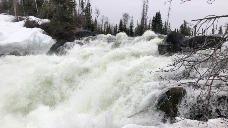
"The last peak we have on record here is a 2005 peak level, and that was just over 9.5 meters in the area," Boyle said.
This year, he said the peak reached 10.14 metres, with 2,400 cubic metres of water flowing per second in the same area.
Because the population is less dense in northern Saskatchewan, Boyle said the biggest effect of the flooding has been property damage. There have been no evacuations reported because of the flooding.


_(720p).jpg)


 OFFICIAL HD MUSIC VIDEO.jpg)
.jpg)


