How normal is it for Sask. to have extremely cold temperature swings in winter?
Despite this week's deep freeze, much of Sask. has seen fewer days colder than -30 C than normal
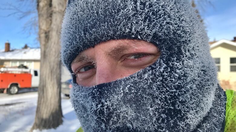
If it feels colder than it should outside, you're right.
Typically, at this point in January, we would see daily highs closer to -9 C in areas like Regina and Saskatoon, and lows closer to -20 C. But Saskatchewan winters are often anything but normal.The prairies often dealin extremes. So how doesthis winter's extremes measureup to the rest?
It may feel like we'vehad a lot of days where the temperatures have dropped past-30 C, but actually in most areas of southern and central Saskatchewan, we have seen far fewer frigid days than normal.
You can blame it on the polar vortex, that cold pool of air rotating near the north pole. This week, the polar vortex has slipped south, bringing extremely cold conditions to Manitoba and Saskatchewan. Temperatures have dipped to the -30s and even -40s in the north, with wind gusts making it feel even colder.
When we're in these days, it feels like the cold will just never leave us, but actually this winter, we have done fairly well in avoiding the extreme cold, at least in the southern half of the province.
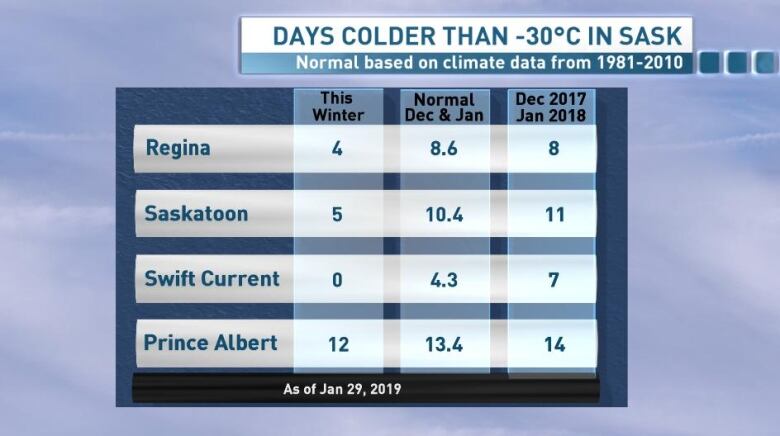
Typically in December and January, Regina would see around ninedays where the weather has dropped below-30 C, and Saskatoon would see around 10 days.
Northern Saskatchewan has been in the thick of the cold weather a little more frequently this winter, coming closer to its typical norm in the number of - 30 C days.
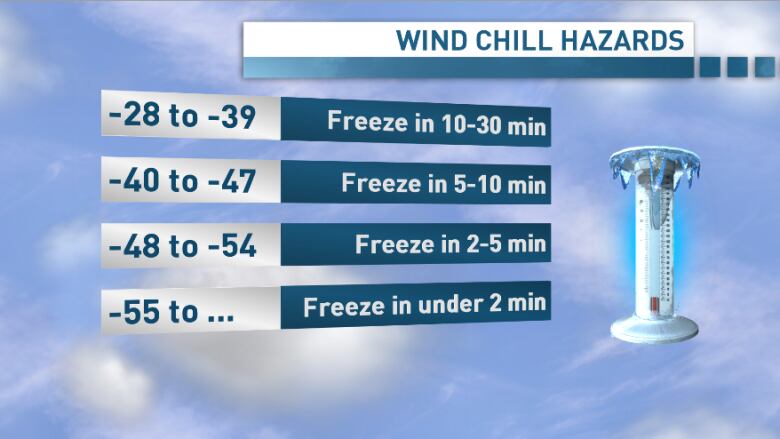
Wind chill vs temperature
Wind chills this winter have frequently made it feel closer to - 30 C stepping outside, even thoughour temperatures haven't broken that threshold as often.
Wind chill refers to how cold temperatures actually feel on exposed skin when you factor in the wind speed. When you are outside in cold weather,your body heats up a thin layer of air around your skin. On a windy day, that boundary layer of warmer air is removed and replaced by the colder ambient air, cooling your skin faster. Your body, in turn, will generate more heat to try even harder to maintain a normal temperature. All of this will make it feelcolder than it actually is.
So although wind chill doesn't affect things like vehicles, it does mean that frostbite can happen much quicker on a windy day.
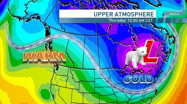
When will this deep freeze end?
Although Tuesday night will bring temperatures back towardthe -30s, we will see a little relief from our extreme cold this week. On Wednesday, that polar vortex sitting over Manitoba will move further south and to the east, allowing milder air to return to Saskatchewan.
Temperatures should approach-20 C on Wednesday afternoon in much of southern and central Saskatchewan, and return to the minus single digits in much of southern and central Saskatchewan by Thursday before another cool down this weekend.


_(720p).jpg)


 OFFICIAL HD MUSIC VIDEO.jpg)
.jpg)


