Northern Ontario 'glacial droppings' leftover from shrinking ice sheets
Northern Ontario explorer Bill Steer says "glacial droppings are souvenirs from the past, and worth a trip along the back roads" to see them.

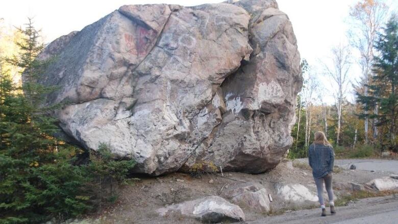
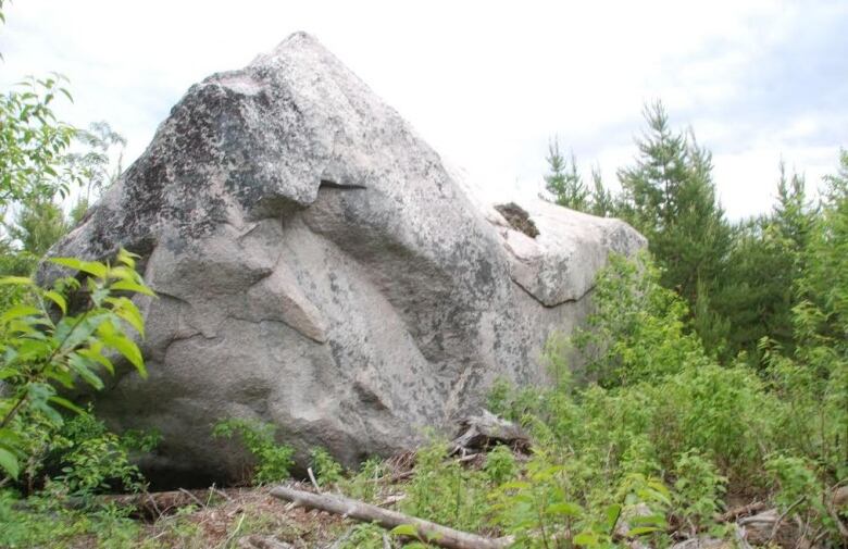
"For the most part they tend to be rounded," Steer says.
"The surface is often fine-grained, indicating grooves and scratches the remnants of the movement of the ice sheets and the constant scoring by neighbouring boulders. After the ice melted, the boulders remained distributed in a random way."
Steer's research reveals the term "erratic" is commonly used to refer to these "glacial droppings."
Most parts of northern Ontario wereonce enveloped by ice sheets.
"Glacial striae (scratch patterns on bedrock) and glacially oriented features, such as drumlins and eskers, indicate that the general direction of ice movement was towards the southwest," Steer said."So as a result most areas have erratic boulders."
Where can they be found?
IgnaceJust north of Sandbar Lake Provincial Park, a dozen kilometres north of Ignace in northwest Ontario the landscape is dominated by large room-size boulders. Visitors walking among these behemoths cannot but be overwhelmed by them. You can find these 15 km north of Ignace on Highway 599 (Savant Lake), past the park entrance and drive 4.3 km and turn at WGS 84 15 U E607201 N5484213 or N49 30.064' W91 31.166'
CartierA very large one is located10 km north of Windy Lake Provincial Park (north of Sudbury) on Highway 144, just before Cartier on the east side of the highway; you can't miss it. N46 40.671' W81 32.592'
TemagamiRed Squirrel Road accessed just north of Temagami a wonderful back roads, 29 km drive to the sandy beach on Ferguson Bay on Lake Temagami. Between the 20 to 21 km mark, on the south side of the road look for the huge glacial erratic, at co-ordinates WGS 84 17 T E576466 N5225182 or N47 10.541' W79 59.453'.
New LiskeardA large erratic is found on the shore of Lake Temiskaming, northeast of Dawson Point near New Liskeard (Temiskaming Shores); WGS 8417 T E 606013 N 5259941 or N47 29.056' W79 35.567'. Also in the immediate area there is a large erratic on the intermediate "blue" trail at the Temiskaming Nordic Ski Club.
Elliot Lake Steer said"there is a real beauty" north of Elliot Lake on the Cobre Trail just outside Mississagi Provincial Park, see www.cityofelliotlake.com/en/visit/hike.asp .
Stonehenge of the North
Steer saidthe "stonehenge"erratic boulders arelocated east of Virginiatown (east of Kirkland Lake) off of Highway 66 near the shores of Larder Lake.
"This is a spiritual location where the erratics are lined up in a north-to-south direction and linked to a constellation," he said, giving the following directions:
Journey east of Kirkland Lake on Highway 66, through to Larder Lake. From the junction of Highway 624 and 66 at the community's fish monument travel eastward on Highway 66 for six kilometres.
Watch for an unmarked road (N48 06' 56.4" W79 39' 00.7" or WGS 84 17 U E 600464 N 5330036) on the right or south side just before the Bob Lake/Tournene roadside picnic area. Travel this side road; there is one hill, for 1.5 km. When you come to the fork veer left or SSE.
If you go right orSW you would end up at Pearl Beach.Within 200 m you will park amongst the pines; walk to the SE about 200 m and you will see the exposed bedrock, the large erratics and Larder Lake. Take a look around and find all the erratics and walk the short distance to the shoreline.
Note the absence of broken rock, the striations and align your compass with the four rocks (17 U E 600584 N 5328370 or N48 06' 02.3" W7938' 56.3"). The Stonehenge video and story is on www.steertonorthernontario.ca.
Back Roads Bill can found at wilstonsteer@gmail.com, www.steerto.com, and on Facebook at Steer to Northern Ontario.


_(720p).jpg)


 OFFICIAL HD MUSIC VIDEO.jpg)
.jpg)


