Find out the latest on spring flooding, washout conditions on highways in northwestern Ontario
Highway 599 remains closed south of Pickle Lake
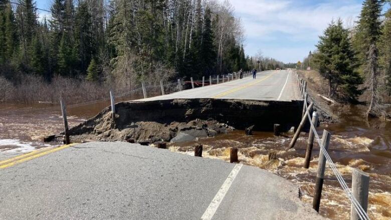
Rising water levels across northwestern Ontario have caused several highway closures and washouts.
Red Lake declared a municipal state of emergency Tuesday night due to flooding, after multiple sections of the community's primary road access to the Trans-Canada Highway has been affected by washouts.
Highway 105 was closed in both directions as of Wednesday morning due to a washout about 20 kilometres south of the town. It has since reopened.
Another part of Highway 105, between the Highway 17 junction at Vermilion Bay and Highway 609, is also closed due to water over the roadway.
A section of Highway 17 between Dryden and Vermilion is also affected by water on the road.
Highway 599 is closed about 15 kilometres south of Pickle Lake due to washout damage.
In Fort Frances, the municipality added flooding due to high water levels to its state of emergency declaration that was made last month. Town officials said plans are being worked on to start sandbagging, beginning with protecting municipal infrastructure and assets.
You can see the latest highway conditions from Ontario 511 in the interactive map below:


_(720p).jpg)


 OFFICIAL HD MUSIC VIDEO.jpg)
.jpg)


