Ontario restricts access to Kenora-area roads due to extreme forest fire activity
Over 20 fires burning in northwestern Ontario on Thursday morning, Manitoba fires force evacuations
The province is restricting access to some roads near Kenora, Ont., due to extreme forest fire activity in the area.
Two large forest fires are burning near Willow Lake,about 30 kilometres east of the city:
- Kenora 25, about 2,000 hectares in size.
- Kenora 30, at 1,300 hectares.
The provincial Aviation, Forest Fires and Emergency Services (AFFES) agency said neither fire is under control.
On Wednesday, the province announced access to certain roads and Crown landsis being restricted.
All use of the following roads is prohibited:
- Richard Lake Road.
- East Hawk Lake Road.
- Willard Lake roads.
- Gordon Lake Road, including the Shrub Lake Road.
- McIntosh Road and all other branch roads south of the Canadian National Railway line.
- All roads on the south and east side of Jones Road/Hwy 671, beginning at the High Lake junction up to the Canadian National Railway/Jones Road intersection.
The province has implemented similar measures in the area of Kenora27, about 51 kilometres north of the city, and listed as not under control at 2,600 hectares.
Due to Kenora 27, access to the following roads is prohibited:
- Sand Lake Road from the intersection of Hwy 596, east through to the English River Road, and all branch roads within.
- English River Road beginning at unnamed road (onekilometrenorth of Forgotten Lake), through to Lennan Road, including all roads within.
Non-essential personnel asked to leave
All useor occupation of Crown land within 500 metres of the roads is also prohibited, AFFES said, and all non-essential personnel in those areas are beingasked to evacuate immediately, unless they have authorization to be in the area from the Ministry of Natural Resources and Forestry.
The two fires wereamong more than 20 burning in northwestern Ontario as of Thursday morning.
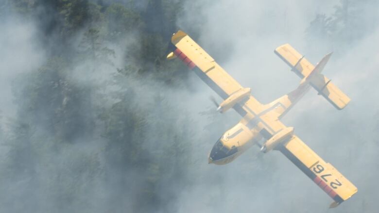
AFFES said progress is being made on Thunder Bay 8, which is burning in Oliver Paipoonge.
Water bombers slowed the progression of the fire, which was moving toward Highway 102/Dawson Road on Wednesday, and while the fire is not under control, AFFES said it has not grown appreciably in size (it was listed as 97 hectares on Thursday morning).
For a full list of fires in the region, visit the province's interactive forest fire map.
The fire hazard is extreme in the Fort Frances area, mainly high in the Kenora, Drydenand Thunder Bay areas, and low in the Red Lake, Sioux Lookoutand Nipigon sectors, AFFES said.
The fire situation in Manitoba
In Manitoba, fires burning in the Interlake region have forced more First Nations to begin evacuations, sending people to hotels in Winnipeg and Dauphin.
The largest fire in the area is near Homebrook, a community north of Lake Manitoba that's about 240 kilometres northwest of Winnipeg. It was 144,000 hectares, more than 80 kilometres long and approximately 16 km wide at its widest point, the provincial government said Wednesday afternoon.


_(720p).jpg)


 OFFICIAL HD MUSIC VIDEO.jpg)
.jpg)


