Kenora issues evacuation notice as spring flooding drenches northwestern Ontario
Serious flooding also happening in Northwest Territories, Alberta and Manitoba
Officials in Kenora, Ont., have issued an evacuation notice for residents in flood zones as high waters continue to threaten homes and infrastructure.
"As water levels continue to rise, there is no way to accurately predict how quickly roads can become unsafe and impassable," the city said in a statement Friday.
Kenora is one of several communities in northwestern Ontario seeing high wateramid serious spring flooding happening across Canada. Flooding has also been reported in the Northwest Territories, Alberta and Manitoba.
The Lake of the Woods and Winnipeg River systems are higher than in 95 per cent of the years water levels have been tracked, according to the city.
Kenora Mayor Dan Reynard told CBC News on Friday that the evacuation zone includes about 250 homes, some of which are seasonal residences.
"Thearea we're talking about is the Black Sturgeon Lake area," Reynard said. "The lake flows into the Winnipeg River."
Heavy rains and melting snow mean"twice as much water coming in as they can push out through the dams in the Winnipeg River system," Reynard said. "Because the river, obviously, is a lot narrower, it causes rapid rise in the levels in the river."
Currently, the Winnipeg River's water level is higher than that of Black Sturgeon Lake, Reynard said.
"Instead of Black Sturgeon draining, water from the river is actually pushing back into Black Sturgeon," he said. "So there's nowhere for this water to be released, which causes it to rise rapidly."
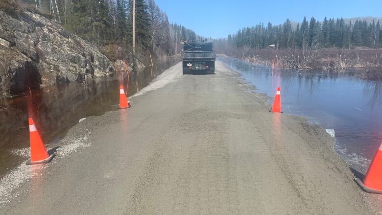
Roads in the evacuation zoneare not safe to travel on, and aren't accessible by first responders in the event of an emergency, due to the amount of water runnning over them.
"That's why it's imperative that people move out of the area," Reynard said. "We're asking them to for their own safety."
He said Lake of the Woods water levels are regulated by the Lake of the Woods Control Board, which is in a "catch-22."
"Ifthey don't dump water, then the lake levels get too highand will cause issues at this end of the lake," Reynard said. "If they do dump water, then it causes issues below the dams, into the Winnipeg River system."
"So it'sunfortunate," he said. "We've had some major storms, one on Wednesday night, one on Thursday night. And a lot of water has been dumped in.
"It gets dumped all the way to Fort Frances, which is 135 miles [217 km] away. That all flows this direction. We've done pretty well everything we can to protect where we are at this stage."
The City of Kenora said crews are working to clear a safe route out of the evacuation zone, and anyone still there will need to evacuate by 6:30 p.m. Friday.
After that, the roads will be closed and no entry or exit will be allowed, the city said.
An emergency shelter has been set up at the Kenora Recreation Centre for those needing a place to stay, the city said.
Meanwhile, Reynard said, the city will watchfor flooding in other areas.
Across northwestern Ontario, highways remain closed due to washouts.
Click on the interactive map below for the latest information:
Several other communities in northwestern Ontario remain under flood warnings and watches.
Conservation officials reissued a flood warning for Thunder Bay, Neebin, Oliver Paipoonge, Shuniah, O'Conner, Conmee, Gillies and Dorion earlier Friday.
In theThunder Bay area, little or no rain is in the forecast for nearly a week, giving the area some time to dry out.
WATCH| See the effects of flooding and high water in Thunder Bay:


_(720p).jpg)


 OFFICIAL HD MUSIC VIDEO.jpg)
.jpg)


