Markham to transform industrial area into green space to prevent flood damage
Ottawa announced on Monday it will spend $48.6M on 3 Markham flood mitigation projects
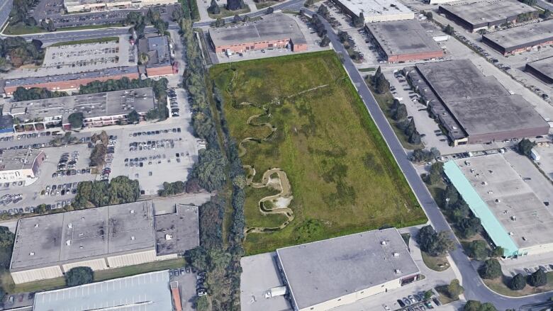
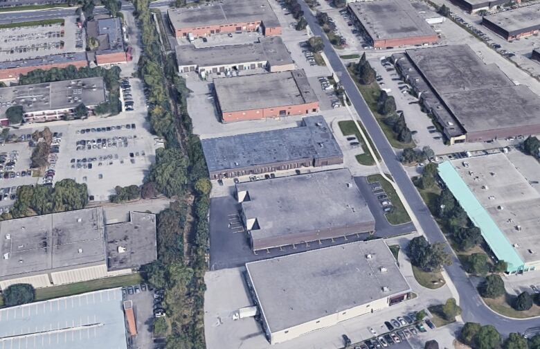
Markham is poisedto restore an industrial area to its natural state in a project aimed at mitigating flood damage.
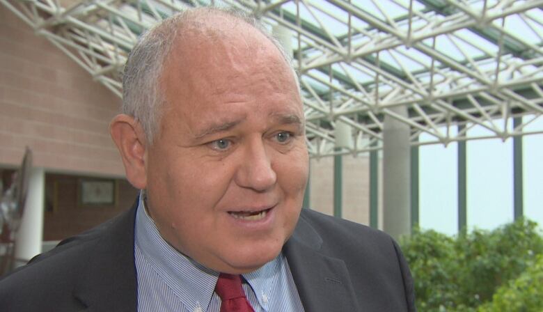
The Don Mills Channel, in the area of Woodbine Avenue and Denison Street, is set to be transformed back into a more natural flood plain, according to Markham Mayor Frank Scarpitti.
The green spacewould help reduce the annual costs of flood damage up to $1.5 million, he said.
"It'll almost be an oasis, quite honestly," Scarpitti told CBC Toronto.
Designed to protect roads and buildings, the flood plain would span more than two hectares, roughly the size of four football fields, and be able to contain about 37,000 cubic metres of flood water, he said.
City crews will demolish buildings in the industrial area and reconfigure the man-made Don Mills Channel. When finished, it wouldbe a meandering waterway lined bytrees. Underground culverts downstream of the flood plain will also need to be replaced to make it work.
The project is expected to take about five years to complete.
On Monday, the federal government announcedthat it will help to fund the project with $48.6million for Markham's storm water management strategy and flood control projects.
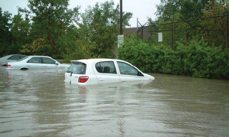
According to the city of Markham, the industrial area is particularly vulnerable to floods, and flooding in 2005, 2014 and 2017 caused significant damage.
The city said in a news release that the project would reclaim the flood plain, create a storage pond and partially restore the Don River watershed in the area to its previous state.
Containing flood water
The storage would help keep flood water levels 1.5 metres lower on average than they have reached in the past, the city said.
According to an environment assessment of the area, businesses surrounding the channel have flooded several times since the land was developed. Roads in the area, including Woodbine Avenue, can become "impassable"during heavy storms.
Scarpitti noted that the Don Mills Channel served a practical purpose when it was builtin the 1960s because it supported development in the growing community. For many years, the area was Markham's"bread and butter" in terms of an industrial tax base, he said.
But the flood control project will serve a "greater purpose," he said.
"It's important to provide protection in these communities for life," he said.
Rebuilding natural infrastructure
Blair Feltmate, head of the Intact Centre on Climate Adaptation at the University of Waterloo, said the proposed project is an example of flood mitigation efforts that he expects to become more common.
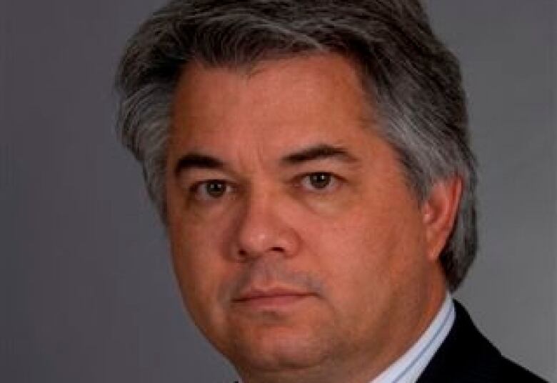
"The big absorbent green space, it actually gives water a place to go," he said.
"By retaining natural infrastructure, you mitigate the probability for flooding. You support biodiversity and support a more attractive aesthetic within communities."
Feltmate estimates that southern Canada has removed 60 to 80 per cent of its natural infrastructure, such as forests, fields and wetlands, in the past 100 years. Southern Ontario has removed about 73 per cent of natural infrastructure, much of it paved over, he said.
"When the big storms hit, the water just runs off very, very quickly to a receiving body of water that contributes to flooding," Feltmate said.
Bigger storms over a shorter period of time on a more regular basis, combined with substantial loss of natural infrastructure, means greater damage, he said. Returning some of that land to its natural state will save communities money on flooding repairs in the long run, he added.
One way to lowerflood risk is "to retain what you have, where possible restore what you have lost, and then build what you must to limit flood risk going forward."
The funding announced Monday will come out of the federal Disaster Mitigation and Adaptation Fund, a $2-billion, 10-year program designed to help communitieswithstand natural disasters.
The other projectsthe West Thornhill and Thornhillcommunity centre and library projects also received funding.According to the city, all three projects will increase the capacity of an overloaded sewer system, with the aim of protecting neighbourhoods from potential flooding and sewer backup.
With files from Kate McGillivray, Muriel Draaisma


_(720p).jpg)


 OFFICIAL HD MUSIC VIDEO.jpg)
.jpg)


