Water level records broken on Lake Erie and Lake St. Clair
Rain is expected to start overnight Monday in Windsor-Essex and Chatham-Kent
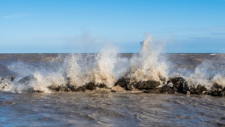
Average daily water levels on Lake Erie and Lake St. Clair have broken records for May.
Lake St. Clair rose about 12 centimetres over the last month and Lake Erie rose about 20 centimetres. Both lakes are about 18 centimetres higher than they were this time last year.
The Lower Thames Valley Conservation Authority has issued a safety bulletin, warning people about shoreline erosion and unexpected localized flooding overnight Monday and throughout Tuesday.
"Waves could reach one metre in height," the safety bulletin reads. "Shoreline residents should pay attention to local conditions for indications that winds are becoming stronger than forecasted and prepare accordingly."
The St. Clair Region Conservation Authority has issued a flood outlook statement as well. It says the rain on Monday night and early Tuesday morning are expected to further elevate water levels into natural floodplain areas, farms and parks.
There's a risk for a thunderstorm in Windsor-Essex and Chatham-Kent Monday night.
"High intensity rainfall is possible, especially during thunderstorms. High amounts of rainfall in a short period of time can lead to increased runoff and flash flooding, particularly in urban areas," SCRCA said.


_(720p).jpg)


 OFFICIAL HD MUSIC VIDEO.jpg)
.jpg)


