29 spring flood advisories issued by conservation authority
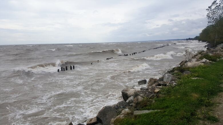
All the flood events in 2019 were caused initially by elevated lake levels
Flood watches, flood warnings and watershed advisories have been issued on what seems to be an almost-daily basis this spring.
Data from the Essex Region Conservation Authority shows that there were less advisories overall in 2019 than there were in 2018 but that doesn't count the long-term flood watch issued at the end of May.
ERCA has said itexpects to issue another long-term flood watch moving forward.
From January 1 to May 31, 8 flood warnings, 10 watches and 11 statements were issued for Windsor-Essex. The majority of those flood events occurred in Leamington, along the shoreline between Wheatley and Point Pelee National Park.
According to ERCA, all the flood events in 2019 were caused initially by elevated lake levels.
Flood advisories issued from January 1 to May 31 year-over-year:
| 2019 | 2018 | 2017 | 2016 | 2015 | |
| Watershed conditions | 11 | 9 | 4 | 1 | 2 |
| Flood watches | 10 | 14 | 11 | 5 | 1 |
| Flood Warnings | 8 | 7 | 3 | 0 | 0 |
| Totals | 29 | 30 | 18 | 6 | 3 |
There were 45 total advisories issued in 2018, up 62 per cent from the 28 advisories issued in 2017.
Wind direction, speed plays a big factor
Due to the high water levels, slower wind speeds caused flood events when they wouldn't have before.
The Hillman Marsh climate station showed flood events can now occur at speeds between 30 and 35 kilometres per hour, where before it would have required sustained wind speeds of more than 40 kilometres per hour.
Erosion beyond repair
Leamington and Pelee have experienced unprecedented problems with erosion. The western shoreline of Pelee Island, specifically West Shore Road and McCormick Road are at risk of being washed out.
ERCA said the severity of thaterosion has surpassed what the equipment can handle repairing.
Flood line mapping for the Essex region shoreline was last completed in 1976. ERCA has begun new flood mapping to update existing records, including working with the City of Windsor to map references for Sandwich and Little River areas.
In Lakeshore, redoing the hazard mapping for shoreline from Lighthouse Cove to the Town of Tecumseh is underway and reference documents are being prepared in Leamington to re-evaluate flood levels and erosion.
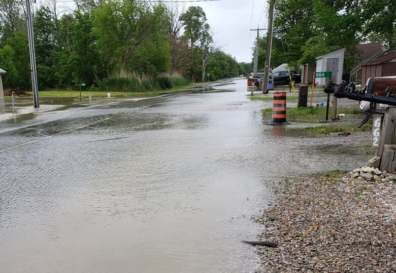
Flood events in Spring 2019
- April 11: Flooding in east Leamingtoncaused Cotterie Park Road, East Beach Road and Marentette Beach Road to be impassable.
- April 14: The same roads in east Leamington were considered impassable after another flooding event.
- May 1: In addition to impassable roads, Cotterie Park Road's west shoulder and southbound lane were washed out.
- May 3: While considered a minor flooding event, aroad in the Marentette Beach community was submerged and the southern portion of the dike sustained damage.
- May 8: Lake levels exceeded 1.7 metres in two separatefive-hour-long peaks.
- May 12: Lake levels near east Leamington and Cedar Creek in Kingsville peaked above 1.7 metres for almost six hours.
- May 22: Wind speeds below 25 kilometres per hour, without generating significant wave action, cause flooding along Cotterie Park Road in southeast Leamington.
- June 8: Tributaries in east Leamington and Kingsville were at bank-full levels.


_(720p).jpg)


 OFFICIAL HD MUSIC VIDEO.jpg)
.jpg)


