All shorelines in Essex region are under a flood watch until mid-June
The flood watch includes Pelee Island
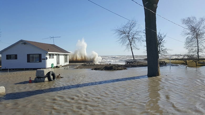
A flood watch is in place for all shorelines in Essex Region, including Pelee Island, until June 15.
Essex Region Conservation Authority issued the flood watch "due to record high lake levels" for both Lake St. Clair and Lake Erie in May, which broke records set in 1986.
"Areas of concern are the low-lying beach communities and shoreline areas along Lake St. Clair, the Detroit River and Lake Erie, as well as low-lying areas along the downstream reaches of major tributaries," the authority said.
Things that require monitoring are as follows:
- Dikes in Southeast Leamington area
- Areas that experienced significant erosion on Pelee Island
- Water levels along dikes within the Little River Drain corridor in Windsor
According to ERCA, available data from the United States Army Corps of Engineers and Environment shows there's potential for Lake St. Clair and Lake Erie water levels to rise more in June and July.
People are advised to avoid areas where flooding is happening, as well as shoreline areas when there's significant rainfall.


_(720p).jpg)


 OFFICIAL HD MUSIC VIDEO.jpg)
.jpg)


