There have been no named hurricanes so far this summer. Here's why
Having no hurricanepowerful enough to get a name this late inAugust is rare
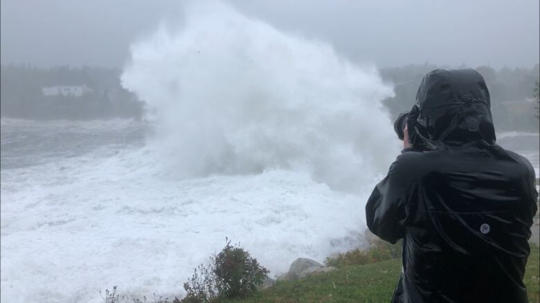
Hurricane season is off to a quieter start than usual, but don't let that fool you, say meteorologists.
Having no named hurricanes byAugust israre it's only happened twice since 1960. Weather experts, however, predict they are coming.
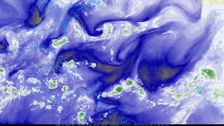
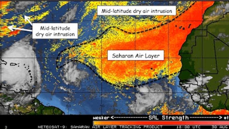
Dry, dusty air blowing off the vast Sahara Desert from the coast of West Africa has kept convection or atmospheric water vapour from whipping up the usual storms. Atlantic hurricane season spans June through November.
"While we have been able to dodge a few bullets early on, I still expect a robust hurricane season," Jeff Weber, an atmospheric scientist at the National Center for Atmospheric Research, said from Boulder, Colo.
Usually by now in August, Weber says there's been at least one major hurricane.
Climate change may be a factor, weather experts say
With August all but over, the next three available names on the 2022 roster of tropical storms and hurricanesmay not even be used this month. A tropical storm brings sustained winds of at least 63 km/h. Hurricanes, on the other hand, have winds of at least 119 km/h.
Weather experts say climate change is a factor.
Weber described howthere's been a persistent ridge of high pressure that he calls a "blister on the planet" the same one that drove forest fires in North America last year now sitting over Europe and Asia and driving intense drought there. That lack of moisturecould be delaying the hurricane season, said Weber.
"That could be part of the reason why we are not seeing as much tropical development. It's kind of diminishing the amount of water vapour that we have to work with off the west coast of Africa," said Weber.
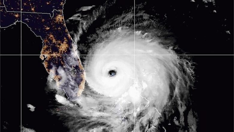
#OnThisDay 17 years ago, #HurricaneKatrina made its second landfall over southeastern Louisiana after hitting Hallandale Beach, Florida four days earlier. The storm led to over 1,800 fatalities and $125 billion dollars in damage. pic.twitter.com/LGnljCd3tc
—@NOAASatellitesBut increasing weather activity in the Atlantic basin which includes the Atlantic Ocean, the Caribbean Sea and the Gulf of Mexico suggests this unusual pattern may be about to end.
"I would not be surprised if it ramps up dramatically here in September," says Weber.
He says the sea surface temperature is warm, which he predicts will fuel10 to 14 storms and up to three major hurricanes, potentially into November.
Hurricane could develop within days
Meteorologist Bob Robichaudof the Canadian Hurricane Centre told CBCNews thatweather models arepredicting a hurricane within the next few days.
Hesays climate change may be playing a part in the reduction of the number of hurricanes, but those that do form, may be more powerful, such as when Hurricane Dorian hit Atlantic Canada three years ago.
"You can'tnecessarily judge the whole season just by the first three months," said Robichaud. "Even a year that starts off slow can really pick up on a dime here if everything lines up."
Right now, stormsnamed Danielle, Earl and Fiona are potentially developing.
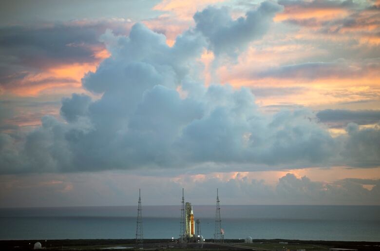
That's something NASA's been keeping a close eye on after being forced to scrub the Monday launch planned for Artemis I due to an engine temperature issue.
Aug 29th - A broad area of ow pressure in the central #Atlantic has a high chance of development over the next 5 days. Fresh to strong easterly #winds in the northern quadrant & #seas of 8-11 ft are expected through midweek. More at https://t.co/26J6UnYRHO #GOESEast #marinewx pic.twitter.com/fYXLm9Gpfe
—@NHC_TAFBNASA has to be wary of Earth's weather with the 32-storey rocket stack poised to launchduring the height of hurricane season in Florida, the state with the highest number of tropical cyclones in the United States.
Monday's launch was delayed; NASA announced it will try again on Saturday.
While the peak of hurricane risk hits Sept. 10, some of the most powerful hurricanes have hit after Aug. 15 such as Andrew (1992), Frances (2004), Ivan (2004) and Katrina (2005).
What it means for the moon rocket
If a hurricane or tropical storm does develop off the coast of Florida or the Gulf, NASA has told the media that the launch director would get a forecast from the Spaceflight Meteorology Group or from theU.S. Space Force 45th Weather Squadron, which monitors any potential issues on the East Coast.
In case of a hurricane, cautious guidelinesthen kick in to reduceweather-related risk, according to NASA.
Launch Weather Officer Melody Lovin, lead weather officer with the U.S. Space Force's 45th Weather Squadron for the Artemis mission says each rocket has its own weatherconstraints.
When Hurricane Dorian hit in 2019, she said NASA had to roll back some equipment into the Vehicle Assembly Building.
"Florida weather is predictable, but challenging in late August and early September. Watching the tropics is always a hot topic for the team," said Lovin.


_(720p).jpg)


 OFFICIAL HD MUSIC VIDEO.jpg)
.jpg)


