Search for missing Malaysian airliner reveals rich detail about Indian Ocean
Maps of sea floor could boost knowledge of continental drift, fisheries in southern ocean
Detailed sea-floor maps made during the unsuccessful search for missing Malaysia Airlines Flight MH370, released by Australia on Wednesday, could help increase the knowledge of rich fisheries and the prehistoric movement of the earth's southern continents.
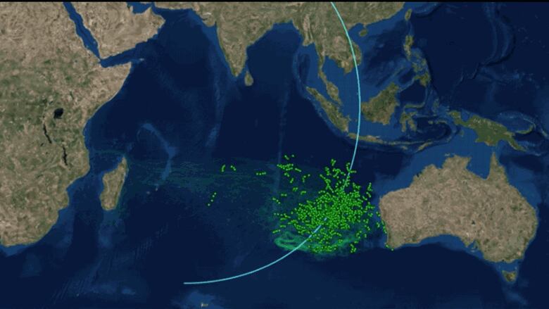
The Indian Ocean search ended in January after covering a lonely stretch of open water where under-sea mountains larger than Mount Everest rise and a rift valley dotted with subsea volcanoes runs for hundreds of kilometres.
However, information gathered during painstaking surveys of the remote waters west of Australia should provide fishermen, oceanographers and geologists insight into the region in unprecedented detail, said Charitha Pattiaratchi, professor of coastal oceanography at the University of Western Australia.
New details about remote ocean
"There are the locations of seamounts which will attract a lot of international deep sea fishermen to the area," Pattiaratchi told Reuters by phone.
- Malaysia Airlines Flight MH370: What we know 2 years later
- Malaysia Airlines Flight MH370: How airlines can lose a plane
High-priced fish such as tuna, toothfish, orange roughy, alfonsino and trevally are known to gather near the seamounts, where plankton swirl in the currents.
Pattiaratchi said the location of seamounts would also help model the impact of tsunamis, given undersea mountains help dissipate their destructive energy, and potentially change our understanding of the break-up of the ancient supercontinent of Gondwana.
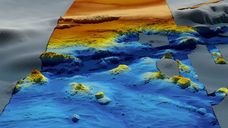
The data consists of three-dimensional models of undersea landforms as well as raw bathymetric survey information and drift analysis. It was published online by Geoscience Australia on Wednesday, with a further portion of the findingsdue to be published next year.
One of the largest marine mapping surveys ever conducted, thesearch for MH370 collected 278,000 square kilometres of bathymetric data within the search area and 710,000 square kilometres of data.
"From a fishing perspective it would be valuable information they've found whale bones and cables and a drum, it is incredible the resolution," he said, referring to the data.
But the expense and difficulty of operating in such remote high seas made a rush to fill nets in the area unlikely, he said.
Stuart Minchin, chief of Geoscience Australia's environmental geoscience division, said the remote search area was now among the most thoroughly mapped regions of the deep ocean on the planet.
Debris, but no transponder from MH370
"It is estimated that only 10 to 15 per cent of the world's oceans have been surveyed with the kind of technology used in the search for MH370," Minchin said.
Older data was only available from satellite images and does not have as much detail. Among the underwater areas mapped are the Diamantina Trench and Broken Ridge.
The data is published in Chinese and Malay, as well as English.
Investigators believe someone may have deliberately switched off MH370's transponder before diverting it thousands of miles off course, out over the Indian Ocean. Various pieces of debris have been collected from Indian Ocean islands and Africa's east coast and at least three of them have been confirmed as coming from the missing Boeing 777.
Australia has not ruled out resuming the search for the airliner but has said that would depend on finding "credible new evidence" about the plane's whereabouts.
"No new information has been discovered to determine the specific location of the aircraft and the underwater search remains suspended," Transport Minister Darren Chester said in a statement.


_(720p).jpg)


 OFFICIAL HD MUSIC VIDEO.jpg)
.jpg)


