Why it's flooding in Ontario and Quebec
Slow-moving storm 'has a lot of time to dump a lot of rain'

Residents of western Quebec and parts ofOntario are bracing for a deluge of rain that could make flooding worse, and the storm system responsible for the wet conditions is expected to reach New Brunswick and Nova Scotia Friday night, Environment Canada says.
The flood problems are due to a number of things:
- Higher than normal water levels in Lake Ontario.
- Higher than normal precipitation.
- Atmospheric conditions that are making the storm system moving up from the Gulf of Mexico a particularly slow-moving one.
Put these things all together and you have a perfect storm, so to speak.
"It's tracking northeastward very slowly, which is one of the problems," PeterKimbell, warning preparedness meteorologist with Environment Canada said of the system."Because it issuch a slow-moving system, it has a lot of time to dump a lot of rain."
- Quebec flooding submerges le Mercier in Montreal
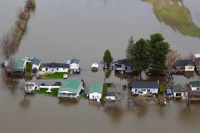
- Aerial view of west Quebec flooding shows extent of deluge
- With rain coming, city prepares for possible evacuation of Toronto Island
Rain is expected to fall across southern Ontario through to Saturday, Kimbell said. Regions can expect anywhere from 30 to 70 millimetres of rain over the next 24 to 36 hours.
Making things worse
Quebec has already faced flooding in Gatineau, Rigaudand Montreal. Twenty-five homes on le Verte, a small island that is part of the city of Laval, are under an evacuation order. More than 100 communities in the province have been affected by the threat of rising water levels.
On Thursday, McGill University professorFrdricFabry, who researches precipitation physics at the university's department of atmospheric and oceanic sciences, toldCBC'sDaybreakthat warm temperatures, followed by a quick melt of the snow packand heavy rains have contributed to the Quebec flooding.

"That water is finally beginning to arrive near the St. Lawrence River, following the major tributaries of the St. Lawrence Riverthe Ottawa River, the Saint-Maurice River and all these others," Fabry said.
'Rain, rain and more rain'
Ottawa and Montreal had almost double the averageprecipitation for the month of April. And that's together with snow melt. In many areas the ground is just saturated, unable to absorb any more water.
"The ground has pretty much taken all the water it can," said Frank Seglenieks, water resources engineer with Environment and Climate Change Canada.
When the ground is saturated, it forces water into rivers, which can cause the flow to change quickly making them dangerous,Seglenieks said.
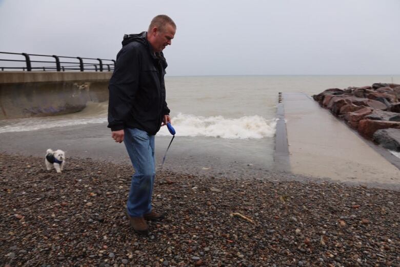
Meanwhile, in Toronto, officials have discussed the possible evacuation of Toronto Island. That's because the Lake Ontario water level is higher than it has been in more than 20 years, according to Environment Canada.
In March, the level was 32 centimetres above the monthly average and just three centimetres above last year's. But then came April.
"The reason why we've had these water levels is for three reasons: rain rain and more rain," Seglenieks told CBC News. "And wherever you've been in southwestern Ontario, depending on the location, you might have had 1 to two times more precipitation than you would have in the average month of April."
Part of the reason the precipitation levels have been so high is due to the meandering nature of the jet stream, a path of air in the upper atmosphere.Often storm systems are influenced by it. It's normally somewhat smooth, but recently it's had more "kinks" in it, resulting in wetter systems and sometimes allowing storms to linger where they'd normally just pass through. While it's too early to definitively link this weather system with climate change, recent studies have suggested it could be a sign of things to come.
With files from CBC News


_(720p).jpg)


 OFFICIAL HD MUSIC VIDEO.jpg)
.jpg)


