Low snowpack is more bad news for B.C.'s drought-affected rivers and streams
Freshet season beginning weeks earlier than expected; northwest of province seeing worst effects
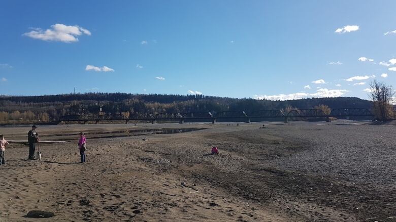
B.C.'s snowpack is at 79 per cent of normal levels, the River Forecast Centre reports, warning that could lead to low water levels in the province's rivers and streams.
The centre, which looks at snow pack, water levels and flood risks, said rivers in the province's northwest and far northwest are among those worst affectedafter severe winter droughts in those regions.
"The ... Stikine, Liard, we've had a few years that are quite low. That is unusual," said David Campbell, who heads the centre.
"Many of the last six or seven years have been in this low snowpack condition."
Snowpack is a key source for determining winter precipitation. Ideally, snow will fall, stay frozen and then thaw out in the spring to recharge aquifers, return moisture to soil and flow through B.C.'s rivers.
But the centre's April report showed that some regions of the province experienced extremely dry conditions, especially in March, leading to low or even record low stream levels.
Campbell says the latest data also shows that snow melt is happening up to a month earlier, due to warm, dry weather.
The centre's report says seasonal flooding due to freshet a surge of water from rapidly melting snow packs has already begun. Under normal conditions, freshet season should begin in about two to six weeks' time.


_(720p).jpg)


 OFFICIAL HD MUSIC VIDEO.jpg)
.jpg)


