Heavy snow, rain and wind warnings in place across coastal, inland B.C.
RCMP ask drivers to slow down for winter conditions after fatal collision on Coquihalla Highway
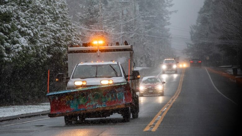
Environment Canada is warning of a series of winter storms that are expected to bring heavy snow to coastal British Columbia and some inland regionsstarting early Monday morning, and drivers are being advised to slowdown in the winter conditions.
"We're looking at some significant snow as we go over the next couple of days, especially for the mountain passes.We're expecting quite a large accumulation," said Environment Canada meteorologist David Wray in an interview Sunday.
The wintry weather has prompted RCMP to call on drivers to slow down, following a fatal crash on the Coquihalla Highway on Monday.
The crash happened about 45 kilometres south of Merritt, when a Ford F150 travelling southbound crossed the median ditch and struck a semi truck heading in the opposite direction. The pickup truck driver was pronounced dead at the scene, and thepassenger was airlifted to hospital.
"We want to remind the public to slow down and drive to the conditions this winter. The conditions on the Coquihalla Highway can change quickly," Staff Sgt. Josh Roda said in a news release, adding that the cause of the crash is still under investigation.
Snowfall warnings are in place for Howe Sound and the eastern Fraser Valley including Hope, which could see up to 15 centimetres of snow, according to Environment Canada.
The agency also issued a snowfall warning for Whistler, which could see up to 20 centimetres before Tuesday as a blast of Arctic air moves in.
Attn: #LowerMainland drivers Wintery conditions overnight into tomorrow AM could create challenging driving conditions tomorrow.
Use caution, prepare for longer commutes, & ensure vehicles are properly equipped with winter tires.
Cc @DriveBChttps://t.co/WloFBKQcz7
—@TranBC_LMDAs of Monday morning, there were more than three dozen snowfall orseparate special weather statements in place across B.C.warning of snow, rain and strong winds across much of Vancouver Island, Metro Vancouver and the Central Coast.
A snowfall warning was issued from the Central Interior, where10 centimetres of snow is expected in places like Prince George.
A winter storm watch along the Coquihalla Highway from Hope to Merritt warned of 40-50 centimetres of snow on Monday. Environment Canada also put in place a winter weather watch for Highway 3 from the Paulson Summit to Kootenay Pass, withheavy snow up to 60 centimetres and strong winds expected betweenMonday and Wednesday.

On the SouthCoast, Environment Canada expects a "wintry mix" of rain and snow to start around 4 a.m. in Metro Vancouver and bring up to four centimetres of snow, said Wray.
"We're not expecting significant amounts [of snow] for Metro Vancouver, but if you get closer to, say, the eastern Fraser Valley, Chilliwack, Hope, or up in the North Shore and Sea-to-Sky corridor, we could get significantly more," said Wray.
Temperatures are expected to rise Monday afternoon through Wednesday, before dropping close to 8 C in Metro Vancouver and as low as 12 C in the Fraser Valley by Thursday, said Wray.
"The biggest thing with the Arctic air coming in,it's not just the temperatures, but quite often we'll get a cold east or northeasterly wind which will really bring you down the wind chill values," Wray said, adding it could potentially feel as cold as 16 C.
Winds gusting up to 100 km/h will hit the west coast of Vancouver Island by Monday night and continue Tuesday, reaching the inner South Coast by Tuesday evening, according to Environment Canada.
Transport ministry urges caution
B.C.'s transport and infrastructure ministry is warning drivers in the Lower Mainland to go slow on Monday.
"Drivers are reminded to use caution, avoid travel in poor weather conditions, prepare for delays and longer commutes, and ensure their vehicles are properly equipped with winter tires," the ministry said in a Sunday evening news release.
The eastbound HOV lane of the Port Mann Bridge connecting Surrey and Coquitlam will be closed from midnight to 2 p.m. on Monday, the ministry said, and more lanes may also be closed on that bridge and the Alex Fraser Bridge if conditions change.
The ministry advised drivers to check DriveBC for updated road closures and conditions.


_(720p).jpg)


 OFFICIAL HD MUSIC VIDEO.jpg)
.jpg)


