Hwy 1 reopens near Revelstoke after flooding closed road
High stream warnings issued for southeastern B.C.; flood warnings for upper and middle Fraser River basin
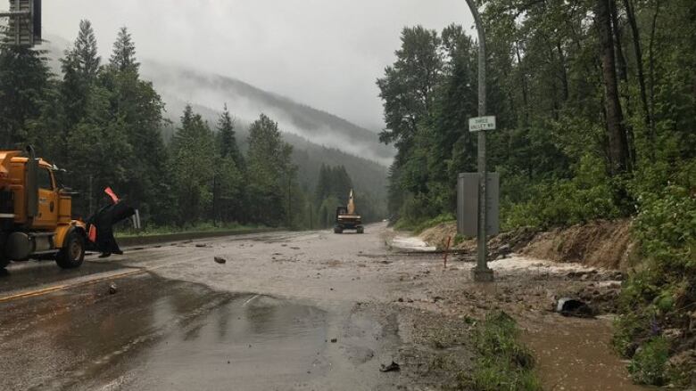
Highway 1 has reopened to single-lane alternating traffic in both directions 15 kilometres west of Revelstoke, B.C.
The road had been closed due to flooding.
According to DriveBC,extended delays are expected due to high traffic.
Earlier, British Columbia's River Forecast Centre issued a high streamflow advisory for the southeast region of the province.
via @driveBC - #BCHwy1 is now open in the #Revelstoke area to single lane alternating traffic due to flooding. Work continues. Expect heavy traffic & delays due to congestion https://t.co/w7HhbjKtyg Thank you for your patience. #goldenbc #sicamous pic.twitter.com/wQrjFmN2IA
—@TranBCOver the past 24 hours, the Upper Columbia has received five to 20 millimetres of precipitation, and a further 30 to 50 millimetres is expected through Friday.
The forecast centre says a high streamflow advisory means river levels are rising or could rise rapidly, but no major flooding is expected.
Watch as water floodsHighway 1:

It says its modelling forecasts the Upper Columbia rivers reaching five- to 20-year flows in response to the wet weather.
The public is advised to stay clear of the fast-flowing rivers and potentially unstable riverbanks during the high-streamflow period.
The centre has posted flood warnings for the upper and middle Fraser River basins, including the Quesnel River, while lower-level flood watches are in place for the Chilcotin and Thompson rivers.
In a statement,Mike Farnworth, minister of public safety and solicitor general, said peopleneed to take extra caution and be prepared.
"I want to stress that any sort of recreation on these waters is highly dangerous right now, so let's make sure we're not taking any unnecessary risks," Farnworth said.
The government says the flooding riskmeans an increased chance of evacuation alerts and evacuation orders. It noted Emergency Support Services (ESS) has a new digital registration system, the Evacuee Registration Assistance (ERA) tool,which allowsevacuees to register online rather than in person at an evacuation centre so people can access support but still maintain physical distancing guidelines.


_(720p).jpg)


 OFFICIAL HD MUSIC VIDEO.jpg)
.jpg)


