Positive news for several B.C. wildfires, new evacuations in Kootenays
Shetland Creek wildfire showing no new growth; 'humidity bubble' established in Barkerville
Wednesday night brought more evacuation orders to B.C., asofficials warned that conditions continue to be volatile.
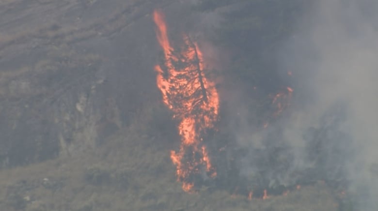
Throughout the day, the number of active wildfires stayedconstant at more than 430. Sixty per cent of them are out of control, according to the B.C. Wildfire Service.
But there have also beenpositive news in the fight against several notable wildfires burning in B.C.
Rain in the north has lessened the wildfire risk in that region, and in the south, crews have been able to establish defences against wildfires that are threatening communities including Ashcroft, Wells and the historic town of Barkerville.
Here is an update on some of the notable wildfires in this province on Wednesday.
- Looking for information on wildfires in your region? Read our B.C. wildfire guide
Silverton under evacuation
The Village of Silverton, a community around 200 people thatis located by Slocan Lake and the Valhalla Provincial Park, is under an evacuation order due to the Aylwin Creek wildfire.
The orderalso covers 17 surrounding addresses in Electoral Area H.
The Regional District of Central Kootenay (RDCK) hadpreviously ordered properties south of Silverton, in the Red Mountain Road area and east of Slocan Lake, evacuated due to the same fire.
The Aylwin Creek firewas discovered on July 18 and is four square kilometresas of 8:30 p.m. PT on Wednesday.
Elsewhere in the Kootenays, the RDCKalso issued an evacuation order Wednesday night for three propertiesand around 60 land parcels inElectoral Area Ddue to the Glacier Creek wildfire. The order coversDuncan Island andGlacier Creek Regional Park.
A wildfire jumping Highway 95 prompted a closure of the stretch between Golden and Radium Hot Springs in both directions at around 8:20 p.m. PT on Wednesday.
Earlier Wednesday, an incident management team from Australia took over command of the SlocanLake complex of wildfires in the Kootenay region, which includes the Aylwin Creek, Komonko Creek, Nemo Creek, Ponderosa FSH and Mulvey Creek burns.
Combined, these fires have prompted multiple evacuation orders and alerts.
Heat warnings for the region have been rescinded, although daytime highs are still expected to be up to 36 C for the remainder of the week, with lows from the mid-teens to low 20s.

Evacuation due to Moose Valley wildfire
The Cariboo Regional District has placed54 land parcels in Electoral Area G under anevacuation order due to the Moose Valley wildfire. Evacuees are told to goto Highway 97 andhead south to 100 Mile House.
The Cariboo Fire Centre continues to respond to the Moose Valley Wildfire (C41440). This wildfire is burning at a rank 4 (meaning a vigorous surface fire with an organized flame front, candling and a fast rate of spread). pic.twitter.com/7v4EHSbzUk
—@BCGovFireInfoThe fire was discovered on July 22 and is suspected to have been caused by lightning, according to the BCWS. It is 2.4 square kilometres as of 9:30 p.m. PT on Wednesday.
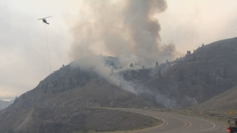
Shetland Creek wildfire shows no new growth
On Tuesday, the B.C. Wildfire Service posted an update on the Shetland Creek wildfire, which has been holding in size at just under 200 square kilometres, with no new growth in the past day.
The fire has forced the evacuation of more than 120 people fromthe Venables Valley and has destroyed 20 buildings, including sixhomes, according to Colton Davies with the Thompson-Nicola Regional District.
It has also placed the community of Ashcroft and a portion of Cache Creek on evacuation alert as hot and dry conditions coupled with gusty winds have driven the blaze northward.
Jeff Walsh, an incident commander with the B.C. Wildfire Service, says in the video that crews are using heavy equipment on the mountain slopes above Spences Bridge to prevent fire from burning downslope toward the southern Interior community.
"Currently our main focus is establishing containment where it's safe and operable to do so," Walsh says.
In a Facebook post Tuesday night, Ashcroft Mayor Barbara Roden said she had been told that a drop in temperature had led to higher humidity levels, helping stop the growth of the fire. She also said the fire had started spreading toward areas that had previously been burned, where there is less fuel.
As a result, Highway 1 between Ashcroft and Cache Creek, which had been closed due to wildfire risk, reopened Tuesday though it could be closed once more should conditions change.
Roden said a forecast of lower temperatures and rain later in the week were also buoying optimism, though she cautioned there was still no word on when evacuation orders and alerts might be lifted.
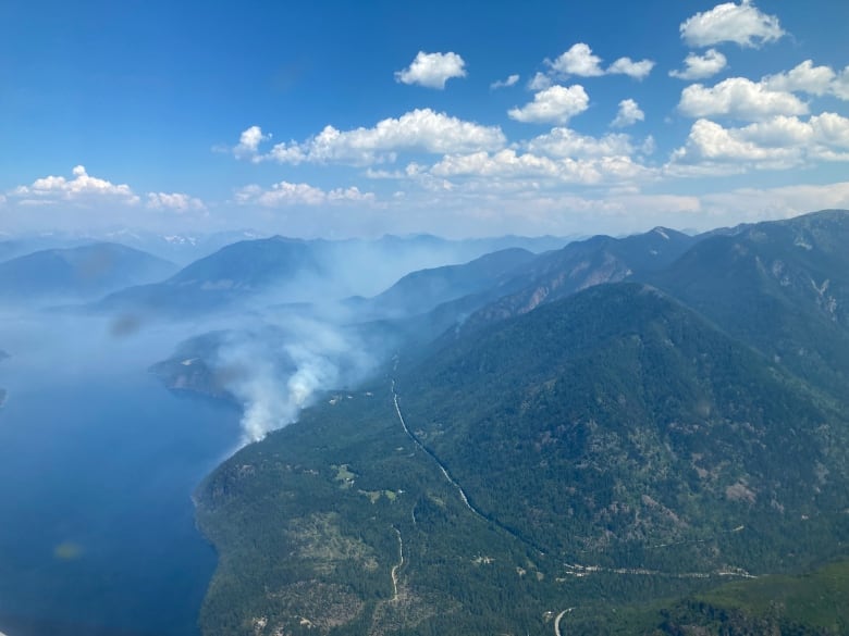
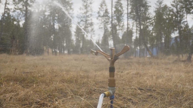
'Humidity bubble' established around BarkervilleHistoric Park
There has been similar good news for the Antler Creek wildfire, which has forced the evacuation of about 120 people from the District of Wells, as well as the neighbouring gold rush-era Barkerville Historic Park and Bowron Lake Provincial Park.
On Tuesday afternoon, the wildfire servicesaid the fire had expanded beyond140 square kilometresand was now just three kilometres from Wells and Barkerville but in a Facebook update the District of Wells said the new growth was not posing an immediate risk, while pictures from the communities showed clear skies and wet ground from recent rainfall.
But there have been some structures lost, according to Wells MayorEd Coleman. Hetold CBC News Wednesday that this includes two homes.
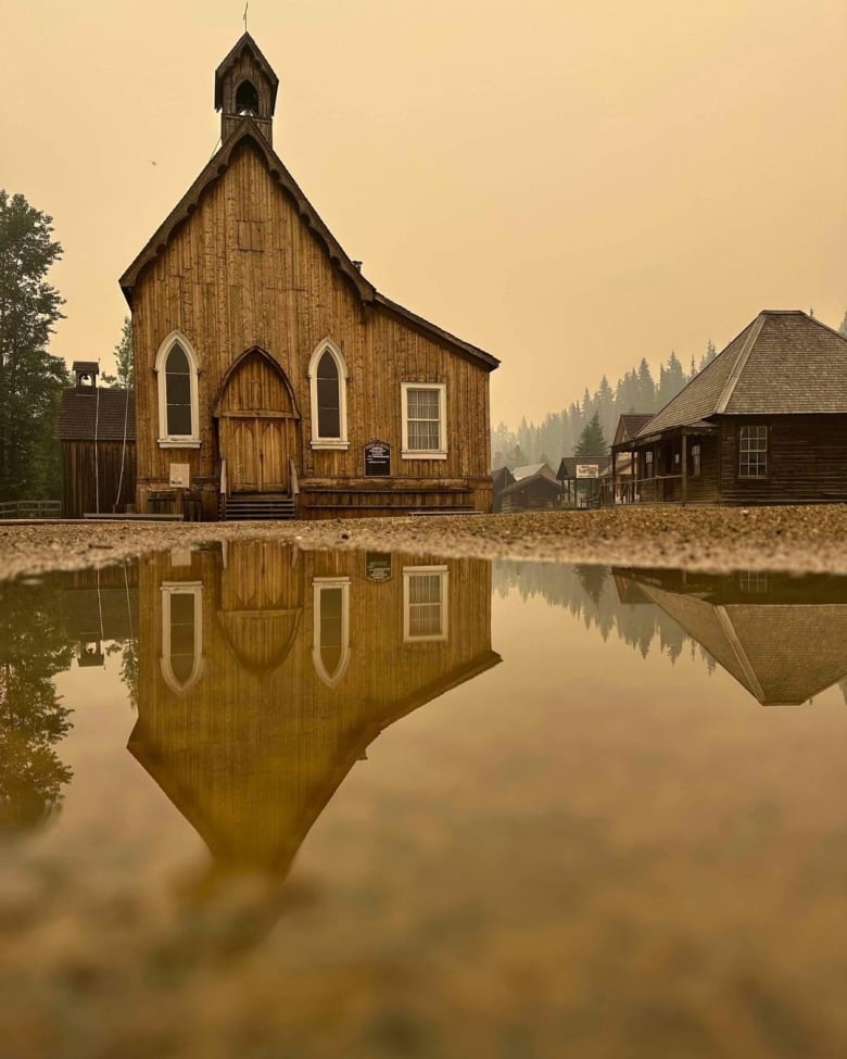
The wildfire service also said it had managed to establish control lines and a "humidity bubble" in Barkervilleand the surrounding area. They have hookedup multiple sprinklers to the existing water system in an attempt to minimize the fire risk tothe old, wooden buildings, some of which aremore than 100 years old.
The service said it was expecting the fire to increase in size in the coming days, as it could merge with other, smaller blazes in the area.
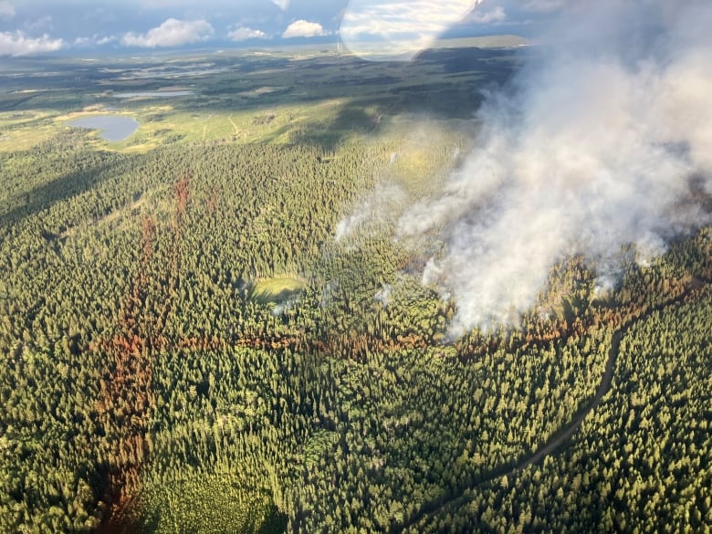
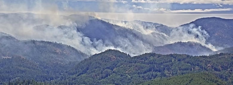
Cluster of fires sparked near Wells Gray Park and Clearwater
In Clearwater, about 100 kilometres north of Kamloops, there are roughly 20 wildfires burning, dropping ash and keeping crews busy, said Mayor Merlin Blackwell.
Another 60 kilometres north, Wells Gray Provincial Park has been partially closed due to a wildfire near Murtle Lake. The park is a populardestination for campers, canoers, kayakers and hikers.

While Blackwell said there was concern about the impacts on the fire on communities, he emphasized that many areas were still open to tourists.
"You can still come here; you just need to have your sense about you," he said.
About 100 kilometres northwest of Clearwater, the community of Lac La Hache has issued a water quality notice due to wildfire fighting efforts in the area depleting a local reservoir.
New evacuations due to Sooke Potholes wildfire
A Sooke-area wildfire, known as the Old Man Lake wildfire, continues to burn out of control on Vancouver Island.
The fire was discovered on Monday afternoon inSooke Potholes Park on Vancouver Island, about 27 kilometres west of Victoria.
The regional park,a popular destination for hikers, cyclists and campers, was closed andevacuated, as was an adjacent provincial park, Sea to Sea Regional Park, and a portion of the Galloping Goose trail.
According to the B.C. Wildfire Service, the fire has since grown to 1.69 square kilometres and is still listed as out of control, though it does not pose a current threat to any homes.
In an interview Thursday afternoon, SookeMayor Maya Tait said that, in positive news, the wildfire was largely growing away from the community.
In a bulletin, the Capital Regional District said that while water quality in Greater Victoria is not currently impacted, that could change if ash begins drifting onto the SookeLake Resevoir.
Environment Canada forecasts temperatures may drop a couple degrees in the area, but dry conditions will persist into the weekend.

With files from The Canadian Press, Isaac Phan Nay, Wildinette Paul, Jen Norwell and Megan Thomas


_(720p).jpg)


 OFFICIAL HD MUSIC VIDEO.jpg)
.jpg)


