Geography: Calgary's hidden puppet master
How the shape of the land shapes our lives
Originally published on Dec. 5, 2015.

Ever wonder why you stick to your particular bit of Calgary? Why you have a "comfort zone"when it comes to your favourite restaurants, bars and coffeeshops.
Maybe why you don't often visit friends down/up/over there, or "all the way past the park."It's all a matter of geography: the kind that nature providesand the kind we build.
- Are you a Calgarian or do you just live here?
- ANALYSIS |Asphalt history lesson: What Deerfoot, Crowchild and Shaganappi say about Calgary
- 7 names for Calgary before it became Calgary
We are animals,and animals have a territorial instinct. We each live in a sort of imaginary bit of Calgary. Our "hood"iscrafted by rivers, hills, valleys, cliffs, bluffs and roads that create borders in our mind. The environment shapes our lives andbuilds our identity.
I flew into Calgary from my home in Monterrey, Mexico,as an exchange student on a frigid, -20 Cwinter night in 2004.
I caught a cab into town, travellingover the DeerfootTrailand along John Laurie Boulevard,thedark, snow-covered emptiness punctuated with a few desolate houses in the middle of nowhere.
"Where's the city? What have I gotten myself into?"I asked myself.
But then, a revelation.
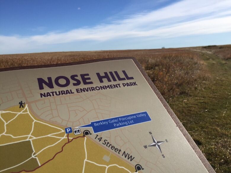
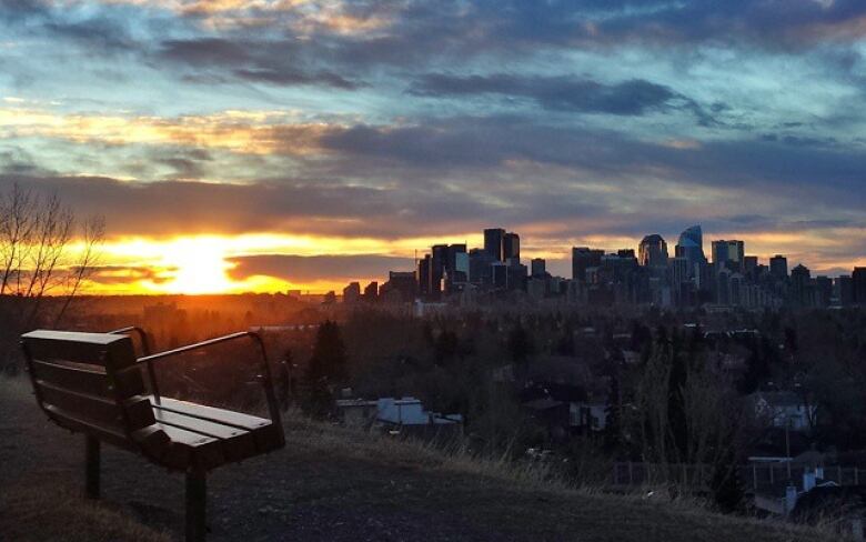
The next morning my new geography professor took me to the top of Nose Hill. Waving out over the expanse, he explained Calgary to mein terms of geography, and itchanged the way I understand the city. I became fascinated with Calgary, and I have been studying it ever since.
Carving out the city
The only reason there is a Calgary at allis because of its geography.
We live on this tiny patch of the planet becausethousands ofyears ago a monster glacier carved out a valleyand left a river a great place for people.
The valley escarpments (think Scarboro, Briar Hill, Crescent Heights), provided a place where the First Nations could hunt by herding buffalo over cliffs. The Bow provided water. So far so good.
But the river was also a problem.
The key was finding a place to cross. The answer was the flats where the Elbow and Bow rivers meet. That's where Calgary, as we know it, was born. It was a perfect spot for a new fort when the North-West Mounted Police was moving into the area.
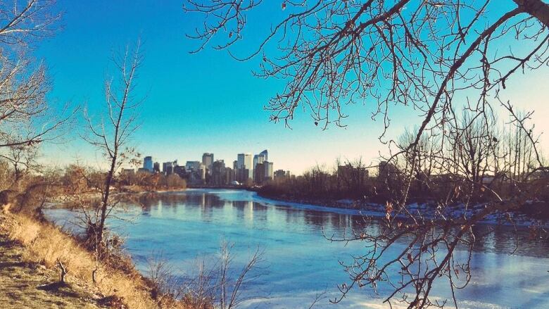
A river runs through it
Rivers are special. Humans evolved with a need to live in landscapes with water. It meant life, literally and figuratively,and so rivers have become the focus of myths, legendsand community.
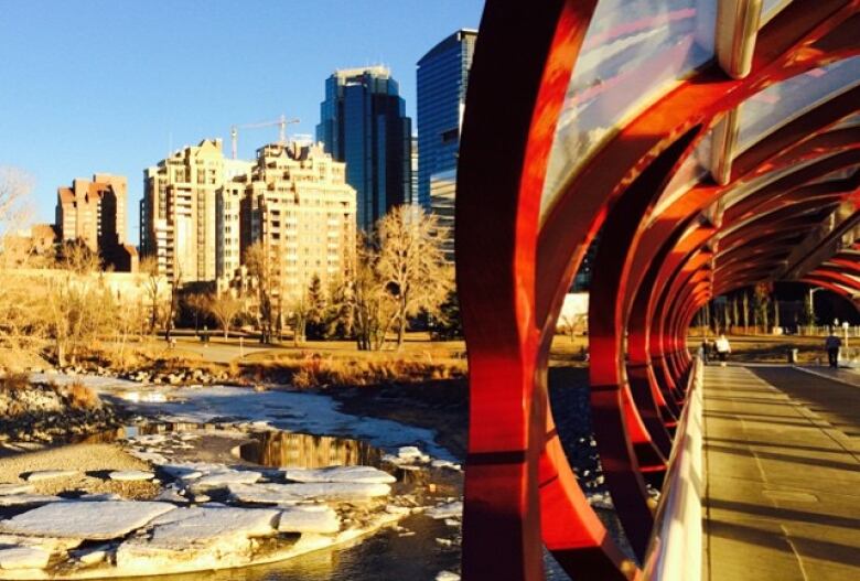
The Bow is a large part of our city's character, and thanks to some visionary people it has been (more or less) preserved as a natural area and a great open space. Because of this, the Bow creates community.
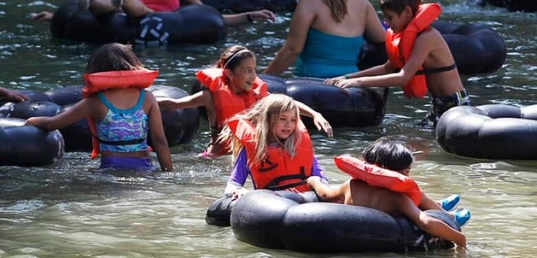
Running groups meet up along itspath system, andfamilies gather on weekends to picnicin parks on its shore. People love to float down the Bow in summer, and floods aside, we want to live near it.
Bowness, Point McKay, Parkdaleand Kensington:Communities that cluster alongthe Bow. And you can add a couple hundred thousand dollarsto the value of your home if you're close enough. Buy into the community, buy into the river. Think about the fancy condos at Eau-Claire, and how our city still struggles to find the right fit for the perfect mix of riverfront living. It's a social nexus point.
But the Bowis also a social barrieraperception both real, and imaginedthataffectshow people choose to travel.
Many Calgarianstry to live their daily lives without having to cross the river.
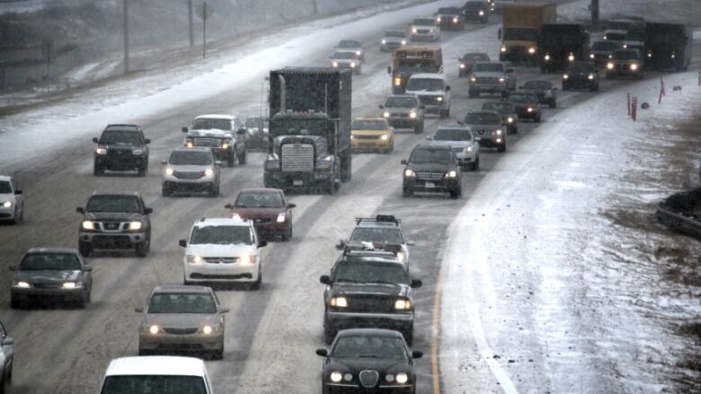
Calgary is a car city, and because there are a limited number of bridges crossing the Bow, people tend to prefer not to have to deal with a potential bottleneck. Have you ever tried to cross northbound 14thStreet between say3:30p.m. and 7p.m.?
Hidden effect
But the effect is there even on foot.
Let's say you live north of the riverand work downtown. Once you get back onyourside of the river after work, you're likely to stay there. You probably don't think about it consciously, but you likely go out to eat, visit a coffeeshopand make friends onyourside of the river.
And here's some fun social science stuff. People who are born on one side of the rivertend to stay there. They identify themselves with "north"and "south."
Soif you went to high school at William Aberhart,you probably made lifelong friends who continue to live in the northwest part of the city. You socialized and spentyour money in the shops, pubs and restaurants of Kensington Road and 10th Street NW. and you probably still do.
The city becomes bisected.
However,the river isn't the only thingthat shapes our "personal"Calgary.
Hills and valleys
When we think of our neighbourhood, we are actually talking about something imaginary,acombination of natural and man-made boundaries that mark 'our' comfort zone andthat say something about how we see ourselves in our city.We rarely think about it, but even a small hill can make the difference.
Hills can divide us socially, but they can also unite us. You can have a park with great views such as the Bowmont Park Natural Area overlooking the river and Bowness, or a barrier such as McHugh Bluff Park between Sunnyside and Rosedale.
A change in slope of the terrain makes getting aroundmore difficult. The bigger the slope, the greater the psychological barrier.
However, just a few metres is enough for the "us vs. them"thing to kick in.
Sunalta is definitely not Scarboro, even though itis just a few metres up a hilland about 30 seconds away on foot. You can throw a rock from Lower Mount Royal toMount Royal, but there's a difference:Those people up there, us down here. It's part of our natural territorial instinct and our need to read and understand our environments.
And there are socio-economic aspects:Higher up means abetter view, a better view, more expensive houses.Signal Hill was the playground for many kids in Calgary's west until it was developed, and now the area with beautiful views has some of the most expensive homes in our city. Again, the us/them paradigm.
Fortunately, Nose Hill was never developed.
That hill represents for me the beginning of the foothills. If you stand at the top and look east you will see the horizon of the Prairies. If you turn to the west you see the rolling land leading to the Rockies. It is not only as a landmark for our city, but a landmark for our region, and people gravitate to it naturally. It, too, becomes a symbolic social point for all people.
How we choose to shape what already exists in naturehills made into parks, valleys into communities etc.deeply alters our relationship with the land.
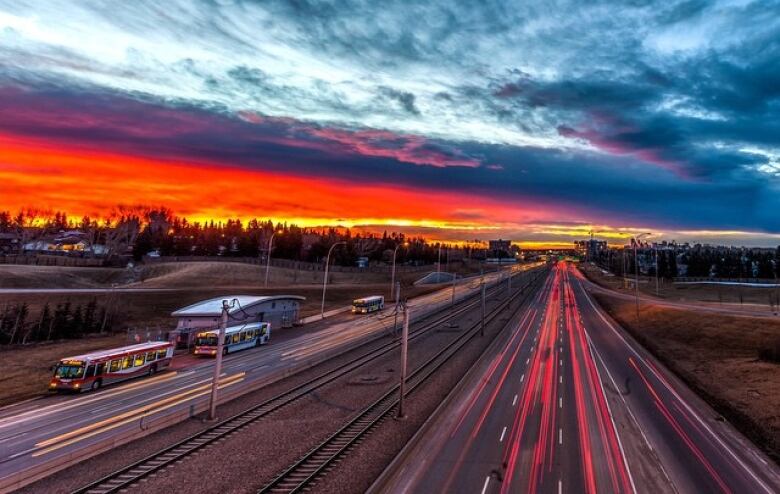
And there'sanother very Calgary thing we do to our geography:Pave it.
The roads
We often take a valley, which as we've already seen can be a kind of barrier, and we reinforce the separation by whacking a big ugly road down the middle of it.
As Calgarians know, our personal relationships with some love-to-hate-it bit of asphalt often helps define us. "Deerfoot. Never again!"
Roads are there to connect the various parts of our city, and allow us to work, shop and socialize beyond our neighbourhoods.They are arteries of interaction.
Take two of the best examples:Crowchild and Deerfoot connect Calgary. Theyhelp define the expansion of the city, and the identity of our neighbourhoods.But while they connect our city by cars, they also divide us as people.
Major roads are designed mainly for cars. In general they are concrete strips without sidewalks or trees, and very unfriendly to pedestrians or cyclists.
We subconsciously read roads as patterns, and because most of them are so unfriendly to pedestrians, they become another boundary to how we understand "our"territoryapsychological roadblock.
If you live in Dalhousie you probably think of yourself different from the people who live "all the way over" in Varsity.You may only be 40 metresaway from someone in the other neighbourhood, but you'll likely feel a stronger sense of community identity with someone on your side of Crowchild, even if they are 400 metres away.
Mental map
You're also more likely to shop, play sportsand make friends on "your"side of Crowchild. The other sideis not on your mental map of destinations.
An even larger example of "road as boundary"is the Deerfoot.
In many people's minds it not only separates our neighbourhoods, but practically separates Calgary into two cities East and West.
We located most of our industrial production east of the Deerfoot,rendering the land there less desirable for housing.This, in turn, made the houses there more affordableand therefore more desirable for many newly arrived Calgarians.
But at the same time, it created a stigma to "living in the northeast", even when the quality of some neighbourhoods there is as high as in the northwest. Again, a valley and a road creates the "us-and-them" paradigm.
Even a small street can make a difference to the sense of our personal territory.
People living on either side of 14thStreetS.W., often feel there is a difference you're in Connaughtor you're not. When it comes to streets, small things matter.
Your street
The neighbourhoods where we live and the places where we work are a result of the decisions we have made as a city. We can shape the city around geography, but the city also creates its own kind of geography. Some of those decisions we've made in Calgary have been,well,bad.
For decades, starting in the '70s, we decided that cul-de-sacs were theway to go. So Calgary kind of went cul-de-sac crazy. We went from designing our neighbourhoods as grids (think Connaught and the core), into the now familiar curvilinear street networks of the suburbs.

The result? It made it very difficult to physically and psychologically connect different parts of a neighbourhood.
Curvilinear neighbourhoods, for example Hidden Valley, tend to have very few places to walk(shops, services, etc.).And the area you can walk in about fiveminutes is significantly smaller than in a grid-based neighbourhoodsuch asHillhurst.
This matters, because it's how we form communities.
Good neighbourhood design helps us make friends and feel more connected with our neighbours.
If you are able to walk to the store, you are naturally going to be walking around your neighbourhood more. The more you do that increases thenumber of chance encounters with your neighbours. If those chance encounters repeatperhaps you keep bumping into the same person bythe third time you mightsay "hello"and start a conversation.
This is what we academics call "social connection," andwhat most people call "getting to know people"or, better, "making friends"
It is also the starting point in building a sense of communityand giving that community an identity. If we spend most of our time moving from point to point in our cars, there is little chance those encounters will happen on the streets of our neighbourhoods.
The choice is ours
Riding my taxi from the airport that cold night, I crossed a river valley to the residential west from the industrial east. I circled around a hill on a road that wasn't part of a grid system of streets. There wereno houses and very few identifiable landmarks or features.
And that's whyI couldn't, at first, understand this city. Now, let's just say I have a feel for the highs and lows.
Key to our future as a cityand how we interact with each otherwill be a better understanding of how we use our geography to connectrather than divideus.
We can't move the Bow, and Pioneer Hill is here to stay, but we do have a choice of where and how we build our communities,where we create parks and put houses, what roads look likeand how "walkable"our streets are.
We can't blame the glaciers for our bad city-building decisions.
CBC Calgary's special focus on life in our city during the downturn. A look at Calgary's culture, identity and what it means to be Calgarian. It's called Calgary at a Crossroads.


_(720p).jpg)


 OFFICIAL HD MUSIC VIDEO.jpg)
.jpg)


