Warnings and watches issued for much of southern Alberta, with up to 50 cm of snow expected
Calgary forecast to be hit with 15 to 25 cm by Tuesday afternoon
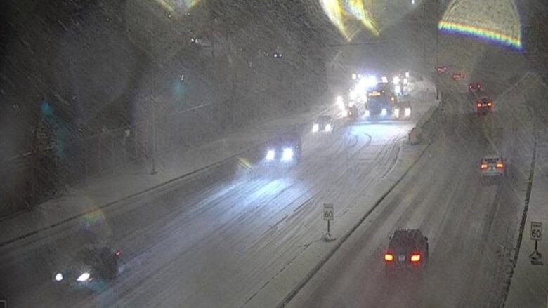
Heavy snow blanketedsouthern Alberta on Monday evening, as the region braced for a winter storm that could drop as much as 50 centimetres of snow in some areas.
Winter storm and snowfall warnings wereissued for the entire region Monday morning, stretching as far north as Nordegg along the edge of the Rockies and into central Alberta, including Red Deer. The warnings remained in place into the evening, cautioning drivers to prepare forquickly changing and deteriorating travel conditions.
- If the storm is hitting your area, we'd love to see your photos and video. Please share them with us by emailing calgaryphotos@cbc.ca, tweet to @CBCCalgary, tag @CBCCalgary on Instagram or reach out to us on CBC Calgary'sFacebookpage.
The areas that could see up to 50 cm of snow include:
- Cardston.
- Fort MacLeod.
- Magrath.
- Okotoks.
- High River.
- Claresholm.
- Kananaskis.
- Canmore.
- Crowsnest Pass.
- Pincher Creek.
- WatertonLakes National Park.
The rest of the region is expected to see between 10 and 20 cm by Tuesday.
That includes 15to 25 centimetres expected to fall in the city of Calgary by the end of the day on Tuesday.
On Monday evening in Calgary,the snow was already beginning to snarl traffic, with 34 non-injury crashes, eight injury crashes and four hit-and-runs between 5 and 9 p.m.
Environment Canada warned there could be significant impact on rush hour traffic in urban areas.
The agency said the snowfall is attributed to a strong low pressure system that will develop in Montana on Monday afternoon.
"This low will bring heavy snow to southwestern Alberta, including Banff National Park, beginning Monday afternoon," the weather agency said."Snow is expected to persist throughout the day on Tuesday."
The agency recommended that Albertans living in the affected area avoid travel if possible.
If travel is necessary, Albertans should keep an emergency kit and mobile phone with them, and let others know where they are headed.
Some areas of the province already saw challenging road conditions on Monday morning, including on Highway 1 between Seebe and Banff National Park.


_(720p).jpg)


 OFFICIAL HD MUSIC VIDEO.jpg)
.jpg)


