Fort McMurray residents pore over new app to see how fire damaged their town
The app provided by Alberta government uses images from French satellite
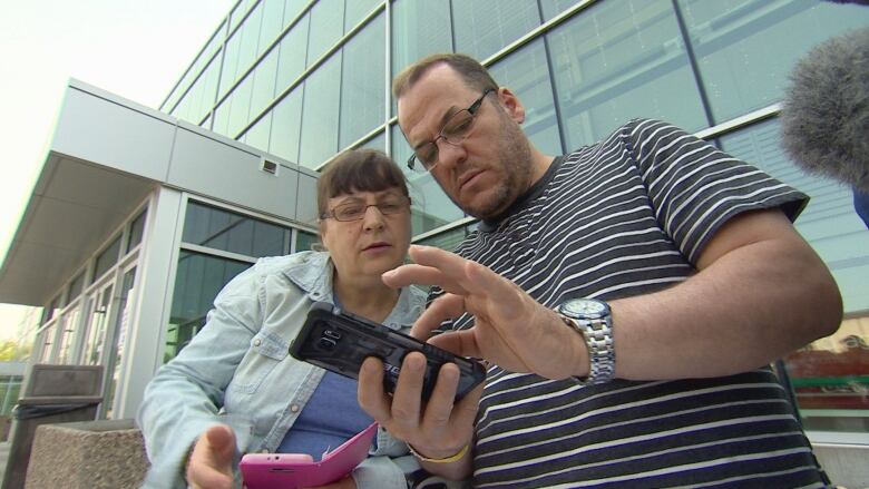
An app from the Alberta government showing satellite images of Fort McMurray is givingevacuees of the wildfire a closer look at their homes from afar.
Rifat and Kozeta Dyrmishi, who arestaying at the Northlands evacuation centre in Edmonton, are breathing a sigh of relief after searching for their home on the app for the first time.
"It's our home, our house, we have all our belongings and memories and everything," Rifatsaid.
"My house is safe, it's great."
Seeing their home on the app offers a peace of mind they said you can't get from reports saying certain neighbourhoods might be untouched, he added.
Beacon Hill
May 2011 vs. May 2016:A look at Beacon Hill North, one of the hardest hit neighbourhoods note the difference between thehomes with and without roofs. Below that,Beacon Hill South looks as if the entire neighbourhood has been damaged, and a lot of it extensively.
(Image Credits:Before/GoogleEarth,After/Alberta Government)
Released this weekend, the app is meant to help Fort McMurray evacuees see if the wildfire known as "the beast" took their home.
Thegovernment hopes that when the higher-resolution images become available, it will help homeowners with insurance claims.
- Urge to live with trees, nature may be leading wildfire to our front doors
- The FortMcMurraywildfire: what you need to know
- FortMcMurrayrecovery: lessons from the Slave Lake rebuild
At the beginning of May, thewildfire forced over 90,000 people from their homes.
Thefire tore through several neighbourhoods primarily Beacon Hill andAbasand and also hit others sporadically, leaving evacuees wondering about the state of their homes.
The app shows images taken from thesatellitePlaides-1A. Thesatellite was launched in 2011 byCNES,France's space agency, along with thePlaides-1B.
The satellitescovera total area of 1 million square kilometres daily andorbitthe entireEarth every26 days.
Anyone wanting to view the satellite images must first click on alink, acknowledging that they have read and understand the terms ofuse agreement on the government website.
The government saysit will release higher resolution images as they become available.
"Having been through a devastating fire and evacuation myself, I know first-hand how stressful it is to wait for updates on which homes have been lost," Alberta Municipal AffairsMinister Danielle Lariveesaidin a statement.
AbasandHeights
This neighbourhood was hit particularly hard by the fire. Note the roofs that remain intact as well as Father Beauregard School. Below that, an aerial look at the Wildwood Estates in the same neighbourhood.
"We are committed to providing information to residents as soon as we can, and these images will help us begin to answer the questions people have about the state of their homes and community."
- The 180 |'There was so much stuff': the 'second disaster' of unwanted donations
- Children still affected five years after Slave Lake fire
Lariveehad to flee her home inSlave Lake during the wildfires five years ago.
Shepoints out, while the app will help with insurance claims, it's important to realize that"structures that appear to be standing should not be considered undamaged."
Lariveewarned that viewing the satellite images may be traumatic.
Anyone affected by the images can contact Alberta's Mental Health Help Line at1-877-303-2642.
Get breaking news alerts on this story and others. Download the CBC News app for iOS and Android.
With files from Haydn Watters and the Canadian Press


_(720p).jpg)


 OFFICIAL HD MUSIC VIDEO.jpg)
.jpg)


